Quick-Hitting Light Snow Event For Central U.S.
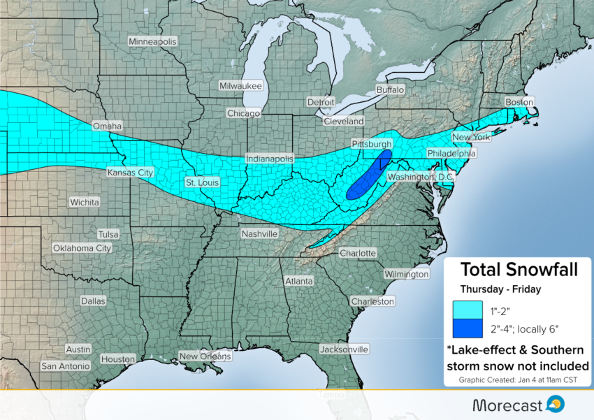
Cold air settling southward across the Central Plains to the Ohio Valley will set the stage for a quick-hitting light snow event.
Read full article![]()
Cold air settling southward across the Central Plains to the Ohio Valley will set the stage for a quick-hitting light snow event.
Read full article![]()
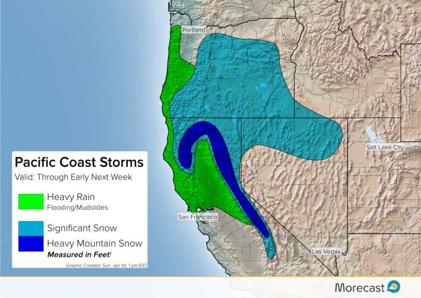
A persistent pattern of moist Pacific storms slamming into the West coast will mean unsettled weather through early next week. Heavy rain in the lower elevations will lead to localized flash flooding and landslides where terrain is favorable. Snowfall measured in several feet will occur over the mountains.
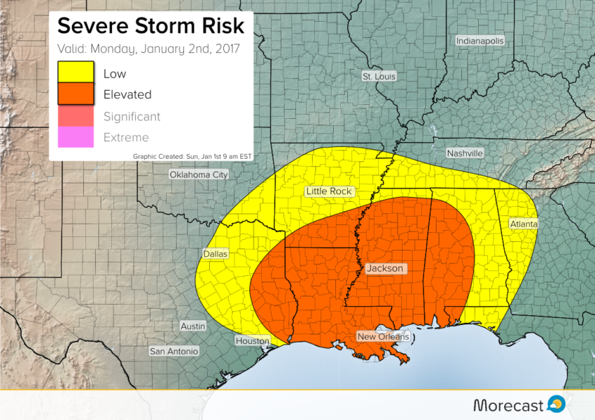
Despite the calendar just rolling over to January, a spring-like elevated risk for severe storms is expected for Monday. The target zone will be the Mid-South as a system emerges from the southern Rockies. These storms will produce damaging winds, large hail, flooding rains, and a few isolated tornadoes.
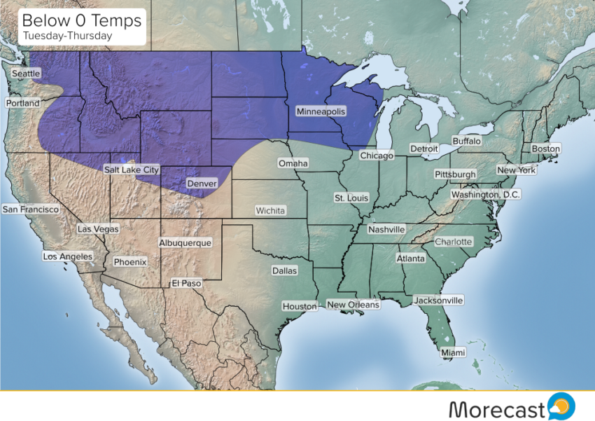
A major Arctic air mass is loading up over western Canada and will be sliding down into the Pacific Northwest on Monday. By mid-week, the frigid air will be spreading east across much of the Lower 48.