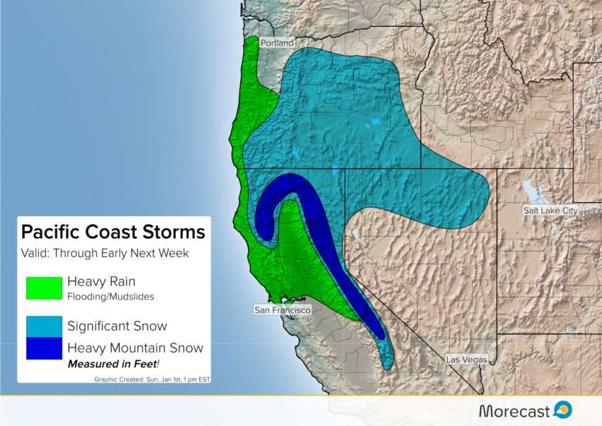
A persistent pattern of moist Pacific storms slamming into the West coast will mean unsettled weather through early next week. Heavy rain in the lower elevations will lead to localized flash flooding and landslides where terrain is favorable. Snowfall measured in several feet will occur over the mountains.
Timing and amounts associated with any individual storm will vary from one model run to the next. However, the pattern indicates prodigious precipitation totals are likely. The stormy pattern is already in place, but will really ramp up by mid-week. Several storms are likely to impact the area through early next week before the pattern breaks. Travel will likely become difficult if not impossible, especially through the mountains. On the plus side, mountain resorts are primed to offer excellent ski conditions – if you can make it up there, that is!
For more details on the specific forecast for your location or travel destination, consult the Morecast app. We’ll have updates as needed on Twitter and Facebook as well. Happy New Year!