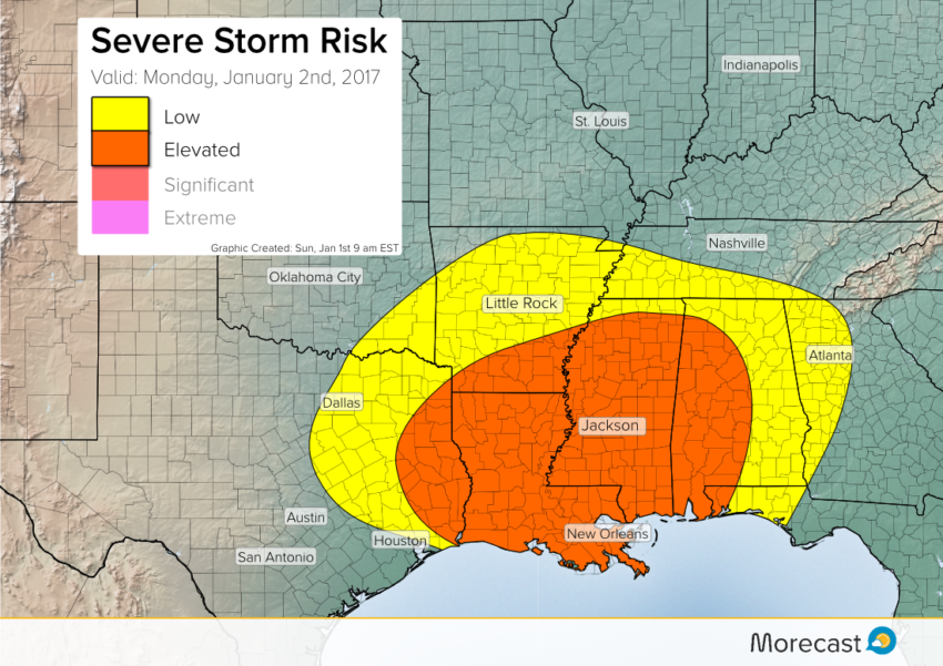
Despite the calendar just rolling over to January, a spring-like elevated risk for severe storms is expected for Monday. The target zone will be the Mid-South as a system emerges from the southern Rockies. These storms will produce damaging winds, large hail, flooding rains, and a few isolated tornadoes.
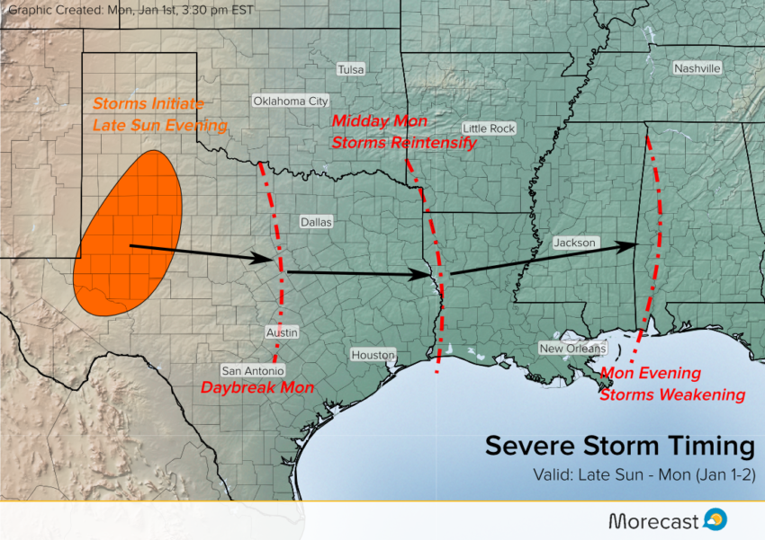
Ahead of this severe weather episode, a weaker disturbance could produce a few isolated stronger cells on Sunday in this same area. However, the Monday system will be stronger, able to draw Gulf moisture further north. Storms will be moving out of central Texas during the morning hours. They’ll intensify as they encounter unstable air in the Mid-South by midday into the afternoon. The storms will eventually diminish Tuesday night as they move from Alabama towards Georgia and lose afternoon heating.
Major cities in line to see dangerous severe storms include New Orleans, LA and Jackson, MS. Depend on the Morecast app to give additional forecast details for your locale! We’ll also be issuing updates as needed over Twitter and Facebook.