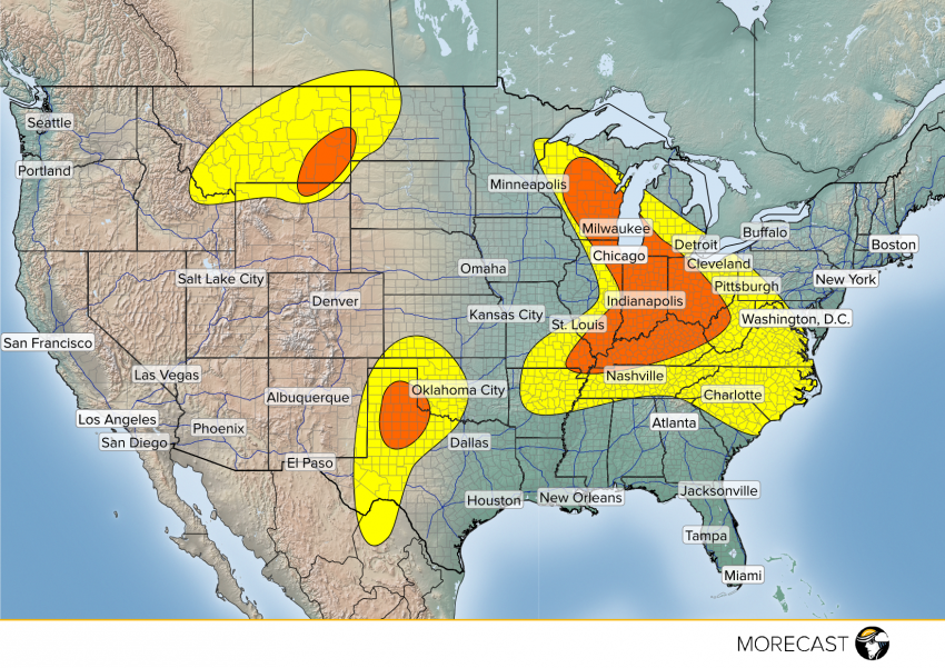
A storm system that brought hail, strong winds, and isolated tornadoes to the Upper Midwest on Tuesday will continue to push east into the Midwest, Lower Great Lakes, and South Central US on Wednesday. A warm front will move through the region through the afternoon hours, providing some good instability. During the afternoon, a cold front will approach from the west and help spark storms ahead of it. The major cities with the greatest threat of severe storms on Wednesday will be Milwaukee, Chicago, Indianapolis, Cincinnati, Louisville, Lexington, Nashville, and Memphis. The main threat from these storms will include wind gusts up to 65 mph, large hail up to 2″, isolated tornadoes, and localized flash flooding.
Keep up to date with these storms as they develop and intensify by following along with the MORECAST team on our Facebook and Twitter pages. Also be sure to upload any photos you can safely take to your MORECAST app.


