Scattered Severe Storms to Threaten the Northern Plains Friday
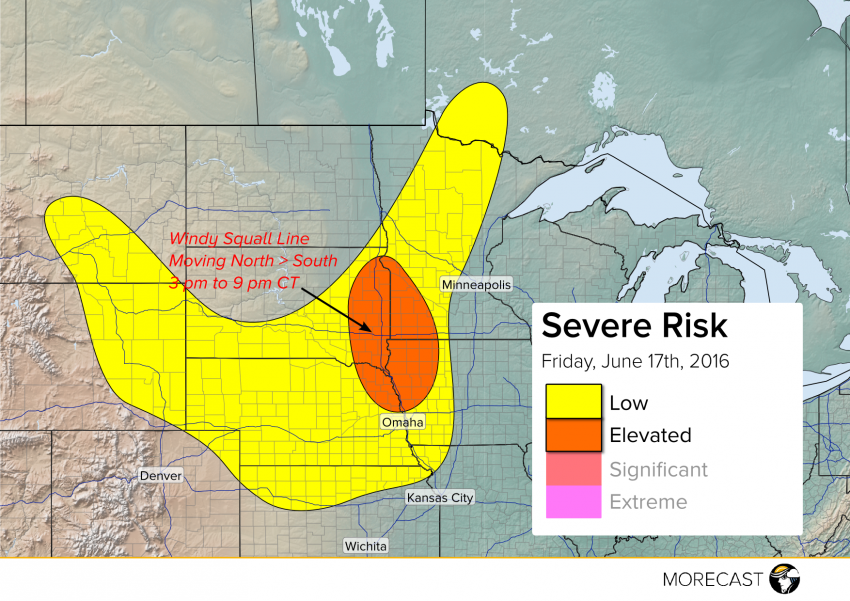
The outflow from a morning squall line in the Northern Plains will spark severe storm development Friday afternoon. The most organized threat for damaging winds is expected along the Missouri River from eastern South Dakota and southwestern Minnesota into northeastern Nebraska and northwestern Iowa from mid-afternoon through early evening.