Parched West Primed for More Summer Wildfires

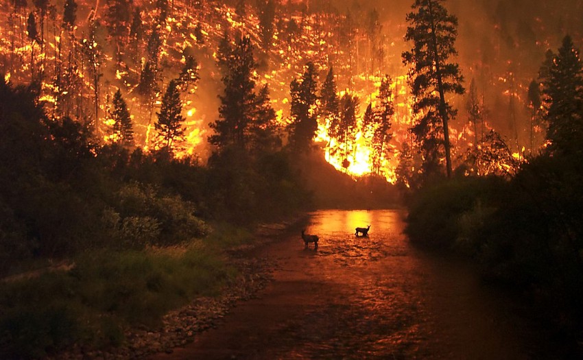
The collapse of the 2015-16 El Niño, one of the strongest ever recorded, has left many residents of the Golden State similarly deflated. Despite forecasts and hopes of an alleviation of California’s multi-year drought by abundant precipitation from El Niño-driven winter storms, much of the state remains stuck in the “Exceptional” category. With a drier, warmer La Niña pattern in the forecast heading into the fall and winter, not only are agricultural interests preparing for another handicapped harvest season, but a more sensational and urgent threat associated with persistent drought has unfortunately made recent international headlines – massive, devastating wildfires.
Read full article

Stormy Saturday for the Northern Tier

Potential for severe weather June 25 for Minnesota through Nebraska

A cold front sagging through the Midwest and Central Plains extending from an area of low pressure in southern Canada will force a line of strong to severe thunderstorms this afternoon.
Read full article

Severe Storms Across the Northern Plains and Mid-Atlantic on Friday

Severe storms will fire along a stationary front, that will stretch from the Mid-Atlantic to the Mississippi Valley. With some good upper level support across the Mid-Atlantic and parts of the Southeastern US, severe storms are possible for these areas on Friday. The main hazards will include hail up to 1.5 inches, wind gusts up to 65 mph, isolated tornadoes, and localized flash flooding.


Across the Central and Northern Plains, storms will fire during the evening along a warm front. With an approaching cold front from the west and a good low level jet expected to develop, this will help fuel some storms across this area. The main hazards will include hail up to 2 inches, wind gusts up to 70 mph, isolated tornadoes, and localized flash flooding.


Stay up to date with MORECAST on Facebook and Twitter!