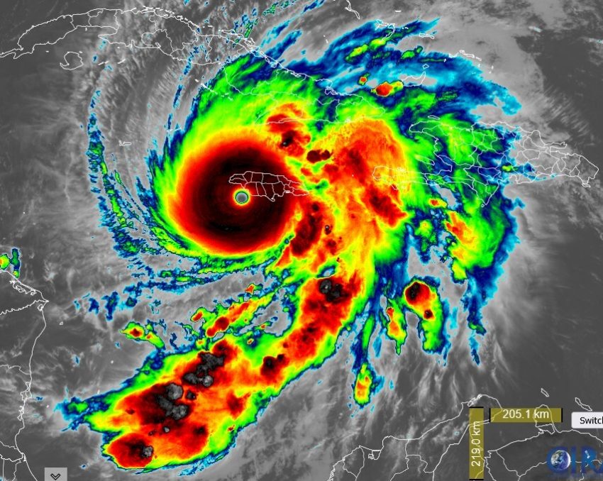
Typhoon Kalmaegi Slices Through the Philippines and Vietnam, Killing Hundreds
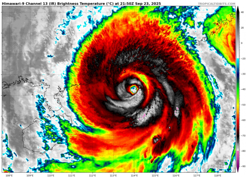
Category Four Typhoon Kalmaegi rolled through the central Philippines, particularly the province of Cebu, on Tuesday into Wednesday. The storm than reintensified as it crossed the South China Sea and pounded central Vietnam Thursday into early Friday. Kalmaegi has claimed a total of 188 lives as of midday Friday in the Philippines alone. Severe flooding and fallen trees account for most of these fatalities.
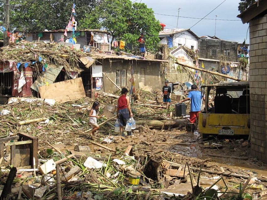
The devastation in the Philippines is heartbreaking. As of this morning, officials say at least 114 people have died and 127 are still missing after Typhoon Kalmaegi (TinoPH) tore through the central region.
Entire communities were flooded, homes destroyed.
The government has… pic.twitter.com/h7KSegfv68
— Volcaholic 🌋 (@volcaholic1) November 6, 2025
Death toll from devastating Typhoon Kalmaegi in the Philippines rises to at least 188, with 135 more still missing pic.twitter.com/vdR6RhCr02
— TRT World Now (@TRTWorldNow) November 7, 2025
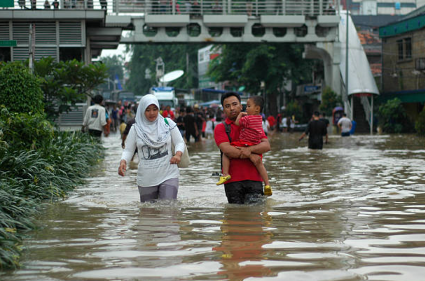
The typhoon developed last weekend over the open Pacific and intensified quickly as it approached the Philippines. Gusty winds knocked down numerous trees and powerlines but the most devastating impact has been flooding. Rainfall amounts well in excess of 200 mm combined with storm surge have resulted in widespread inundation. At least half of Cebu City, home to nearly a million people, was reportedly under water after the Butuanon River exploded out of its banks. The mayor reported over 200,000 homes damaged there, forcing hundreds of thousands to relocate. The mud-choked floodwaters have left behind masses of debris that will take months to clean up, complicating efforts to locate the 136 still reported missing. Unfortunately another intensifying typhoon will threaten the Philippines early next week, although it is projected to more directly affect the northern islands.
The powerful Typhoon Kalmaegi makes landfall in Quy Nhơn, Vietnam 🇻🇳 pic.twitter.com/46dbWeJFIu
— Disaster News (@Top_Disaster) November 6, 2025
#BREAKING : Typhoon Kalmaegi slammed into Vietnam last night, unleashing heavy rain and destruction.
Current visuals from Xuan Thanh Fishing Village, show widespread damage and devastation across the region. https://t.co/LbJtiFmpFp pic.twitter.com/jDyj4NazVH
— विश्वम् (@_vishvam) November 7, 2025
Kalmaegi is one of the strongest cyclones on record to hit Vietnam, boasting 200 kph (125 mph) sustained winds at landfall. The storm prompted evacuation orders for at least 350,000 residents of Gia Lai province alone. Numerous reports of roofs blown off of houses and downed trees and powerlines have been received. The death toll has been limited to five so far in Vietnam. This number may rise as the cyclone winds down and cleanup efforts begin.