An upper low drifting slowly across northern Queensland has a history of producing major flooding. As of Saturday morning, it’s still producing heavy rains over western parts of the state. These are less densely populated but more arid areas sensitive to these record rains. Here’s a select list of rainfall totals over the last several days:
Queensland Rainfall Totals (since 28-February):
Bluewater: 516 mm
Mt. Margaret: 509 mm
Stony Creek: 441 mm
Deeragun: 420 mm
Pallarenda: 342 mm
Townsville: 263 mm
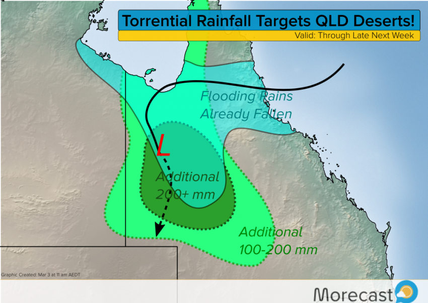
A tap of rich tropical moisture from the Gulf of Carpentaria is to blame for the prolonged heavy rain threat. The upper low is expected to drift slowly and erratically over western Queensland and perhaps eastern Northern Territory, dropping additional heavy rains over the inland deserts through the next several days (see above). It could also help fuel a severe storm threat further southeast later this weekend. Check morecast.com and the Morecast app for the latest forecast details for your location!