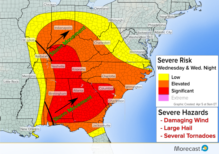
A widespread severe weather outbreak will occur across the Southeast and Ohio River Valley Wednesday. Severe storms with damaging wind, large hail, and a tornado risk will erupt Wednesday morning and continue into Wednesday night.
Low pressure across Missouri Wednesday morning will track toward the southern Great Lakes by early Thursday. An associated cold front will plow eastward into a highly unstable air mass. The result will be rounds of severe thunderstorms impacting several major cities across the Southeast and Ohio Valley.
Storm Details:
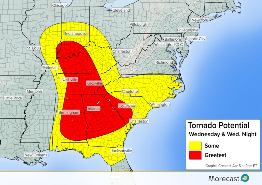
The first wave of thunderstorms is ongoing across the Deep South. Several clusters of discrete thunderstorm cells will bring a risk for damaging winds over 70 mph, large hail greater than 2″, and several tornadoes. Cities such as Birmingham, Montgomery, Atlanta, and Columbus, GA will see the risk of severe storms continue through the afternoon.
These storms will move east into the Carolinas later Wednesday afternoon and during the evening hours. Damaging wind, large hail and a tornado threat will also be a concern for cities like Charlotte, Columbia, and Wilmington. Northeast of Columbia, the tornado threat will not be as high as farther west, but residents should remain aware of any severe thunderstorms approaching.
Farther north, a second area of thunderstorms will develop around mid-day over the Central Mississippi River Valley. These storms will move east through the lower Ohio Valley and into the western Appalachians later Wednesday evening. Severe risks will be similar to areas farther to the south; damaging wind, large hail, and isolated tornadoes.
Follow us on Twitter and Facebook for updates on the severe weather threat. For the latest forecast information, be sure to download the Morecast app.