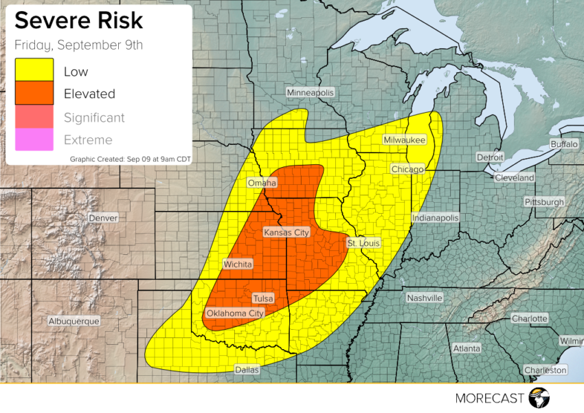
A cold front will be moving across the Plains today which will trigger thunderstorms.
An upper-level trough with an associated low pressure system and cold front will start moving through the Plains and Midwest this afternoon. Instability builds through the day which will feed the storms to keep them strong and healthy. The main hazard across all risk areas are strong damaging wind gusts and large hail. Across the ‘elevated’ risk area there is a possibility of an isolated tornado or two. Expect storm development to fire off around 1-2 pm CDT today.
Be sure to keep up to date by checking the MORECAST app and following along with our team on Twitter and Facebook.