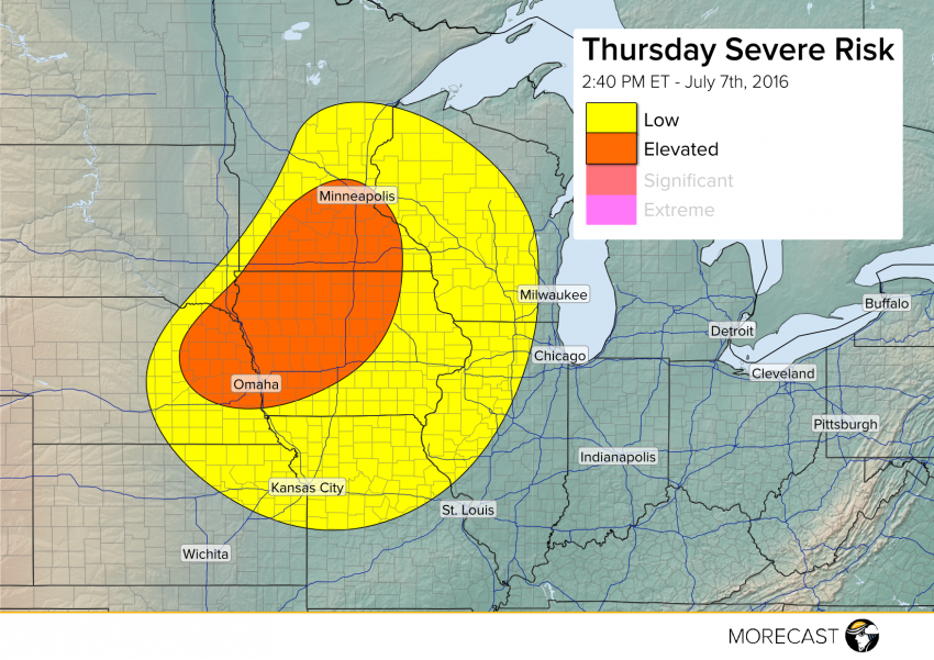
A long-lived squall line of severe storms has passed into the Ohio River Valley with clearing skies allowing the atmosphere to destabilize over the Upper Midwest. An approaching cold front will spark storm development shortly. Severe cells will be capable of producing damaging wind gusts to 65 mph, large hail to 1.5″ in diameter, and perhaps a tornado or two.
Storms are already developing over northeastern Nebraska with coverage expected to expand into portions of Iowa and southern Minnesota in the next few hours. Storm activity will generally move west-to-east and weaken by the late evening hours.
We’ll continue to issue updates as needed to our Facebook and Twitter pages, as well as the MORECAST app.