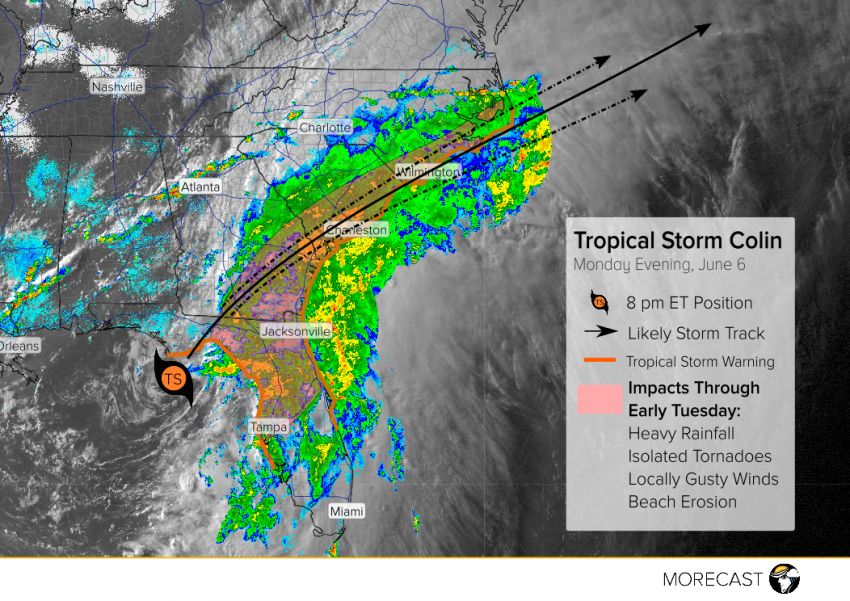
Tropical Storm Colin is now moving faster, very close to landfall in northern Florida. Heavy rains and locally gusty winds will continue to affect much of the Southeast US with tropical storm warnings now in effect up through the Outer Banks of North Carolina. When will Colin start to vacate? Mr. Morecast has the latest forecast details.
Widespread heavy rainfall has been the most common hazard today, as expected, with storm totals of 7-8 inches in some spots. The heaviest rain overnight will affect southern Georgia and the coastal Carolinas with localized flash flooding a distinct threat. Large waves and gusty winds will occur along the coast, leading to some minor beach erosion. An isolated tornado can’t be ruled out of the question, either. Colin is beginning to accelerate, however, and should be sprinting off the Carolina coast by later on Tuesday afternoon.
MORECAST meteorologists will continue to keep you informed with timely updates across our social media platforms and on our app! Follow @MORECAST_USA