Transitioning out of Fall and into the Winter months brings an increasing threat for wintry precipitation, exciting for some but a headache for many others. While some imagine winter as picturesque landscapes with lightly falling snow quietly painting the evergreens, others see traffic nightmares and a paralyzing coating of ice that leaves millions without power.
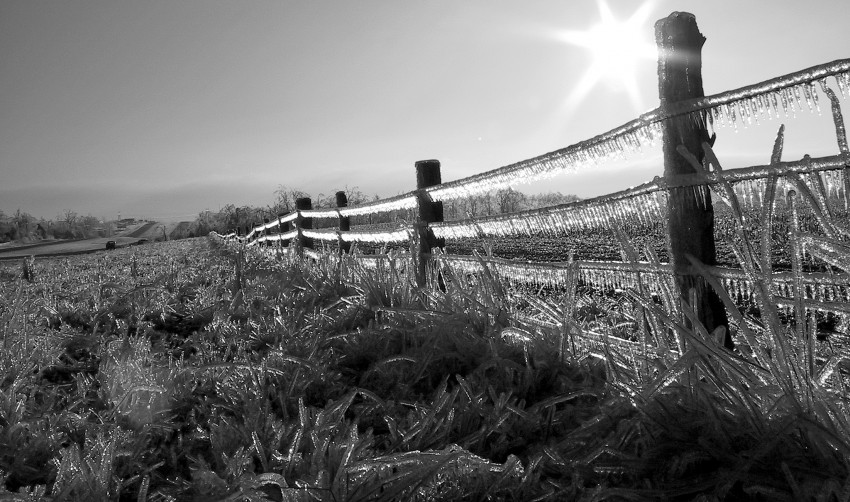
Freezing rain is liquid rain that comes into contact with a sub-freezing surface, causing it to freeze instantly and create a much more slippery surface than you typically get with snow and sleet. Along with turning untreated roads into ice rinks, the heavy weight from the ice accumulation on trees and power lines puts a tremendous amount of stress on objects (see image above, courtesy of Ray Dumas). A cubic foot of ice weighs close to 60 pounds, extra weight that eventually causes trees to fall and power poles to collapse, leading to widespread power outages. One notable ice storm in January 2009 hammered areas from northern Arkansas through the Ohio Valley with ice accumulations exceeding 2 inches (50 mm), knocking out power to 1.3 million people. Ice storms can also be deadly, especially on roadways. In fact, in 2008 and 2009, ice storm related accidents killed twice as many people as did tornadoes in Oklahoma, the heart of “Tornado Alley”. Simply put, travel is highly discouraged anytime there is freezing rain in your area.
While ice storms, technically defined as ice accumulation of at least one-quarter inch (6 mm) within a 12 hour period, are a relatively rare occurrence due to the severity of the definition, at least light freezing rain occurs one or more times a year on average across most of the USA and Canada east of the front range of the Rocky Mountains. The most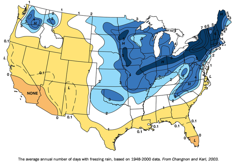 prone region for freezing rain stretches through the Midwest and the Northeast of the US (see image at right), as well as along the St. Lawrence River and Ottawa Valleys in Canada. The east side of the Appalachians and the Cascades in Washington and northern Oregon tend to have more days with freezing rain than adjacent areas west of the mountains due to a phenomenon called cold air damming. A very shallow layer of cold, dense air gets trapped just east of the mountains underneath a warmer, more moist layer aloft. Snow falling through this warm layer will melt, but refreeze as the droplets fall into the shallow layer of cold air at the surface. Icing of up to 0.5” inch (13 mm) due to this trapping of cold air in the Columbia River Gorge between Washington and Oregon led to thousands of power outages within the last couple of weeks.
Another large scale process that causes freezing rain is when a warm front pushes up against an extremely cold air mass. The clash in air masses typically causes the warm air to ride over the cold surface layer since warm air is less dense than cold air. This process often yields precipitation as well, and if the surface air is below freezing, icing will result. This process is the main driver for ice storms in the Midwest and Great Lakes. If the front is stationary with a prolonged feed of overrunning moisture, crippling ice accumulations of the magnitude of January 2009 will wreak havoc.
Morecast will keep you up to date on any winter storms heading your way, including ice storms. And you can share your winter experiences with the rest of the Morecast community by uploading your photos, showing what makes winter so beautiful, and sometimes so agonizing.