Roller-Coaster Temps But Overall Warm First Five Months of 2018


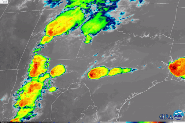
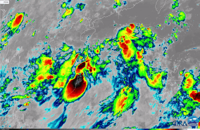
We’re well into the warm season across the U.S. We’ve had several weeks of routine severe storms, and we’ve even had our first land-falling tropical storm! But it’s not that long since many were experiencing record cold temperatures and spring snow. Just how much of a roller coaster have we been on this year?

Below you can see an animated loop of temperature anomalies over the first five months of 2018. Areas of red shading are warmer than normal, and blue shading indicates cooler than normal. The reddest (bluest) areas denote areas that saw their warmest (coldest) months on record.


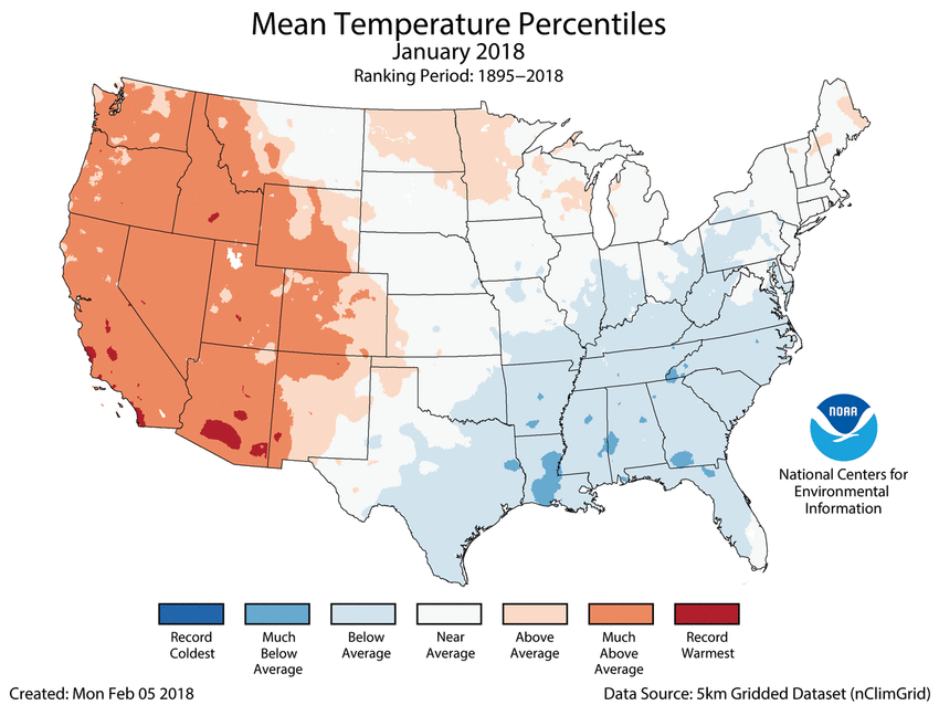
January saw a continuation of a persistent ridge in the west that had been causing much warmer than normal temperatures for most of the winter. Temperatures across the South and Midwest were below normal. Then, a total flip for February. Most of the eastern third saw very warm weather, indeed record-breaking warmth for a large part of the Southeast and southern New England. We were back below normal for March in the East, followed by dead-of-winter record cold for the central and eastern portions in April. May shifted totally in the opposite direction again with above normal temps almost nationwide, including record warmth from the Plains into the Midwest and Mid-Atlantic. In fact, it was the warmest May on record nationwide.

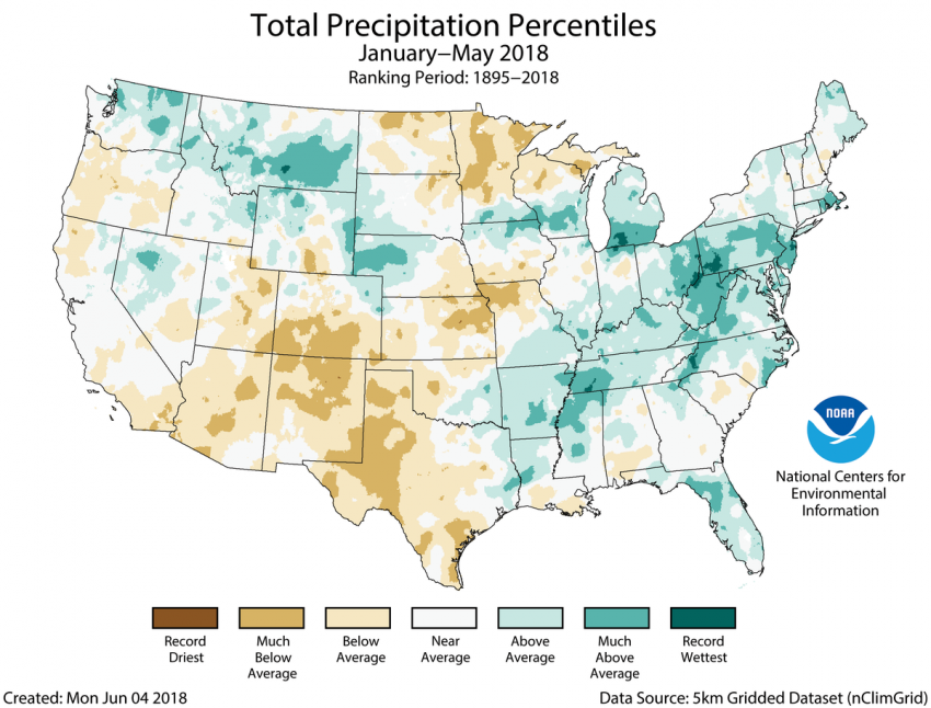
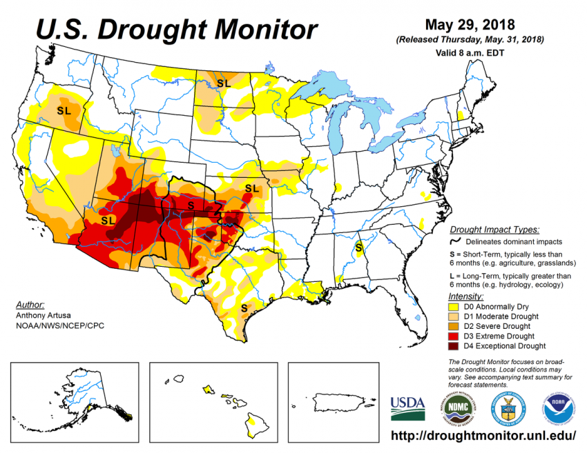
One near-constant through the first part of the year has been warm to very warm conditions in the Desert Southwest and southern High Plains. This same region has also seen below to much below normal precipitation in the same time frame (see graphic below). The combination of warm temperatures and lack of moisture has contributed to widespread drought conditions, in some cases extreme drought (see bottom graphic). The forecast into summer calls for continued warmth in the West.


“Fire Volcano” Eruption Continues to Impact Guatemala

The Guatemalan volcano known as “Volcán de Fuego” erupted Sunday morning sending rocks, ash, and volcanic gases high into the sky.

The eruption occurred about 25 miles (40 km) from Guatemala’s capital city and was detectable on NASA’s GOES-East satellite.

NASA GOES-East satellite imagery from the visible channel shows a darker plume over the mountain of Volcán de Fuego late Sunday morning. This darker plume represents ash being thrown high into the air from the volcanic eruption.

A satellite loop from the region clearly detects the eruption. Notice that a pink-looking dot becomes visible just prior to the dark ash plume.

Impacts

The village of San Miguel, which sits 6 miles (10 km) from the volcano, was hit especially hard with many buildings damaged or destroyed.

What makes volcanoes particularly dangerous are pyroclastic flows. These dangerous flows are a mix of hot rocks and volcanic gases that flow down a mountain at highway speeds, according to the Global Volcanism Program (GVP). Pyroclastic flow rates of up to 45 mph (20 m/s) have been observed in the past.

Tweets

Take a lot at the next few tweets depicting impacts and footage from the Fire Volcano.

American Airlines Plane Damaged by Hail in Midair

Severe thunderstorms pelted an American Airlines airbus plane en route to Phoenix with hail on Sunday evening causing the flight to divert to El Paso, Texas.

The plane was carrying 130 passengers and 5 crew members.

Thunderstorms erupted across central and western Texas Sunday afternoon and continued into the evening. Ground-based hail reports of up to tennis ball-sized were reported in the vicinity of where the plane was pelted.


Meteorologist Stu Ostro put together some visuals showing the plane’s movement superimposed onto radar imagery. The darker red and purple colors from radar on the top two images are indicative of heavy precipitation, while the white colors on the bottom left image suggest hail was falling.

American Airlines is expected to conduct an inspection on the damaged plane.

Tropical Depression 5 Forms in South China Sea

Tropical Depression 5 (TD 5) formed over the South China Sea this weekend and could become Tropical Storm Ewiniar this week.

TD 5 Expected Track

The Details

Satellite imagery over TD 5 shows the system is rather disorganized due to a moderate amount of easterly wind shear. Some gradual intensification is likely over the next couple of days, however, moderate wind shear through Monday will cap how strong the system can get.

TD 5 is expected to move in a northward direction over the next several days. This trajectory would take the system near or over the Chinese province of Hainan between Tuesday and Thursday.

Wind shear will weaken by the middle of the week allowing a more conducive environment for tropical development. If the center of TD 5 stays mostly out over water, the storm will have to be watched for additional strengthening between Tuesday and Friday.

Regardless of strength, rounds of heavy rain and strong winds are likely across Hainan beginning on Monday and continuing for much of the week. A cold front moving across mainland China will draw moisture from TD 5 northward bringing the risk of heavy rain and flooding to a large area of southeast China.

TD 5’s track later in the week becomes more uncertain. If the cold front picks up the storm, then TD 5 will move in a easterly direction toward Taiwan. However, the TD 5 misses the connection with the cold front, the storm could meander in the South China Sea just off shore.

If the latter scenario pans out, there could be a more significant flooding threat to southern China.