Roaring Wildfires Prompt Emergency Evacuations from Coastal Towns in NSW
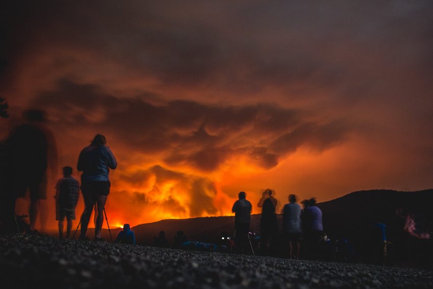
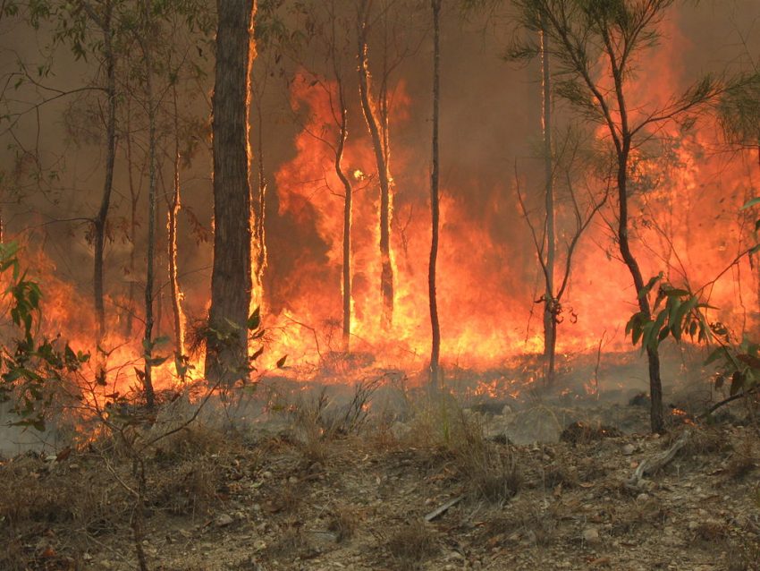
Dozens of wildfires continue to burn thousands of acres across portions of eastern Australia. Some of the largest fires are now raging across the highlands of southern New South Wales just inland from the coast. High winds and scorching temperatures are stretching already-taxed firefighting resources past the breaking point. The result is out-of-control wildfires threatening the homes and lives of thousands.
This afternoon in Bateman’s Bay…. https://t.co/tAlZS387aL
— 💧Jane Alcorn (@JaneAlcorn) December 31, 2019
Fires surrounding Bateman’s Bay, NSW forced officials to evacuate thousands of residents to the beach on Tuesday. Choking smoke turned midday into midnight as ash rained down. Desperate evacuees were prepared to flee in boats or even swim if the fires threatened the beach itself. The Australian Navy was on alert in case called upon to help evacuate residents of cut-off towns like Bateman’s Bay.
Fires creating vast pyrocumulus clouds.
Striking imagery of Victoria & New South Wales in Australia. pic.twitter.com/0wO1Qtj7O5
— Dakota Smith (@weatherdak) December 30, 2019
#PryoCB southeast of #Canberra product by lots of lightning. pic.twitter.com/ztmWsMkfLu
— Neil Lareau (@nplareau) December 30, 2019
The wildfires are burning so hot that they have created their own cloud systems. Called “pyrocumulus clouds”, these structures tower thousands of meters into the air. They operate very similarly to thunderstorms, so much so that they’re producing periodic bursts of lightning (see radar tweet above). Just like thunderstorms, these fires can also produce very high winds, even tornadoes. One such tornado may have claimed the life of a volunteer firefighter working the Green Valley fire near Jingellic, NSW on Tuesday. Witnesses reported a sudden fire tornado flipping multiple vehicles over, including the 10-ton truck the firefighter was riding in, as they were attempting to rescue cattle. Two others in the same truck were flown to a Sydney hospital with serious burns.
A few isolated storms are moving across the region today associated with a cool change. Unfortunately, these are not likely to produce the kind of widespread precipitation necessary to tamp the fires down. Gusty southwest winds in the wake of the front may in fact exacerbate the dangerous conditions, pushing the fires towards previously unburned areas.