Deadly Tornadoes Rip Through Southern U.S. on Easter
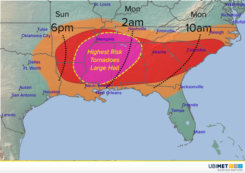
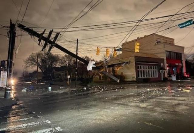
Amid the horrors unleashed by Covid-19, residents of several southern states have been thrust into another dangerous scenario as severe weather has struck the region this Easter weekend. Violent storms containing hail, heavy rain, and tornadoes have moved through the states of Texas, Tennessee, Louisiana, Mississippi, Alabama, Arkansas, and Georgia. As of now, 6 people have been confirmed dead due to tornadoes in Mississippi, while close to 365,000 are without power across the aforementioned states.
#BREAKING: Catastrophic damage reported following extremely violent tornado tracking across southern Mississippi. The communities of Bassfield and Soso appear to have been hit directly. pic.twitter.com/kYQDsTLpCi
— UA News (@UrgentAlertNews) April 12, 2020
The damage has been deemed catastrophic in many areas. One such area is the city of Monroe, Louisiana. Here, a tornado with winds estimated to be around 165mph (266 kph) touched down on Sunday afternoon, destroying or damaging at least 300 homes. The city’s airport sustained substantial damage, estimated to be around $30 million dollars. Fortunately, no fatalities were reported in the city, although some residents sustained minor injuries.
Here is a look at some of #tornado damage from #Monroe #Louisiana. #MonroeTornado https://t.co/0JzWUwBSXy
— Erik Taylor (@WeatherErik) April 12, 2020
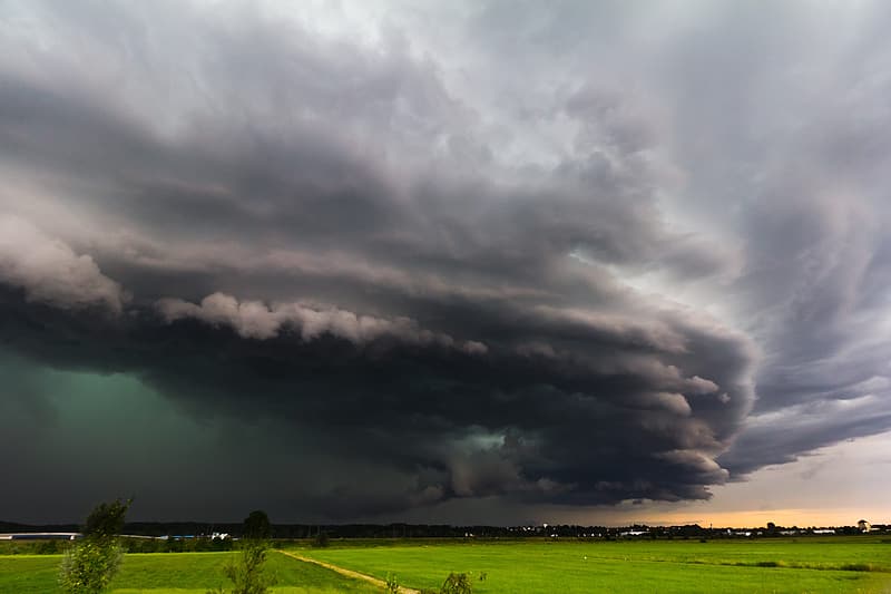
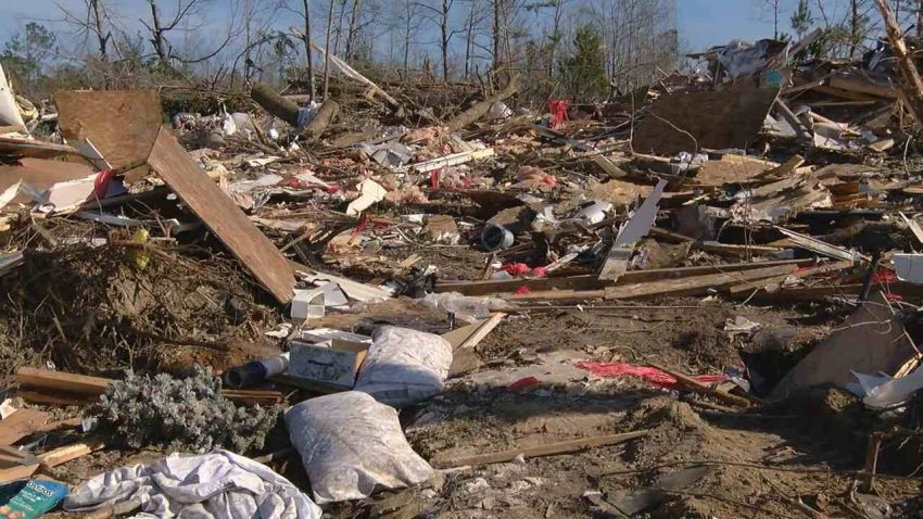
It appears Mississippi has taken the brunt of the storm system, as multiple tornadoes touched down across southern portions of the state. The twisters ravaged towns including, Soso, Heidelberg, and Pachuta, with winds estimated by Doppler radar to be between 170-205 mph (274-330 kph). This would equate to a rating of EF4 or EF5 on the Enhanced Fujita Scale. At the height of the tornado outbreak, two Tornado Emergencies were issued by The National Weather Service. This is an occurrence that does not happen frequently. Two of the tornadoes sent debris 20,000 feet (6096 meters) into the air. One meteorologist claimed that these were the most intense tornadoes he has ever seen on radar throughout his career.
Back-to-back tornadoes moving across the same area!? These radar signatures are terrifying. Thinking of Southern #Mississippi today and everyone in the path of these particularly dangerous storms. #mswx @CNNweather @cnnbrk @cnn pic.twitter.com/9Pdt80AxJK
— Derek Van Dam (@VanDamCNN) April 12, 2020
The combination of extremely favorable conditions in the upper levels of the atmosphere, and deep moisture from the Gulf of Mexico in place, is what led this multi-faceted storm system to become so destructive. As this system moves eastward on Monday, the threat of severe weather will shift to the East Coast and Mid-Atlantic regions. Conditions will not be as conducive for tornadoes as they were on Sunday, but a few isolated tornadoes may occur. Damaging winds, hail, and torrential downpours look to be the greatest hazards.
Soso Baptist Church at Soso, Mississippi (near Laurel) sustained major tornado damage because of a large tornado that moved through earlier… Thanks to Andee Thomas for sending these photos. Terrible damage! @NickLilja @PatrickWDAM @NWSJacksonMS pic.twitter.com/ZjAAkPJnvm
— Spinks Megginson (@rzweather) April 13, 2020