Spring Snow to Kick off the Weekend
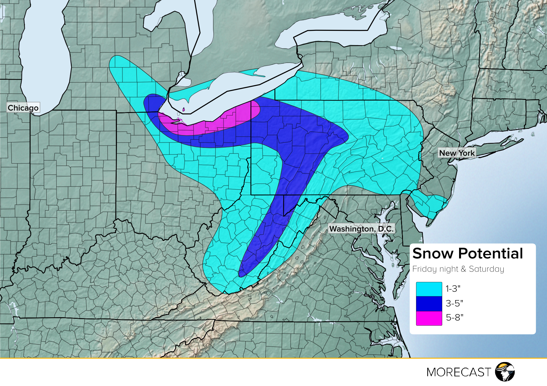
Just when you thought winter was going into hibernation, portions of the Great Lakes into the Northeast will see chances for snow. A disturbance will track into these regions starting Friday evening, with rain overspreading Ohio and southeastern Michigan. As temperatures cool, rain will switch to snow, spreading eastward into Pennsylvania and West Virginia Friday night. Winds shifting north-northeast off of Lake Erie will lead to some lake enhanced snow near the shoreline in Ohio, with up to eight inches of snow in the heaviest bands.
Snow will continue Saturday morning across Pennsylvania with 1-3” of accumulation in most locations, with higher totals of 3-5” in northwest parts of Pennsylvania into the rest of northern Ohio and far southeastern Michigan. Higher temperatures will keep accumulating snow out of Washington D.C., Baltimore, Philadelphia and New York City, but it will be a soggy day with a cold rain and maybe a couple snowflakes mixed in for these cities.
You can post your snow and any other weather pictures you have in the MORECAST weather app under the Community tab. Also for updates you can follow MORECAST on Twitter @MORECAST_USA and Facebook.