Severe Storm Threat for Parts of the East Today
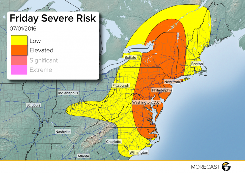
Isolated to elevated threat of severe storms this afternoon and evening across much of the Northeast and Mid-Atlantic. Mr. MORECAST has your details for what to expect.
Isolated to elevated threat of severe storms this afternoon and evening across much of the Northeast and Mid-Atlantic. Mr. MORECAST has your details for what to expect.
Isolated severe storm threat today across parts of Upstate NY and interior New England this afternoon/evening, as a cold front moves east. Main hazards include hail up to 1.5″, wind gusts up to 65 mph, and localized flash flooding.
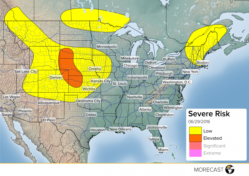
Across parts of Northern Minnesota and the Western Plains, isolated severe storms are possible late this afternoon/evening. An elevated threat is possible across Northeast Colorado, Northwest Kansas, Western Nebraska, and Southwest South Dakota. A combination of a surface low along a stationary front and some good upper level support will help produce storms capable of hail up to 2″, wind gusts up to 70 mph, isolated tornadoes, and localized flash flooding.
Follow along with the MORECAST team on our Twitter and Facebook pages for updates. Also be sure to upload any pictures you can safely take to your MORECAST app Follow @MORECAST_USA
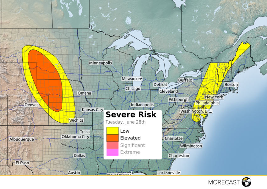
Storms are expected to fire up this afternoon from southeastern Montana to northeastern Kansas. Large hail up to 2 inches and damaging winds to 60 mph are the main hazards. There is also potential for a few isolated tornadoes across the ‘elevated’ region. These storms will move towards the south and southeast through the afternoon to the evening when diurnal heating is at its maximum.

Some widely scattered strong to severe storms will fire up this afternoon from southeastern Wyoming and northeastern Colorado into much of Nebraska and Kansas. These storms will produce damaging wind gusts to 65 mph and large hail to 2 inches in diameter before they weaken overnight. An isolated tornado can’t be ruled out completely, but the threat is low.