Severe Weather Threat for the High Plains and Midwest Today
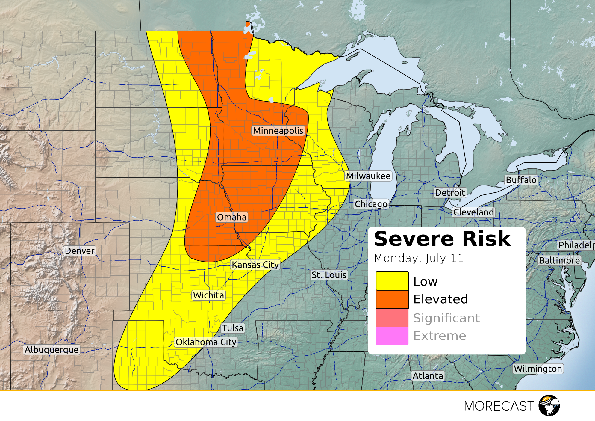
A cold front will be pushing through the High plains into the Midwest which will trigger severe weather across the area this afternoon into evening.
A cold front will be pushing through the High plains into the Midwest which will trigger severe weather across the area this afternoon into evening.
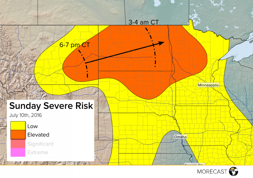
Conditions will become ripe for severe storm development later Sunday afternoon into the evening. A squall line of severe storms will likely develop this evening in eastern Montana and sprint across North Dakota tonight. Very large hail, isolated tornadoes, and strong winds will all be threats late this afternoon into this evening, with damaging straight-line winds becoming the predominant hazard overnight.
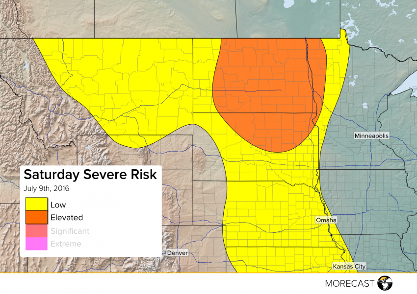
Strong to severe storms are expected later Saturday afternoon into the overnight especially from central and eastern North Dakota into northern South Dakota and eventually far western Minnesota. High winds, large hail, and potentially a tornado or two will accompany these dangerous storms.
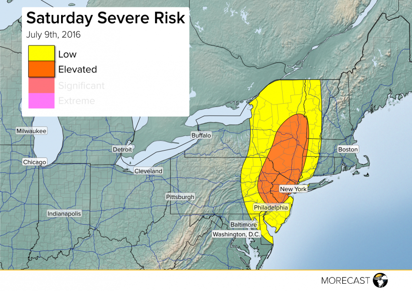
Instability is building just behind a warm front inching slowly eastward across the Northeast. Along and just behind this front will exist a threat for widely scattered severe storms this afternoon into this evening from eastern Pennsylvania into northern New Jersey and the Hudson Valley of New York. Gusty winds will fell trees, leading to scattered power outages.