Tropical Storm Javier Impacts Baja California Sur
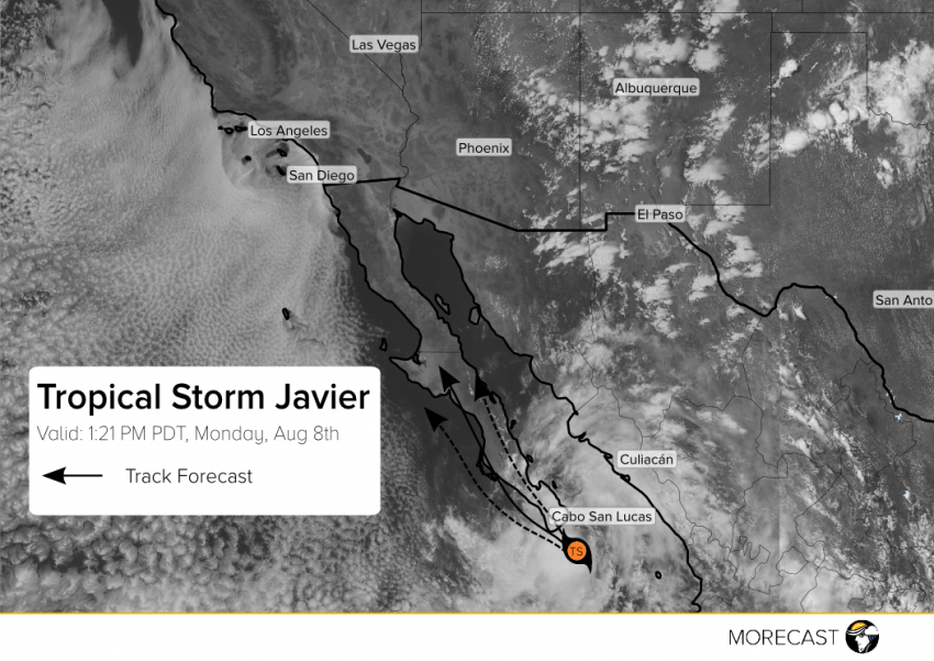
Tropical storm Javier has brought strong wind gusts and heavy rainfall to Baja California Sur on Monday, and tropical storm conditions are expected to continue into Tuesday.
Tropical storm Javier has brought strong wind gusts and heavy rainfall to Baja California Sur on Monday, and tropical storm conditions are expected to continue into Tuesday.
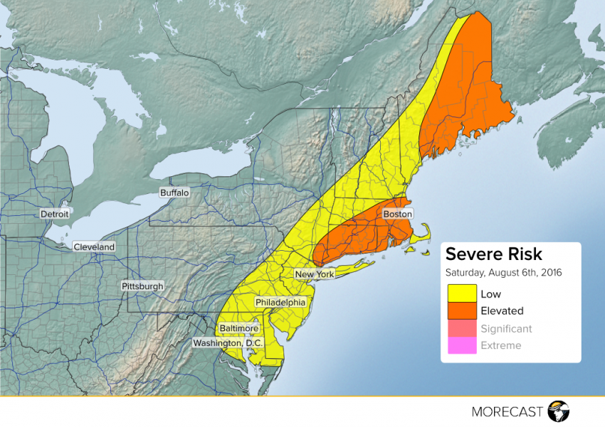
As a cold front moves through the Northeast today, thunderstorms will ignite along and ahead of the front from Maine to Maryland.
A low risk of severe storms exists for several major cities including Washington, D.C., Baltimore, Philadelphia, and New York. The best chance for severe storms will be in portions of Massachusetts, Rhode Island, Connecticut, and southern New York. These storms will be capable of producing damaging wind gusts, with a low risk of flash flooding.
In addition, much of eastern Maine has an elevated risk of severe storms. Wind gusts and small hail are possible with these storms.
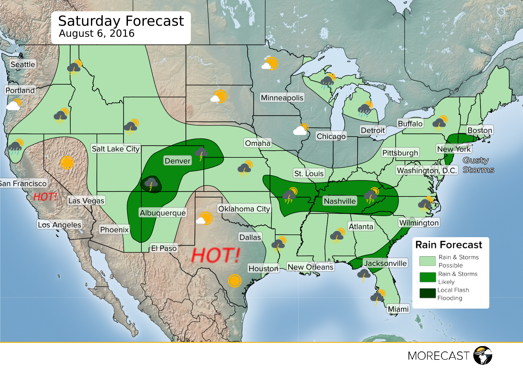
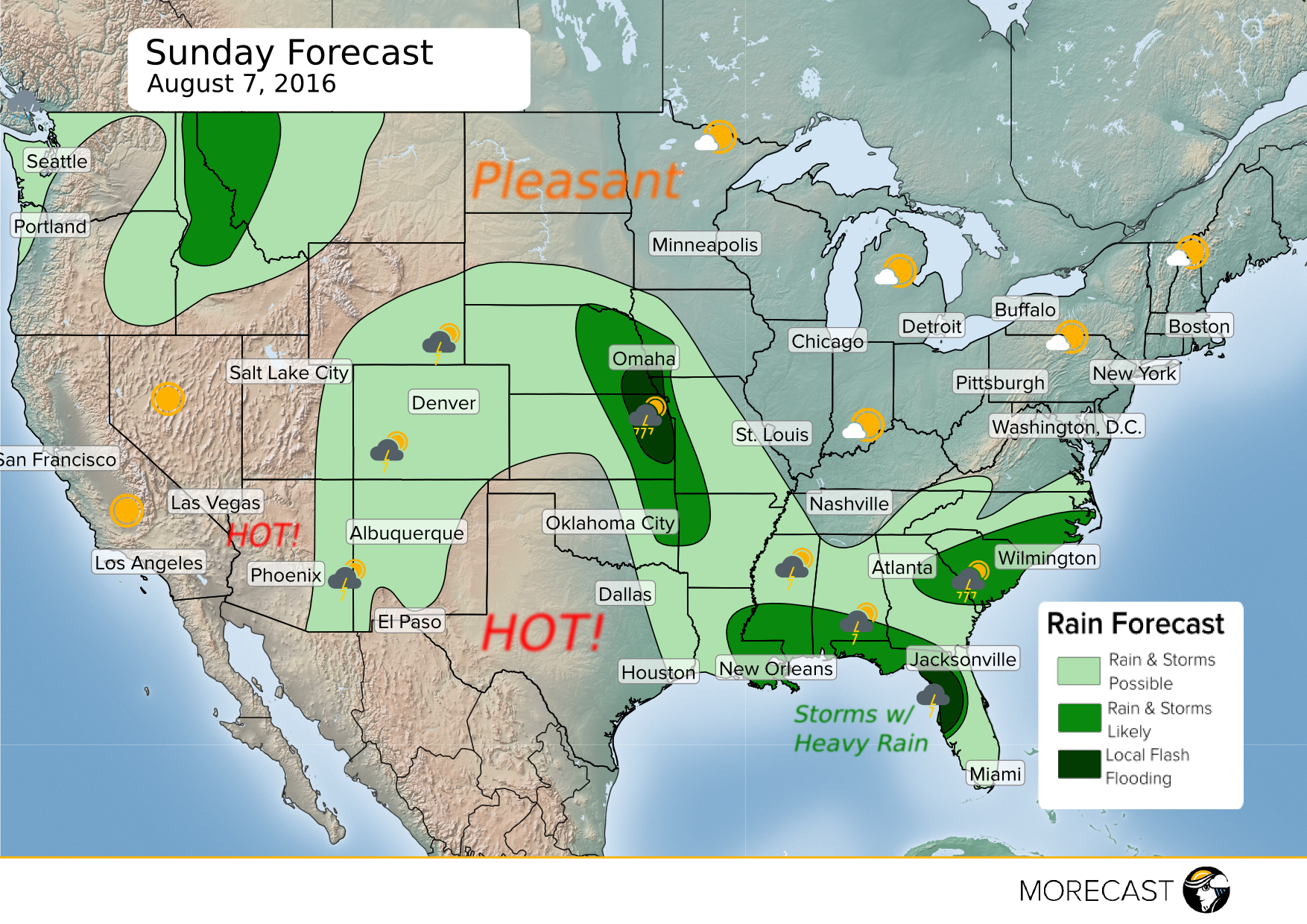
The first weekend of August will start off with a cold front moving through the Northeast, bringing scattered showers and thunderstorms Saturday afternoon and evening. Storms that do form in the Northeast will be capable of gusty winds around 40 mph, with a few isolated storms possibly becoming severe with 60 mph gusts. The second half of the weekend will bring pleasant weather to the area.
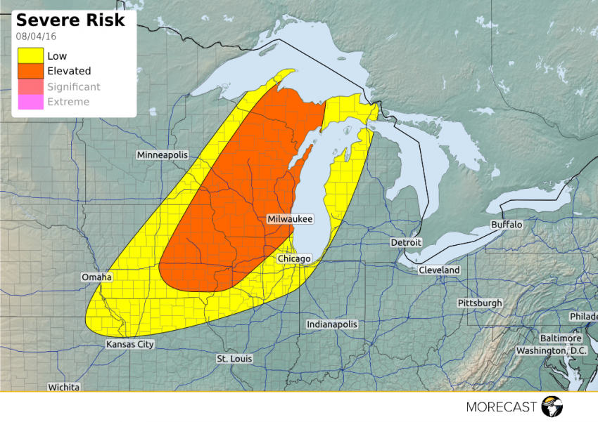
Strong storms are expected across portions of the Upper Midwest this afternoon and into the night hours. Wisconsin looks to bear the brunt of the action, with Milwaukee included in our “elevated” risk area.
