Coral Sea Tropical Basin Could Heat Up Next Week

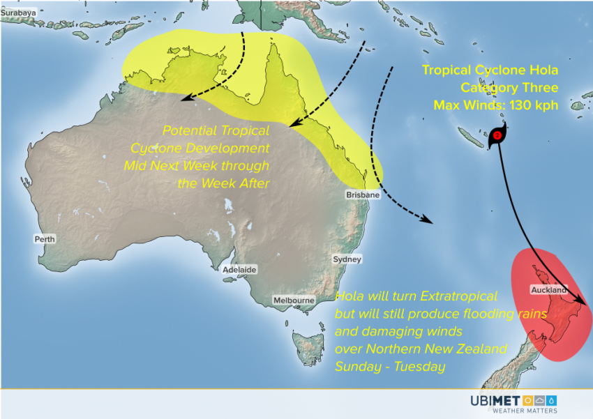
Almost a month has passed since the last cyclone threatened the Australian coast. However, we’re in the heart of the cyclone season, and coastal residents should keep a sharp lookout. There are indications that some cyclone activity could develop next week in the Coral Sea and/or the Gulf of Carpentaria.

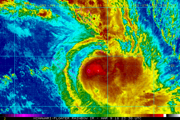
Currently Cyclone Hola is the main tropical story in the region. Hola is a Category Three storm moving mainly between the islands of New Caledonia and Vanuatu (see satellite image above). Hola will move south and encounter cooler waters, eventually turning extratropical by early next week. It’ll still be a powerful system, though, and northern New Zealand will likely see heavy impacts, including flooding rainfall, dangerous surf, and damaging winds. That will make three remnant but powerful cyclones to strike New Zealand in the last few weeks.


Model guidance suggests the next tropical lows could develop in the warm water north of Australia, perhaps in the Coral Sea or the Gulf of Carpentaria. If they were to develop, these systems could threaten portions of North Australia or Queensland from the middle of next week through the weekend and even into the week after. However, it’s much too early to make a definitive statement about potential intensities or landfall points. We’ll keep watching closely!

Still Time to Ski and Board!

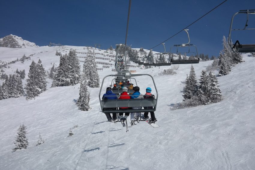
It’s March, but it’s not too late for skiers and boarders to hit the slopes!

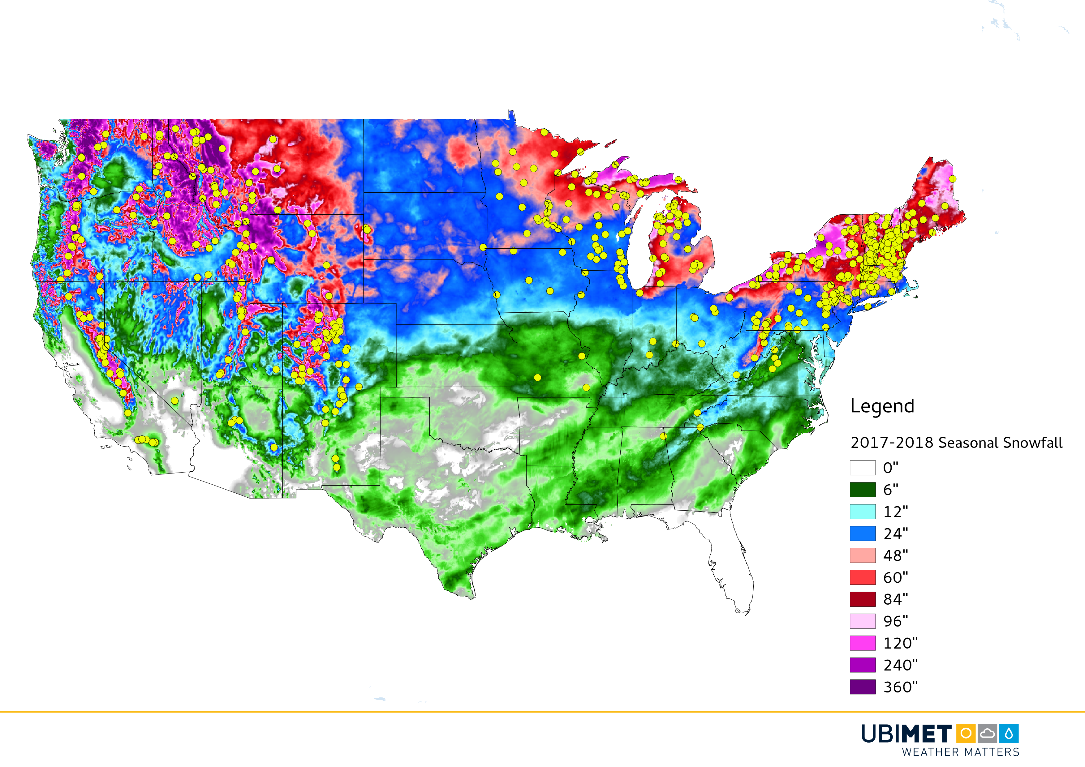
Here’s a look at this season’s snowfall amounts across the continental U.S. (The yellow dots show all of the ski resorts across the country!) All states in the Lower 48 have seen some snow this season!


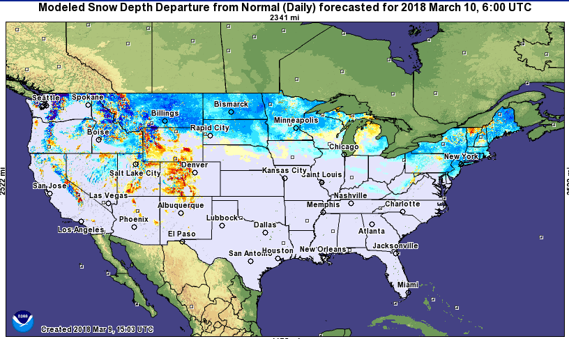
The Northeast is recovering from back-to-back Nor’easters that provided several feet of late season snow. Check out this map showing the departure from normal snowpack across the U.S. This recent winter blast holds much of the Northeast in above average snowpack (blues) through the first part of March.

Besides the Northeast, the northern tier of the U.S. and the Cascades are also hanging onto higher than average snowpack. On the flipside, the Central Rockies have suffered in terms of snowfall this year, with Colorado only receiving about 70% of their average seasonal snowfall. Unfortunately for their ski resorts, less than average snowpack (yellows and reds) are shown on this map.

There’s still plenty of snow out there skiers and boarders-get out and have some fun!


Watching a Storm Threat This Weekend & Early Next Week

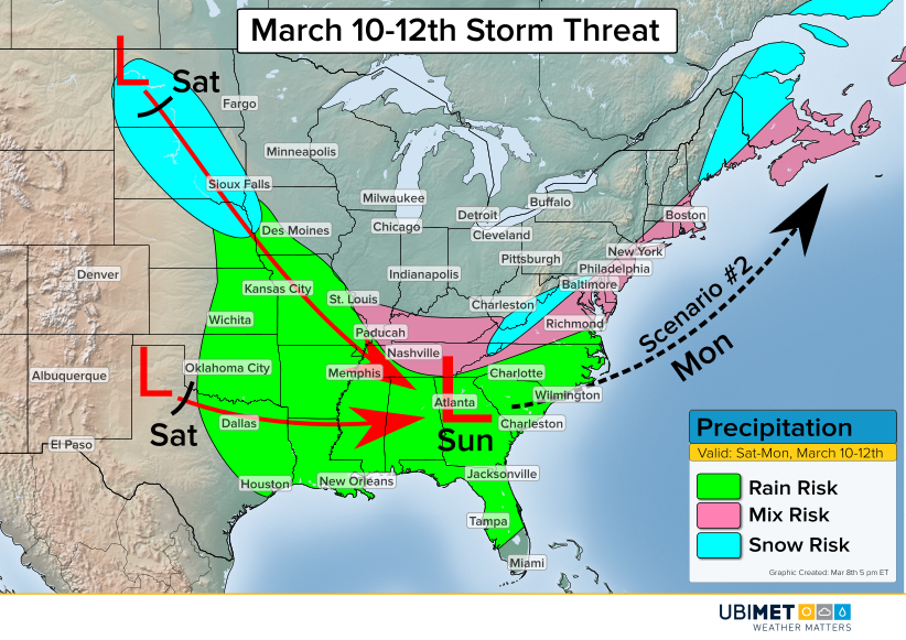
The active March weather will continue this weekend as a new storm eyes the central and southern US.

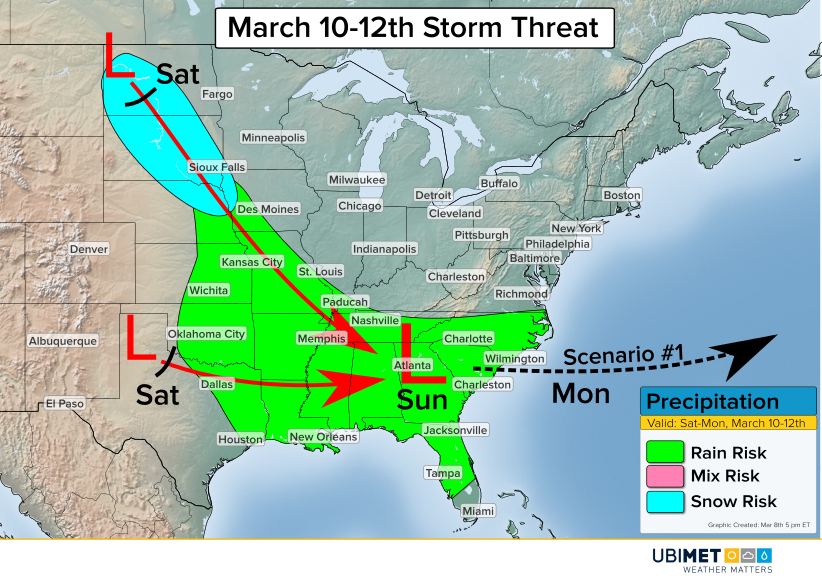
One piece of energy will dive southward from Canada into the northern Plains on Saturday. This disturbance will bring with it an area of mainly light snowfall. Meanwhile farther south, a second disturbance will begin to organize over the southern Plains.

The steering winds in the upper atmosphere will bring these two disturbances together on Sunday. Consequently, the disturbances will consolidate to one low pressure center over the Southeast. As this occurs, rain will break out across the southern Plains and merge with precipitation from the Plains.

Once the new low pressure forms, there are a couple of paths that the low pressure could take.

Scenario 1

The first scenario is a low pressure track out to sea. This track would occur if the two pieces of energy are slow to combined forces, causing a weaker and more flat system to move off of the coast.

Rain would be likely across much of the Southeast with the cutoff being near the Virginia/North Carolina border.

Scenario 2

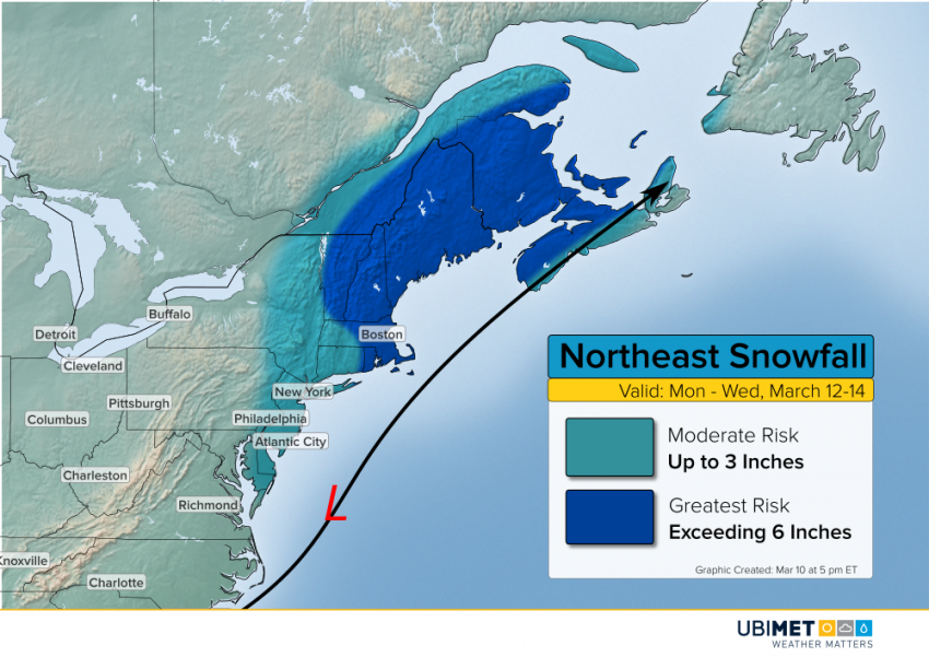
The second scenario is a low pressure track closer to the East Coast Sunday night and Monday which would have the potential to impact millions more people.

A track closer to the coast would occur if the two pieces of energy are able to combine quicker. A quicker merger would cause a stronger low pressure system over the Southeast. A stronger low would give the steering winds more of an opportunity to direct the storm up the coast as oppose to out to sea.

Scenario 2 would introduce the opportunity for an accumulating snow on the northwest periphery of the storm, possibly including many of the major cities along the I-95 corridor.

Current indications would favor a track closer to scenario 1, however, residents along the East Coast should continue to stay up-to-date on the latest forecast trends.


Tropical Cyclone Hola Churns in South Pacific

Tropical Cyclone Hola continues to spin in the South Pacific near the island of Vanuatu, about 1,600 km northeast of Brisbane, Queensland.

The slow movement of Hola this week has brought copious amounts of rain to Vanuatu. Since 7-March, the villages of Lamap Malekula and Saratmata have received close to 400 mm of rain.

Where will Hola go next?

Hola will begin to interact with a trough and move toward the southeast on Friday. Over the weekend, the tropical cyclone will merge with the trough and get steered toward New Zealand.

Sea-surface temperatures are currently warmer than average surrounding New Zealand. Orange and reds in graphic below indicate above average temperatures, while blues indicate below average temperatures (Map courtesy of tropicaltidbits.com). As Hola moves southeast into this area, these warm waters will help add fuel to the system.

Sea-surface temperatures are warmer than average across the waters surrounding New Zealand

Hola’s interaction with the trough will gradually transition the tropical cyclone towards a strong non-tropical cyclone. Despite the change in character, Hola will threaten the North Island of New Zealand with wind and rain as early as Sunday night or Monday. Auckland, New Zealands largest city, will be at risk for wind and rain on Monday.