Super Typhoon Trami a Harmless Giant for Now


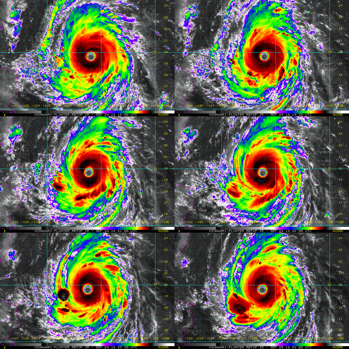
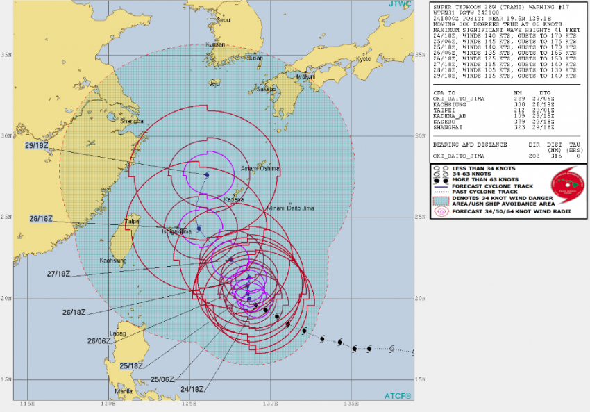
Super Typhoon Trami became the fourth category five cyclone of the 2018 Western Pacific season on Monday. Forward motion has slowed to westward crawl, however. Steering winds will remain quite weak over the next few days and Trami won’t pose an immediate threat to any major land masses. That could change as we head towards this weekend, however!


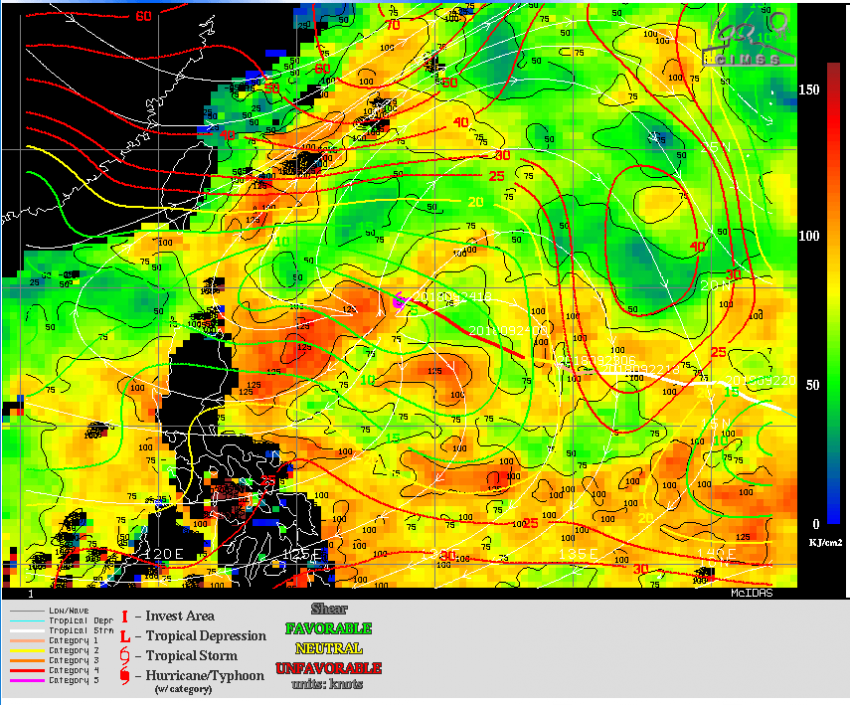
Trami will continue to move through a favorable environment over the next few days. Ocean waters lie beneath the storm with weak vertical wind shear above (see map above). These conditions will ensure that Trami remains a strong typhoon despite the slow storm motion that might otherwise lead to weakening.


Trami is expected to drift slowly north to northwest through the next couple of days. Later in the week, Trami will move more quickly to the north or northwest as steering currents strengthen. Most models bring the system north into the East China Sea by week’s end. The storm’s track after that is uncertain. There’s a strong possibility it could approach the southern islands of Japan this weekend or early next week. We’ve got several days of monitoring left to do, though, before Trami poses that kind of threat.

Fierce Tornadoes Slam the Ottawa, Canada Metro Area!


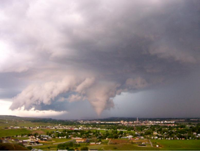
Severe damage is being reported tonight in the suburbs around Ottawa, straddling the border between Quebec and Ontario. Videos taken from the area confirm that one or more tornadoes moved through around 5 pm ET. These powerful storms have led to injuries, shattered homes and businesses, and nearly 200,000 without power this evening!


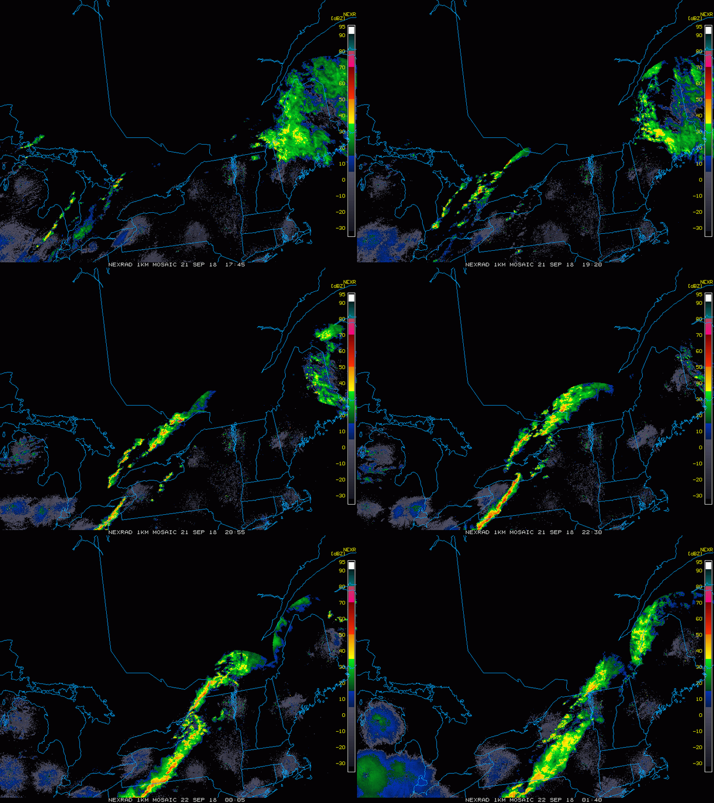
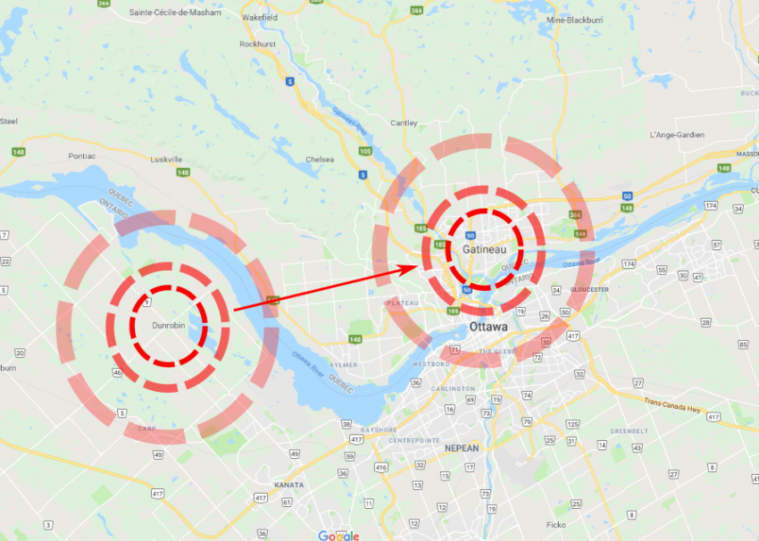
The severe storms erupted earlier on Friday afternoon along a strong front all the way from the U.S. Midwest up through southern Quebec. Particularly strong cells moved along the Quebec-Ontario border late in the afternoon (see radar animation above). One of these cells spawned at least one long-track tornado. It’s also possible there was more than one tornado moving along the same path. The towns of Dunrobin in Ontario and Gatineau in Quebec were especially hard-hit (see map and tweet videos below). A preliminary assessment of the damage depicted by pictures and videos indicate at least an EF-2 tornado moving through a heavily populated suburb of a major city. In fact, the Ottawa International Airport had to switch to backup power Friday evening as the storms rolled through. The severe storms have since diminished and moved into the northeast U.S.


Torrential Oklahoma Rains Threaten State Record!


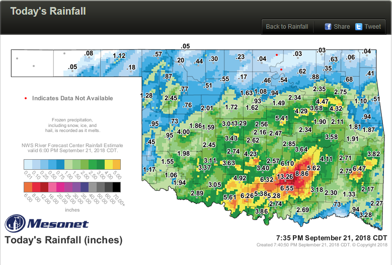
A stationary front has been the focus for storm activity and heavy rainfall throughout the day today in Oklahoma. The heaviest amounts have been tallied in a band across southern portions of the state. One station has recorded more than 13 inches (330 mm) so far, close to the state record for most rainfall in 24 hours!


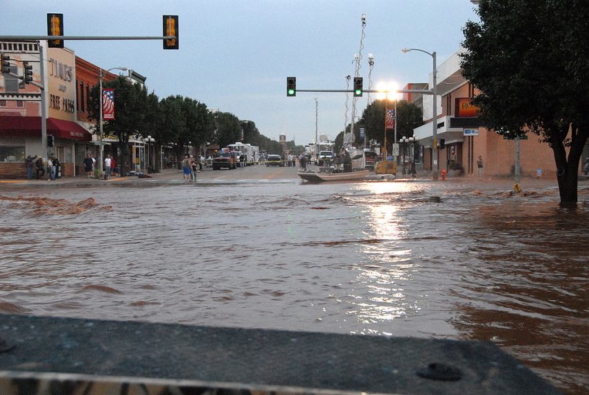
Remnants of a tropical depression that was in the Gulf of California a few days ago have drifted slowly into the southern Plains. The combination of tropical moisture and a slow-moving upper low have prompted the heavy rains (see map above for totals). The Fittstown observation has recorded the heaviest amount so far, 13.26 inches (337 mm) as of mid-evening. These rains have overwhelmed the local drainage system, putting the entire town of Ada, population 17,000+, underwater. Officials have urged residents to avoid attempts to travel unless absolutely necessary through tonight. The picturesque Turner Falls, normally a sunny swimming spot, have become a raging torrent (see bottom tweet). Fortunately, the heavy rain bands will gradually diminish over the region tonight. Lead photo courtesy Marvin Naumann with the Federal Emergency Management Agency (FEMA).


Flooding from Florence Will Be Worse than Hurricane Floyd in North Carolina


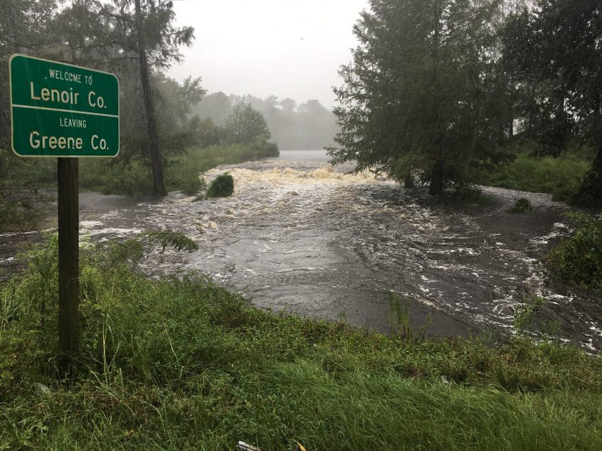
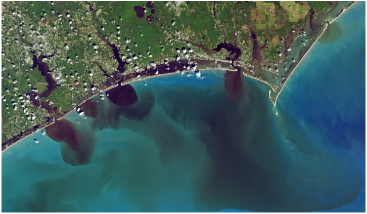
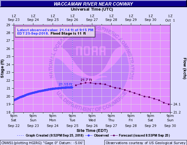
Nineteen years before Florence almost to the day, Hurricane Floyd lashed eastern North Carolina with damaging winds and storm surge. But the most lasting and devastating impact from Floyd was the torrential rain that lead to record-breaking river flooding. The ongoing floods from Hurricane Florence have been or will be even worse in some areas (see maps below).


Hurricane Floyd was a different kind of storm from Florence. It was a stronger storm, category three at landfall compared to Florence’s category one status. It was also moving much faster – the heavy rainfall totals were caused by Floyd joining forces with a storm system already in place over the East Coast. Florence, on the other hand, was working on its own but moving much more slowly. There are some striking similarities, however. The two cyclones, exactly nineteen years apart, made landfall within 25 miles of each other. And the rainfall footprint is rather similar, especially in southeast North Carolina. The magnitude of rains from Florence, although covering a somewhat smaller area of the state, is greater. Floyd held the previous state record for rainfall from a tropical cyclone at just over 24 inches. Florence shattered it with nearly 36 inches of rain recorded at Elizabethtown.


Floyd caused over three billion dollars in damages, mostly from the flooding, and cost 51 people their lives. So far Florence has tallied 25 deaths on North Carolina, but that number will probably increase. It’s too early to specify monetary damages on a state-by-state level, but some agencies are already putting Florence in the top ten of costly U.S. hurricanes. Major highways and interstates across the southeast part of the state are still closed (see red dashed lines on the map above) and will likely remain closed well into next week. Lead photo courtesy Spc. Andrea Salgado Rivera, U.S. Army.