Dorian Lashing Carolina Coast, As Death Toll Across Bahamas Climbs

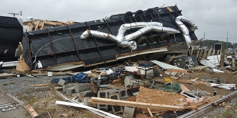
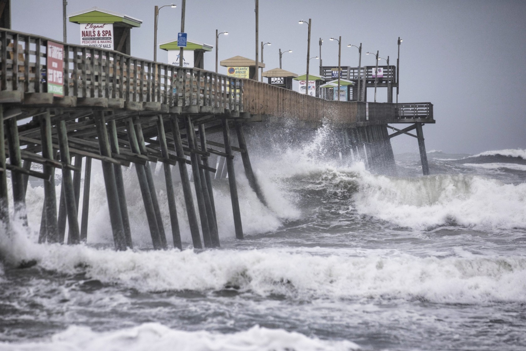
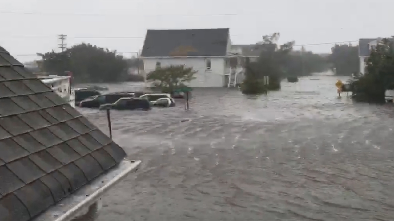
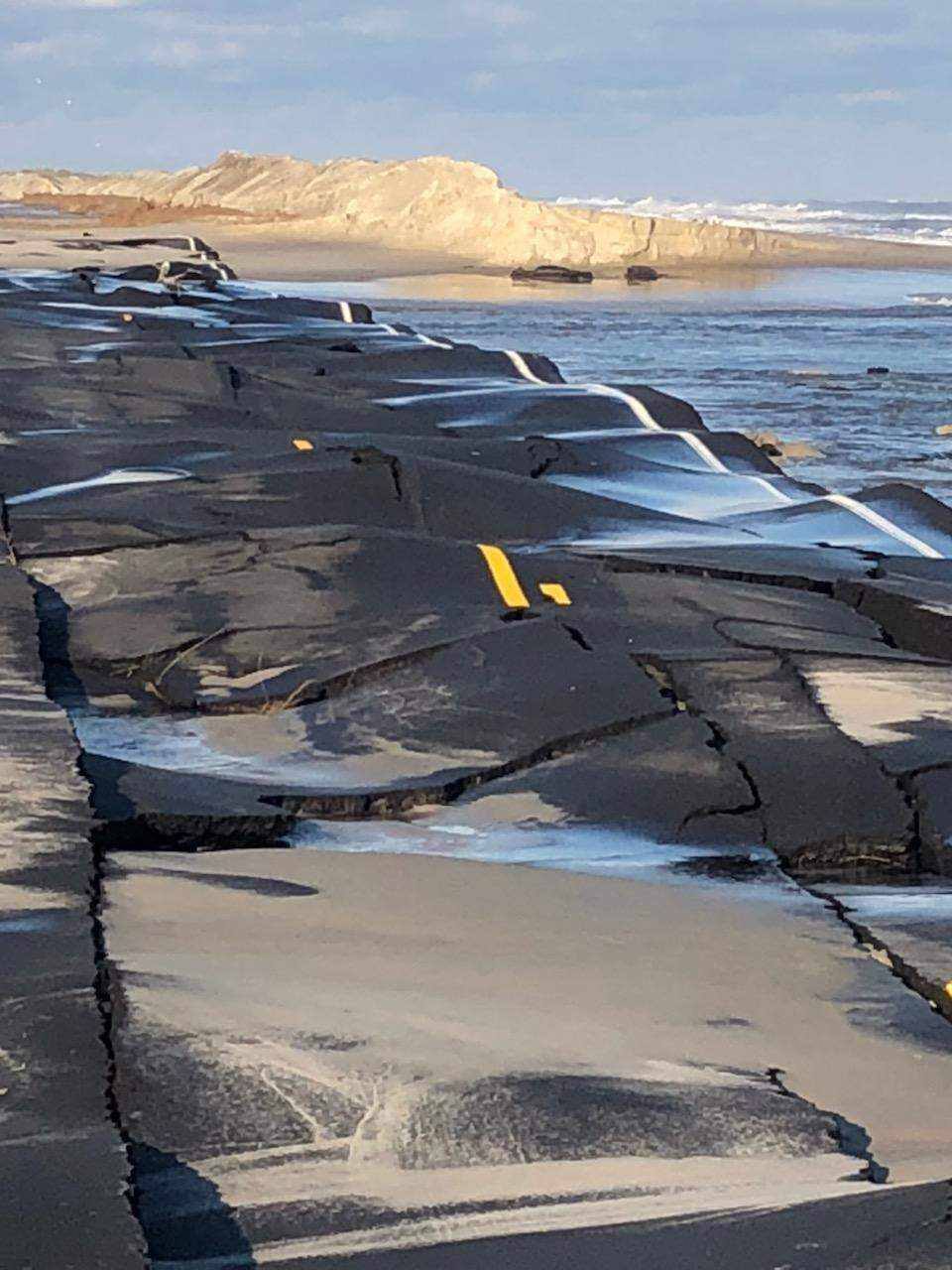
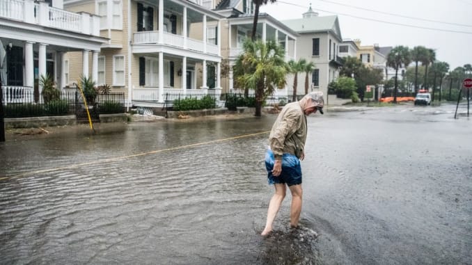
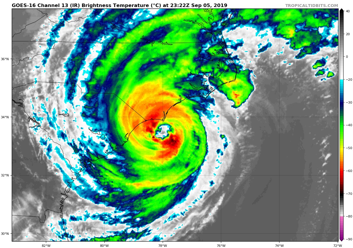
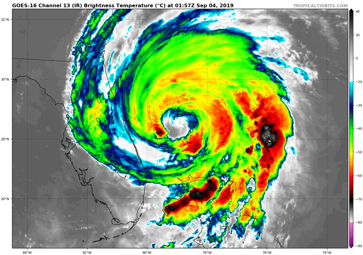
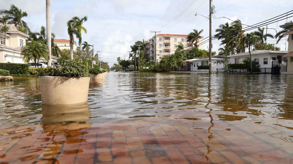
After meandering slowly off of the southeast coast of the United States for the last few days, Hurricane Dorian is finally on the move, but is currently affecting the states of North and South Carolina. The formidable Category 2 storm is unleashing it’s fury in the form of flooding rains, high winds, coastal flooding, and even tornadoes as it churns dangerously close to the shoreline. Several thousand people are now without power across both states, while many roads are closed due to the flooding.

With winds of 100mph(160kph), it is still very possible that Dorian may make a landfall in the early morning hours of Friday along the coast of North Carolina. Residents of that state have been urged to shelter in place by Governor Roy Cooper. Several short-lived, but destructive tornadoes have touched down across the Carolinas. Tornadoes are fairly common within tropical systems, and usually strike without warning. Up to 9 inches(226mm) of rain has already fallen in certain locations, with up to 15 inches(381) possible in isolated spots. Widespread coastal flooding has been observed up and down the coasts of both states, and will continue to be a threat, with some areas seeing a water level rise of up to 8ft(2.4m). A gust of 98mph(157kph) was reported along the South Carolina coast earlier today

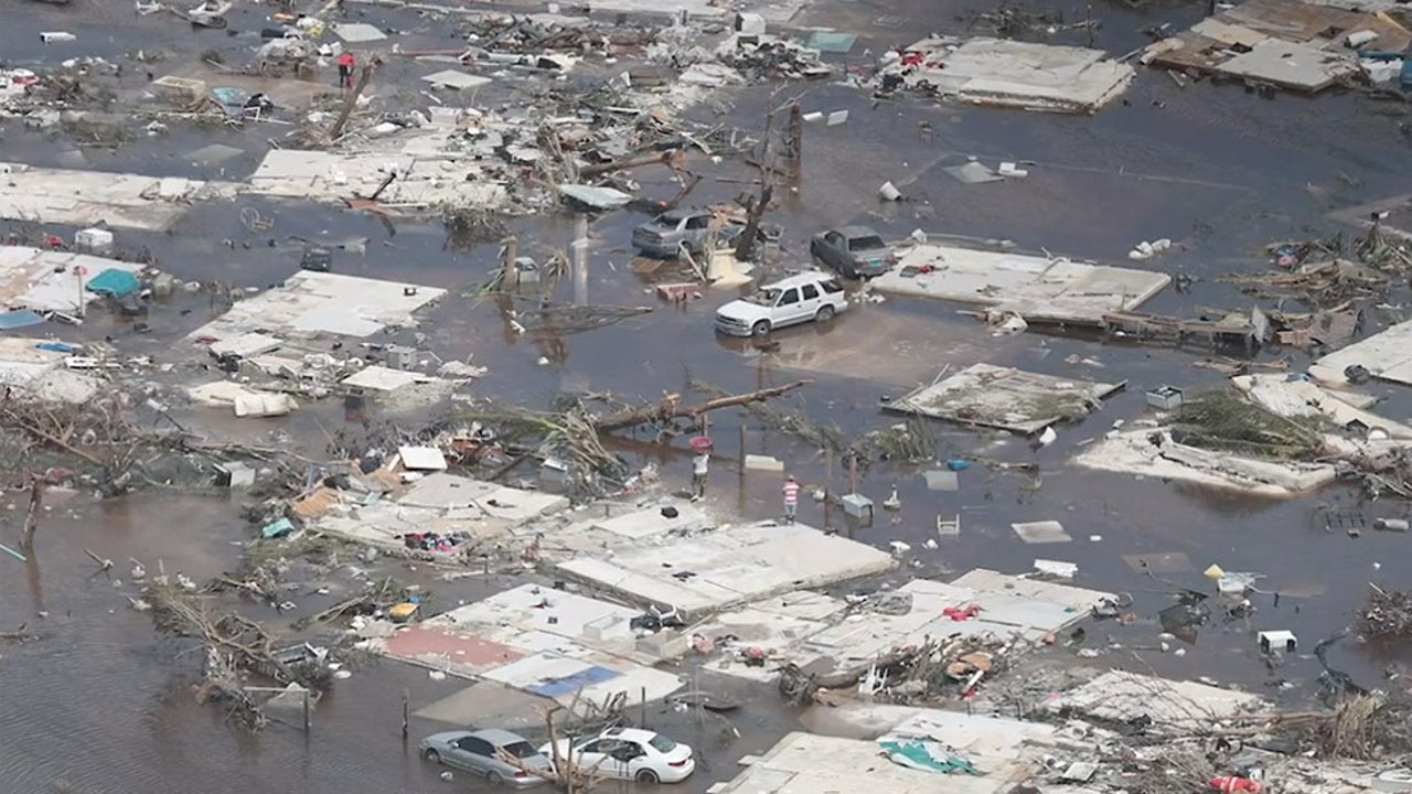
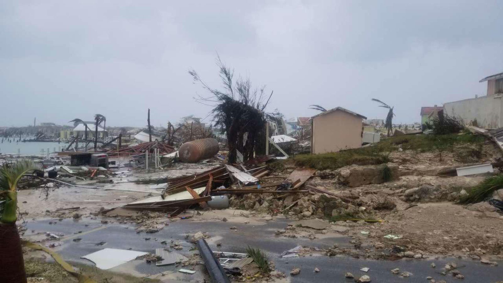
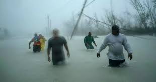
Meanwhile in The Bahamas, Bahamians are trying to piece their lives back together, as a massive cleanup and recovery is underway. Amidst the pummeled remains of homes and neighborhoods, search crews and residents alike are searching for people who remain unaccounted for. The death toll has already risen to 30, and officials predict that the number is likely to soar once everything is said and done. Dorian hovered over the northern Bahamas for two days, with punishing winds, torrential rains, and deadly storm surge. It is one of the slowest moving storms ever recorded.

Deadly Dorian Crawls Towards US!

After ravaging the northern Bahamas for the last few days, Hurricane Dorian has finally started to turn northward, with its eye set on the southeast coast of the US. The storm, which is responsible for at least 7 deaths so far, is departing the Bahamas after spending the last two days pummeling the area with punishing winds, torrential rains, and a ferocious storm surge. Dorian became the strongest hurricane to ever hit The Bahamas, as it made it’s first landfall on Sunday with sustained winds of 185mph(298kph), on the Abaco Islands. With a central pressure of 910mb before it’s first landfall, Dorian had the lowest pressure ever recorded in the Atlantic east of Florida and north of the Caribbean. Within just nine hours on Sunday, it’s peak winds increased from 150mph(241kph) to 185mph(298kph) making it the fastest intensifying hurricane of this magnitude ever seen in the Atlantic Basin.

Aside from breaking records, Dorian has delivered a devastating blow to the Abaco Islands and Grand Bahama Island. After several landfalls, and two days of basically stalling over the area, these islands have been completely inundated by the storm. Homes have been leveled, trees stripped of their leaves, and roads have been turned into raging rivers, as the ocean became one with the land. The islands remain without power, or running water, as many residents remained stranded, trapped in their homes, and are awaiting to be rescued. Numerous people are still unaccounted for.

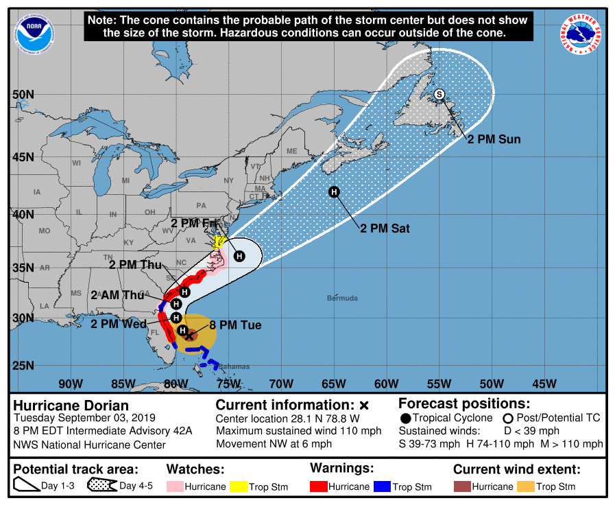
Although Dorian has weakened considerably since his peak on Sunday, the storm remains a strong Category 2 storm with winds of 110mph(177kph), and is on par to make contact with the coast of the southeast US in the coming days. Despite the winds being weaker, the wind field of the storm is expanding, so even if the storm does not make a direct landfall on the coast, hurricane force winds are still likely to be felt here. Hurricane warnings are now in effect for the coastlines of Florida, South Carolina, and North Carolina, while a state of emergency remains in effect for these states as well.

Forecast models depict Dorian remaining offshore, with it’s center just skirting the coastline, as it travels northward. A landfall along the coast of one of these states still cannot be completely ruled out at this time, however. The slow moving nature of the storm has giving residents of the Southeast lots of time to prepare, as storm surge, hurricane force winds, and flooding rains are poised to start effecting the region in the next 24 hours.

Hurricane Dorian Shifts Track; Targets Carolinas!

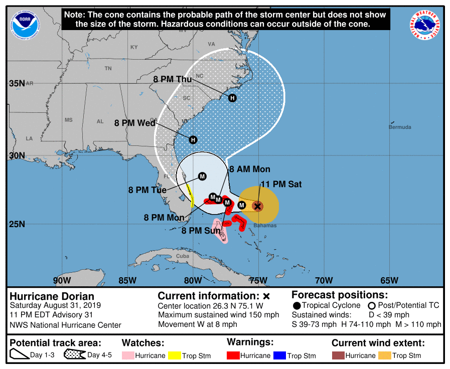
Hurricane Dorian once again has strengthened within the last 24 hours. The Category 4 storm, currently positioned to east of the Bahamas, has sustained winds of 150 mph (241kph), which is only 7mph shy of Category 5 status. It is very possible the storm may reach Category 5 status in the coming days, as it is forecast to move over a deep layer of very warm water, just east of the northern Bahamas. Dorian is also moving quite slowly, at 8mph, which will allow the hurricane to tap into the energy from that warm water. Coupled with a favorable upper atmospheric environment, weakening is highly unlikely in the near future. Dorian’s satellite presentation continues to look outstanding. With a well defined eye, and near perfect symmetrical shape, Dorian is a classic looking text book hurricane.


Although Dorian has maintained it’s intense strength, one thing that has changed dramatically is his track. As of yesterday, it was looking as if a landfall along Florida’s east coast was likely, but as of today, it seems that Dorian may move northward into the Carolinas instead. New forecast data coming in has suggested that an upper level trough of low pressure will steer Dorian more to the north, sparing the Florida peninsula of a direct hit. This may be good news for Florida, however, that does not mean the state will be completely free from the dangers of this hurricane. Fringe effects are still very possible, which has led to tropical storm watches being issued earlier today along Florida’s east coast.

As one state breathes a sigh of relief, (sort of), three other states are now on high alert. In addition to Florida already being under a state of emergency, the governors of both North and South Carolina have issued a state of emergency earlier today. The coastal counties of Georgia are also under a state of emergency. Another hurricane is that last thing these three states want to see, as they are all still reeling from the effects of hurricanes Matthew, Michael, Irma, and Florence; all within the last three years.


The track of Dorian remains uncertain it this time, as not all of the forecast models are in agreement of where the storm will go. The general consensus, as of now, it that Dorian will not make a landfall at all in the United States, but just skirt the coasts of Florida, Georgia, South Carolina, and North Carolina, before turning out to sea later next week. There are several models that do show a landfall along the South Carolina coast, while a few outliers still show a landfall in Florida. Even without a landfall, Dorian is very likely to bring devastating effects to the aforementioned states in the form of high winds, heavy rains, coastal flooding, and beach erosion. Dorian’s timing will also coincide with the presence of King Tides ( astronomical higher tides that happen seasonally), which will enhance coastal flooding significantly.

One thing that is certain, is that a prolonged period of life-threatening storm surge, devastating hurricane-force
winds, and heavy rains capable of life-threatening flash floods are
expected on the Abaco Islands and island of Grand Bahama in The
Bahamas Sunday through Monday, and a hurricane warning is in effect
for these areas. As Dorian passes through The Bahamas, and slowly
approaches the southeast coast of the United States through the
middle of next week, it is possible the track may change once again.
Nonetheless, all residents within the path of the storm should remain
vigilant, and heed all warnings and orders of evacuations from the
authorities. 

Major Hurricane Dorian Turning Towards Bahamas & Florida; Evacuations Ordered!


Thanks to very warm ocean waters and light winds aloft, Hurricane Dorian has continued to strengthen Friday. Sustained winds have increased to 130 mph (210 kph), making Dorian a major Category Four hurricane. Steering winds have also changed direction as anticipated, ominously pushing the cyclone from the northwest more to the west. Dorian is now taking dead aim at the northern Bahamas, and Florida beyond.


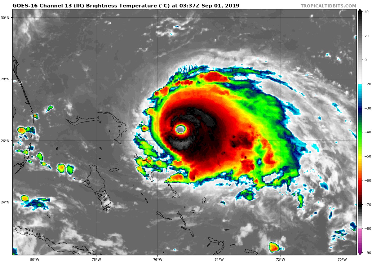
The satellite animation above shows how Dorian has developed a clear, round eye, the unmistakable sign of a healthy, intense hurricane. Hurricane hunter aircraft recently found much stronger winds than previously analyzed in the eyewall, prompting a significant upgrade in intensity estimates. There’s no reason to think Dorian will weaken in any significant way over the next few days. By later on Sunday, the northern Bahama Islands will be getting battered, and hurricane warnings are already in effect there.


Steering winds weaken significantly later this weekend into early next week, and Dorian is expected to slow down drastically. A system far to the northwest will likely start to pull Dorian slowly to the north at some point next week. The vital question is whether this will happen before or after a potential landfall in eastern Florida. Many models wait till the storm is just inland to turn north, but the most recent trends suggest the storm could turn very close to and move north along the coast. Some even indicate no landfall at all, moving the storm basically parallel to the southeast coast all the way up to the Carolinas. Such a scenario would expose a long stretch of the coast to major impacts. However, the storm’s worst winds and surge might remain offshore, since the hurricane’s most intense side is to the right (or east in the case of a storm moving north like Dorian).


There is still some time to watch and hope that the least destructive scenario is realized. In the meantime, however, residents from south Florida all the way up to the coastal Carolinas should prepare for the worst. Heed the messages coming from local emergency management and be ready to evacuate if necessary. Evacuations have already been ordered for areas of eastern Florida, and more may be needed in the coming days.