Soggy End to a Record-Setting Wet 2018 in the Eastern U.S.


Another significant storm system is rolling across the eastern U.S. tonight. The north and west sides of the storm have dumped heavy snow and even blizzard conditions from the Southwest to the Plains and Upper Midwest. However, the main story to the east has been more heavy rain. It’s the appropriate end to a very wet 2018 that saw yearly rainfall records shattered in many locations.
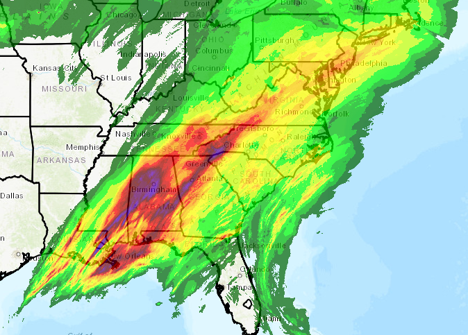


The current system has dropped rainfall amounts of 3-5 inches from the Mid-South to the southern Appalachians (see map above). Flooding has been common in these areas, some of it serious (see tweets below).


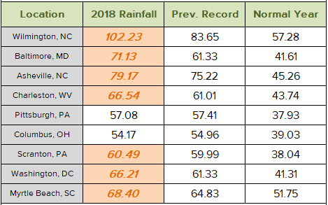
This rainfall has helped some cities set their new record rainfall marks for the year. Many cities, however, saw records broken much earlier. Wilmington, NC outran their previous yearly rainfall record all the way back in mid-September! The table below shows 2018 totals compared to previous records and the normal yearly rainfall. All but two cities easily surpassed their old records, in some cases by ten to nearly 20 inches!


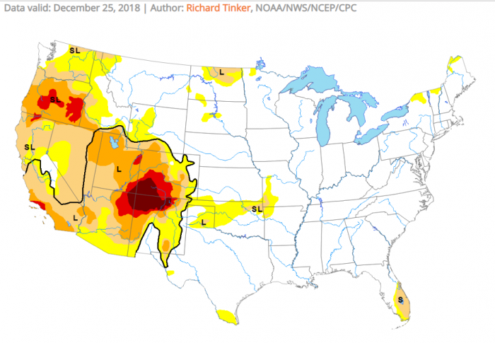
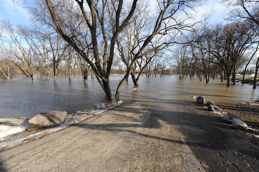
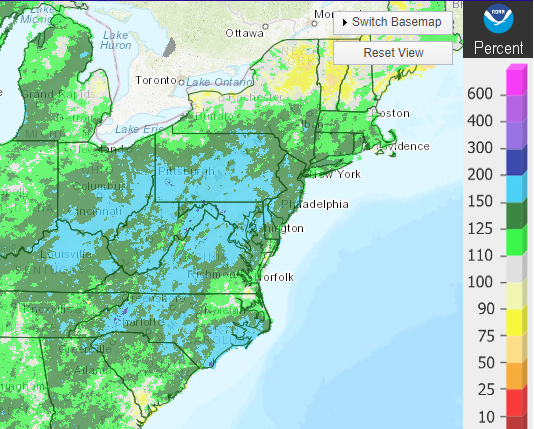
Across much of the Midwest, the southern and central Appalachians, and the Mid-Atlantic, rainfall ran 150% to 200% of normal values. That helped eliminate any remnant drought conditions in these regions. As you can see from the map at bottom, there exists very little drought east of the Rockies. This is certainly good news for farmers as we start to turn towards the spring growing season. In the meanwhile, though, flooding makes for a sour way to start the new year. Lead photo courtesy FEMA.


Massive Hail Stones Slam Sydney Region!


A potent mix of high instability and strong upper level winds combined to produce severe thunderstorms from central into northeast New South Wales on Thursday afternoon and evening. These powerful boomers dropped hail up to 8 cm in diameter and larger along with high winds, leading to serious damage and thousands of power outages. It’s being called the worst hail storm in two decades for Sydney!


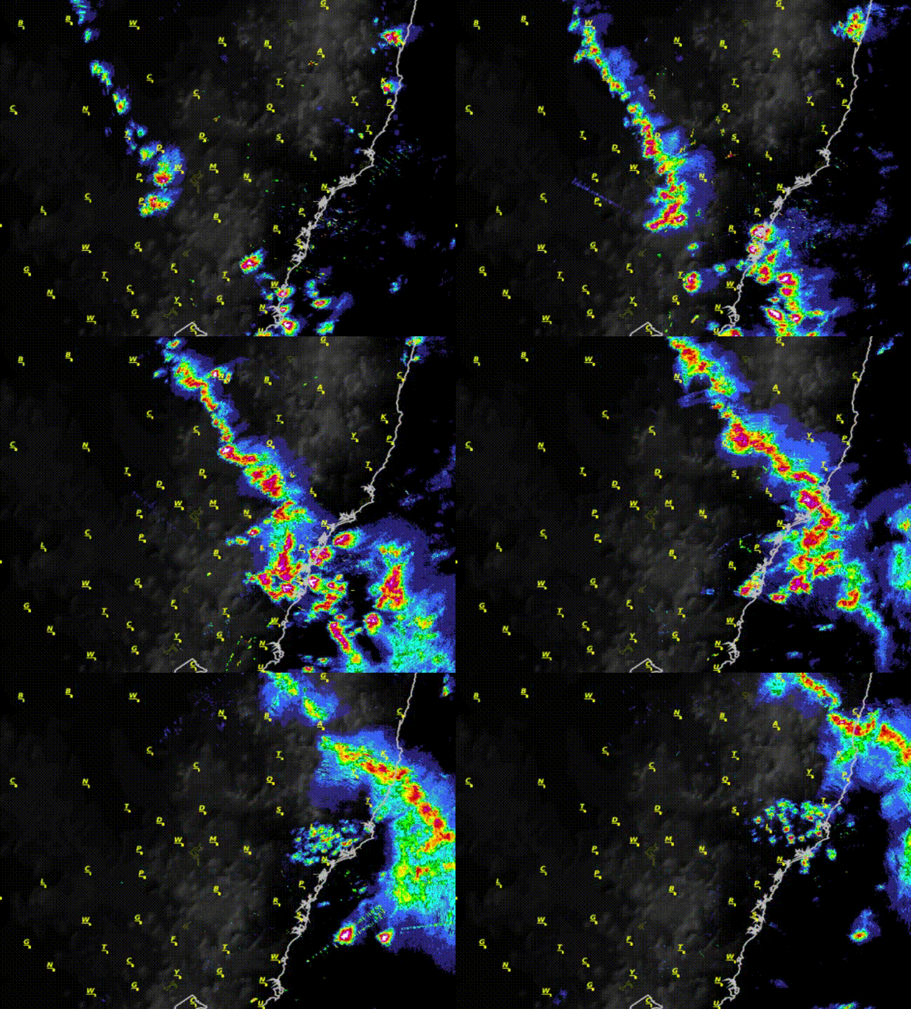
Several rounds of powerful storms moved across the Sydney metro between 4 pm and 8 pm AEDT. The radar animation above shows the intense cells. Radar echo reflectivity values were maxed out (the white spots in the center). There was also quite frequent cloud-to-ground lightning. Hailstones of 5-8 cm were reported in several areas, large enough to shatter windows and punch holes in roofs. Wind gusts of 110-140 kph knocked over trees and powerlines, resulting in tens of thousands of power outages. The storms are being compared to the infamous 1999 hail storm in Sydney that cost insurance carriers $1.7 billion in damage claims, the most expensive natural disaster in Australian history. Lead photo courtesy flickr user DM.


Dangerous Cyclone Owen Rolling Towards Cape York Peninsula!


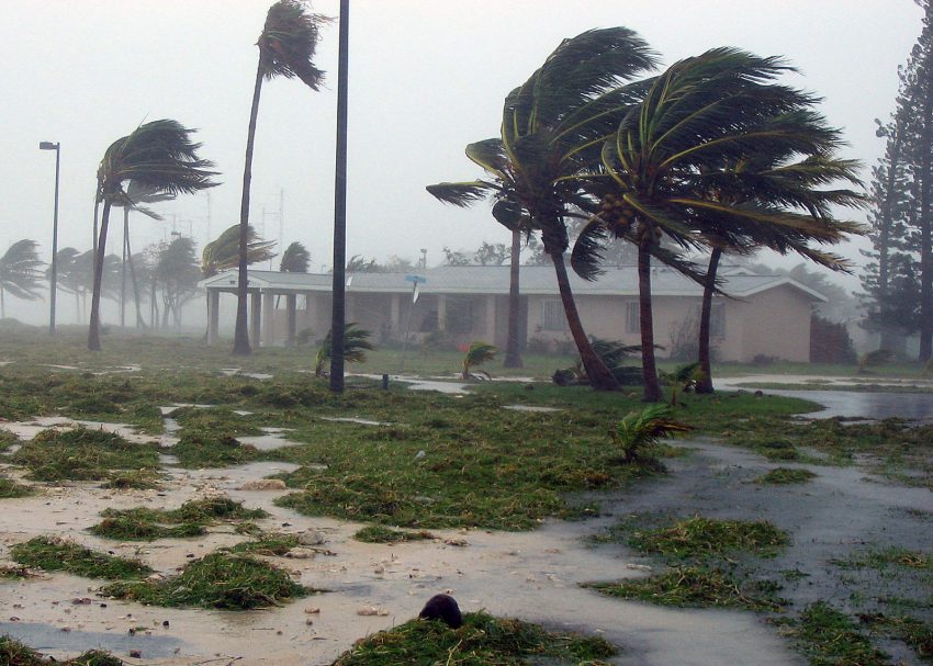
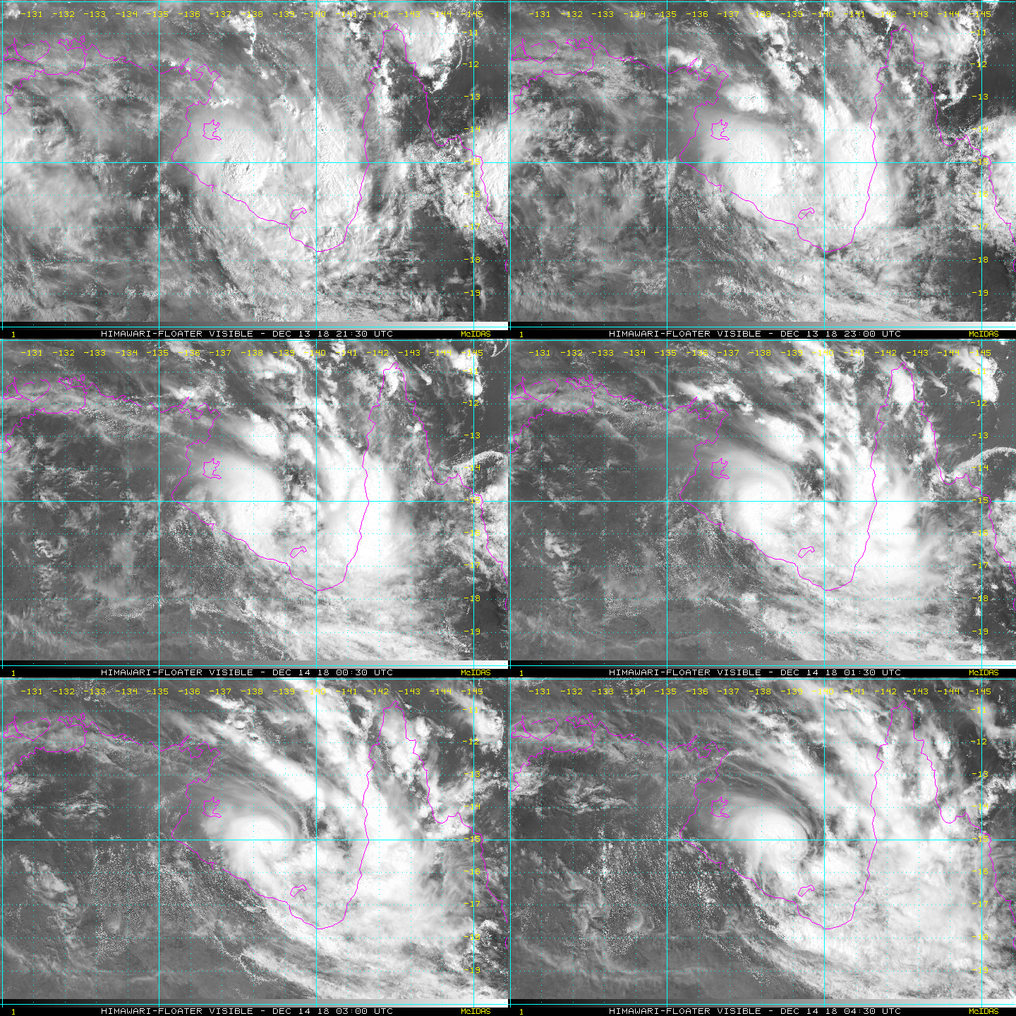
Cyclone Owen has continue to intensify today as it moves slowly east across the Gulf of Carpentaria. Very warm water temperatures and low shear are helping Owen pick up steam. The cyclone is moving more slowly than anticipated, but destructive winds and rains will eventually reach the Cape York peninsula!


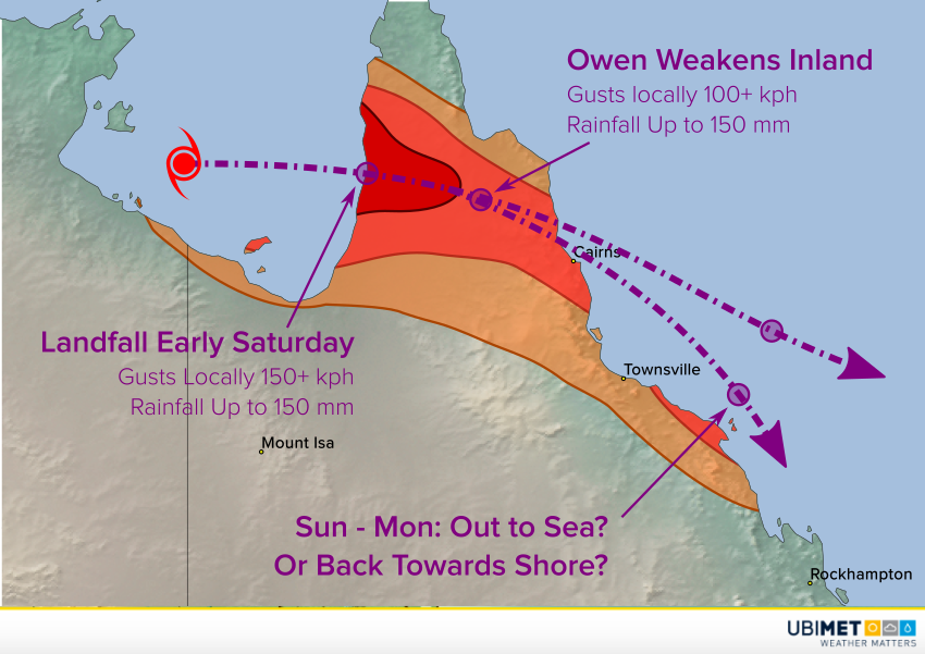
Owen is currently a category three cyclone and may reach category four status later on Friday. Landfall is now expected early on Saturday morning near Pormpuraaw and Kowanyawa. Near the landfall point and just inland, destructive winds are likely gusts exceeding 150 kph. Owen will weaken as it traverses northern Queensland. However, locally damaging winds and flooding rains will accompany the system as it passes near Cairns on the east coast.


Owen’s prospects from Sunday into early next week are in question. Some of the models suggest the storm will continue to move out over the Coral Sea. However, some keep the cyclone hugging the QLD coast. Obviously a track closer to the coast would increase the risk of significant winds and rains south of Townsville towards Rockhampton. We’ll keep watching and issue updates as needed.

Storms Wallop Eastern Australia As Tropical Faucet Opens Wide!

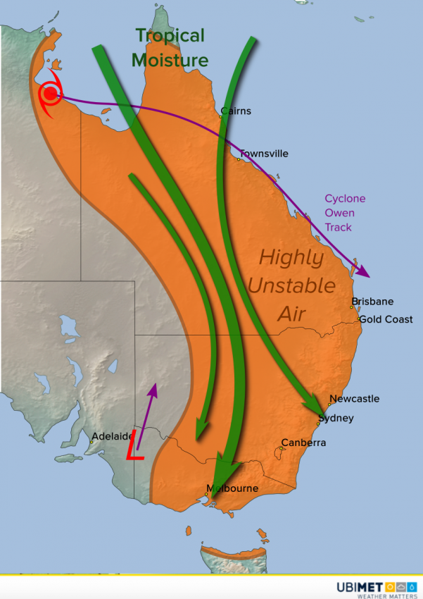
The combination of Tropical Cyclone Owen and a powerful upper low over the southeast has tapped into rich tropical moisture. This moisture has invaded much of eastern Australia, sparking widespread storm development. Flooding rains will continue to inundate many areas through the weekend.

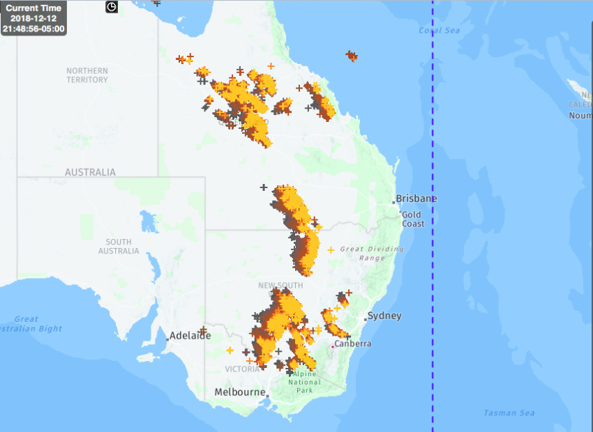
Cyclone Owen continues to loiter over the southwest Gulf of Carpentaria. Meanwhile, an upper low has moved into the interior southeast. Strong northerly flow to the west of these systems is pulling tropical moisture from the Coral Sea south. This moisture is helping feed numerous storms across Queensland, New South Wales, and Victoria. The strongest storms have mostly been over the interior so far where the best combination of tropical moisture and heat resides. You can see on the map below the concentration of lightning activity early Thursday afternoon over the interior. Lightning strike frequency is climbing past 120 strokes per minute!


Although locally damaging winds are a threat, the most common danger with these storms is torrential rainfall and flash flooding. Some of the heaviest amounts so far have been reported in the Alps of eastern Victoria, with rates exceeding 50 mm/hr. Our models suggest this long-ranging squall line will approach the NSW coast later this afternoon or evening, including Sydney and Newcastle.