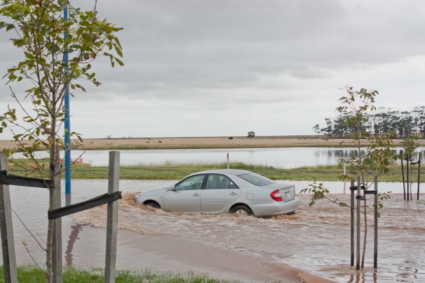
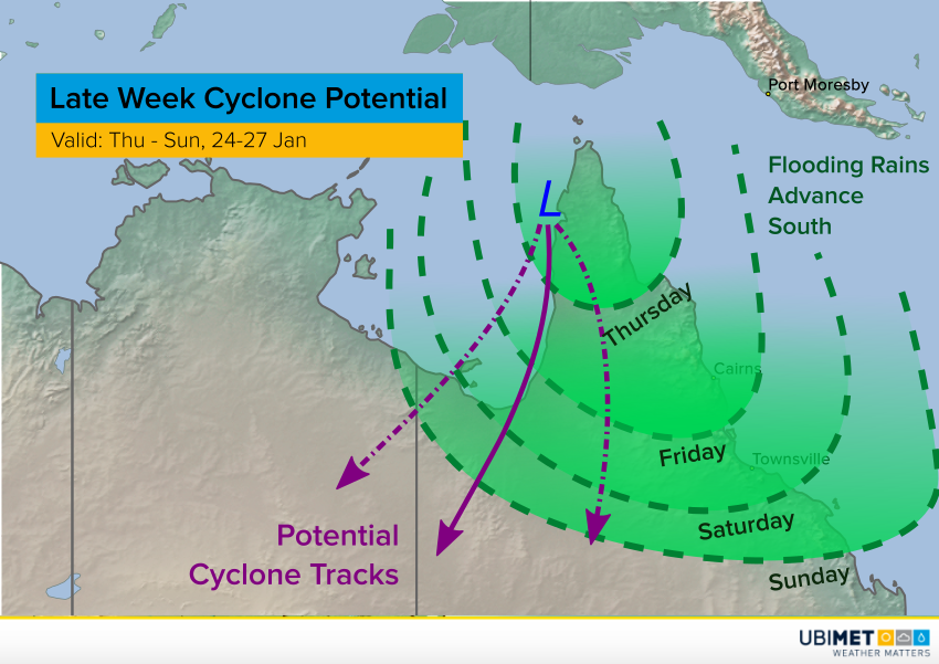
Historic Flooding Hammers Northeastern Queensland, Australia


The remnants of a monsoonal low continue to pump tropical moisture into portions of northeastern Queensland. Some stations have reported upwards of 500 mm of rain in the past several days! Unfortunately, the heavy rain will continue along the coast and near-coastal ranges from Townsville to Mackay. Serious flooding will continue to threaten the region (see tweet links below).


The tropical low in question is tapping into rich Coral Sea moisture. North to northeast winds are pushing this moisture onto the coast and up into the mountains nearby, enhancing rainfall rates. This process began near Cairns last week and has slowly migrated south. The Daintree area among others has seen record-setting rainfall totals, leading to major river flooding.


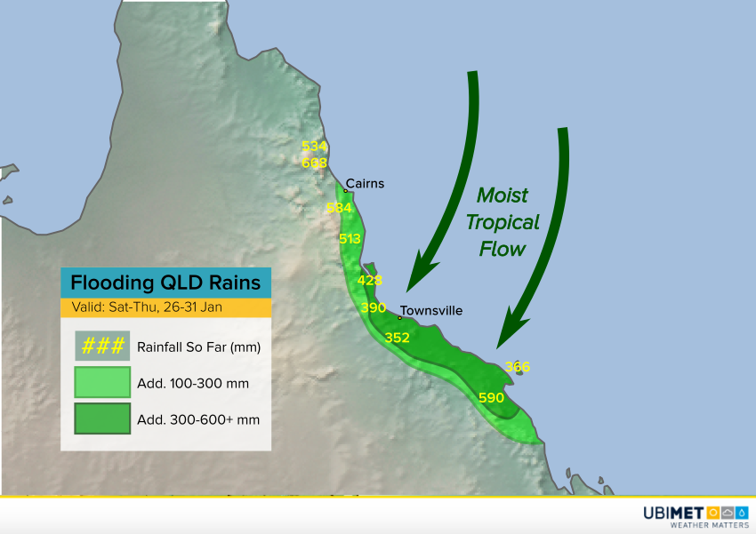
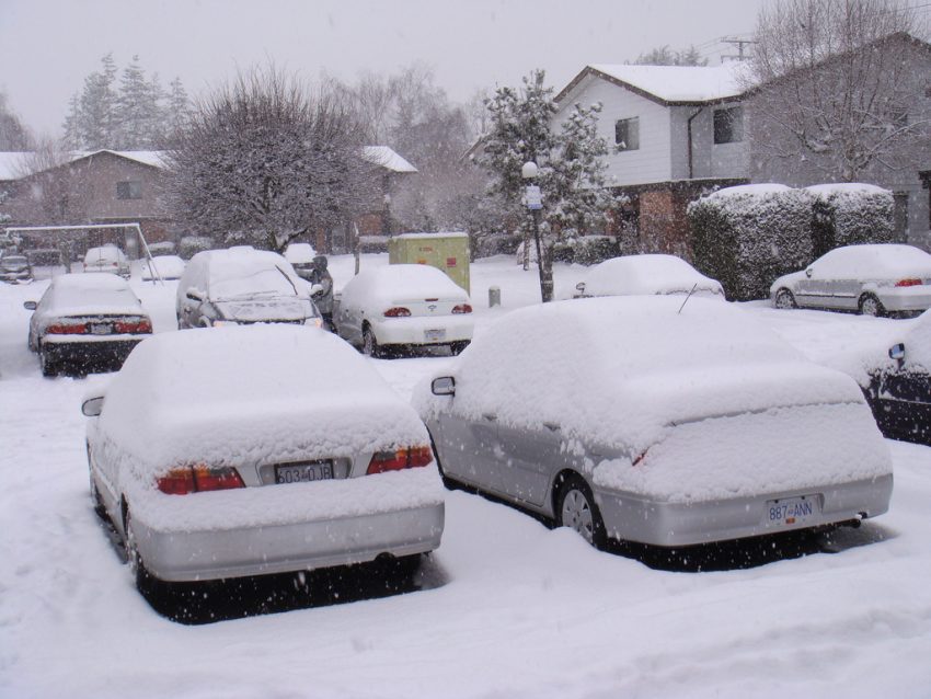
For the next several days, the tropical rain band will pound the coast between Townsville and Mackay, QLD (see map above). This area has already seen 200 to as much as 500 mm. Additional rainfall amounts locally as high as 500-600 mm are likely! Flash flooding will be widespread, and runoff from the rainfall will lead to rapid and dangerous rises in area rivers. Lead photo courtesy flickr user Timothy Swinson.


Powerful Arctic Surge to Invade the Upper Midwest and Great Lakes Next Week!

Winter has taken a firm grip on much of the Midwest and East through the last few weeks. The map below shows temperatures from four to as much as ten degrees colder than normal over portions of the Upper Midwest, Great Lakes, and Northeast in the last week or so. However, the coldest air of the season could be poised to descend on these regions early next week.


A steady supply of frigid Arctic air is streaming down from the high latitudes towards central and eastern portions of the Lower 48. A large, deep upper level trough is providing the pipeline. One last batch of this Arctic air will move into the Upper Midwest early next week, spreading across the Great Lakes and Northeast by mid-week (see animation at top). Many areas will stay well below zero ˚F (-18 ˚C) for several days. In the case of International Falls, MN, at the border with Canada, the streak of subzero temperatures could reach eight or nine days (see forecast graphic below). Some locations will see record-threatening morning lows as low as minus 45 ˚F (-43 ˚C)! Needless to say, cold of this magnitude is dangerous and potentially deadly. Fortunately, it appears that the pattern will change with warmer weather likely the week after next.


Tropical Trouble Brewing Across Northern Australia!


A pair of tropical cyclone threats have developed across the northern coast of Australia. One cyclone has already formed just north of Western Australia, called Riley. This storm’s outermost rainbands will produce some spotty heavy rain in the Kimberly and Pilbara regions of northern WA in the next several days. However, more direct and serious impacts could be coming from a cyclone not yet named in the Gulf of Carpentaria.

As of yet, the Gulf cyclone remains disorganized. Very heavy rains are already falling, however, over the Cape Yorke peninsula. Our weather models have yet to agree on the future track of this tropical low. Some move it southwest across the very warm Gulf waters. That track would increase the likelihood of cyclone development. However, some models move it south along the west coast of the Cape Yorke peninsula, or even over the middle of the peninsula. That would limit the opportunity for intensification.


Regardless of whether the system becomes a full-fledged cyclone or not, it will transporting very rich tropical moisture over northern Queensland. The map above shows the potential cyclone tracks as well as the timing of the flooding rain potential. Some locations will see totals of 300-400 mm by this weekend! Serious flash and river flooding will be the result. Lead photo courtesy flickr user Rexness.

Crippling Snow and Ice Storm Slams the Northeast!


A powerful winter storm raked areas of the Plains, Great Lakes, and Northeast late last week into the weekend. Snowfall up to 30 inches ( cm) was accompanied by wind gusts up to 50 mph (80 kph), leading to dangerous blizzard conditions. The coldest air of the season has invaded the eastern U.S. in the storm’s wake.


The map above shows snow accumulations from Friday through Monday (19-21 January). The heaviest totals exceeding 18 inches (45 cm) were recorded from central New York through the mountains of interior New England to eastern Maine. Widespread totals of 12-18 inches (30-45 cm) were reported all the way back into northeastern Ohio and as far south as Albany. Accumulations of 8-12 inches (20-30 cm) affected northern Pennsylvania and the northwestern suburbs of Boston.

To the south, snow mixed with sleet and freezing rain (not shown on map above). Icing totals of 0.25-0.5 inch (6-12 mm) occurred over portions of northeastern Pennsylvania, southern New York, and southern New England just inland from the coast. The icing and winds combined to knock down branches and power lines, resulting in numerous power outages.


The storm ushered in a frigid Arctic air mass, resulting in the coldest temperatures of the season (see map above for Monday morning lows). Gusty northwest winds persisted through Sunday night and Monday behind the departing storm. Wind chills plummeted well below zero deg F for many areas, even as far south as the major coastal cities. Fortunately, conditions should improve rapidly this week. Lead photo courtesy flickr user Thomas Chung.