4 of Canada’s Most Memorable Tornadoes

  1. The Elie, Manitoba Tornado

On June 22, 2007, the strongest tornado ever recorded in Canada touched down in the town of Elie, Manitoba. Several videos of the tornado show the extreme strength and power of the storm. A home was completely ripped from it’s foundation, tossed cars landed hundreds of yards away, and tree bark was ripped from trees. Thankfully, no fatalities or injuries occurred although the storm cost residents an estimated $39 million in damages.

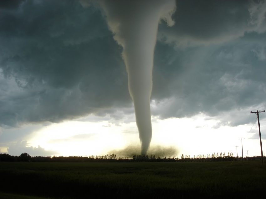
2. A great time to mow the lawn

An Alberta man went viral after his wife posted a picture of him going about his usual routine during a tornado. The man had previously attended a talk hosted by storm chasers and reasoned it was safe to continue mowing the lawn. Despite the tornado’s impressive structure, no injuries or major damage was reported.

3. Edmonton Tornado of 1987

During the summer of 1987, a devastating tornado moved through the town of Edmonton, Alberta. The F4 tornado completely leveled parts of the town and took the lives of 27 people. An estimated 300+ people were injured and cost the country over $300 million in damages. Because of the catastrophic destruction and loss of life, locals refer to this day as Black Friday.

4. Tornado photo bomb

A couple in Saskatchewan didn’t let a little bad weather get in the way of their big day. With the tornado safely off in the distance, the couple posed for some incredible shots and the wedding went off without a hitch.

Icy Chill! Coldest June night in decades for parts of South Eastern Australia

Australian cold Kangaroo in the snow

Finally after a slow start to the season, winter looks set to return with a vengeance for the start of July with some of the coldest conditions in decades across parts of Victoria and New South Wales.

Overnight Friday, clearing skies will allow for temperatures to fall across the state of Victoria with Melbournians expected to wake up to the coldest morning of the year on Saturday. Widespread frosts are expected to envelop much of the inland suburbs with even the Melbourne Central Business District potentially experiencing sub 1°C conditions. Such a feat has not been seen here in June since 1989 when the mercury fell to 0.5°C.

Though unusual, its not unprecedented for the normally milder city centre, as colder air on the elevated regions to the north of the area sinks and drifts toward the coast.
However, these chilly conditions pale in comparison to the all time record that saw the state capital shiver under an icy embrace that sent the mercury plummeting to -2.8 °C back in July of 1869.

Unusual?

Due to it’s more inland location, Melbourne Airport, near Tullamarine, tends to get a greater frequency of colder nights where the warming affects from Port Philip Bay are much less of an influence.
Normally, the city itself can expect the thermometer to drop below 2°C on an average of 2 and 3 nights during the winter months of June and July. In retrospect, actual sub zero temperatures are rare.


South Eastern Shiver

Elsewhere, these frigid conditions are also expected to affect a large swathe of the south eastern states with a glacial -6°C in the forecast for Canberra. This might appear to be bitterly cold but it is still well short of their all time low of -10°C set back in July 1971. More elevated regions in the southern tablelands of New South Wales and Alpine areas of Victoria are likely see overnight minimums drop down close to -10°C.

Present indications suggest that the overnight minimums will tend to rise into the early days of the coming week as clouds associated with an approaching weather system will approach the region from the west.