Beijing Snaps 145 Day Dry Streak with Snow
Beijing, China received its first measurable precipitation in 145 days on Saturday morning when snow dusted much of the city. At least 0.1 mm of precipitation was recorded at the city’s international airport.
The last time measurable precipitation was recorded at Beijing International airport was on October 22nd, 2017 when 0.1 mm of rain fell. According to a Chinese-based news outlet, the dry stretch of weather is the city’s longest streak in 47 years.
Snow fell in Beijing Saturday morning, breaking the city’s longest dry spell in at least 47 years. pic.twitter.com/xJa2VMOzqo
— China News 中国新闻网 (@Echinanews) March 17, 2018
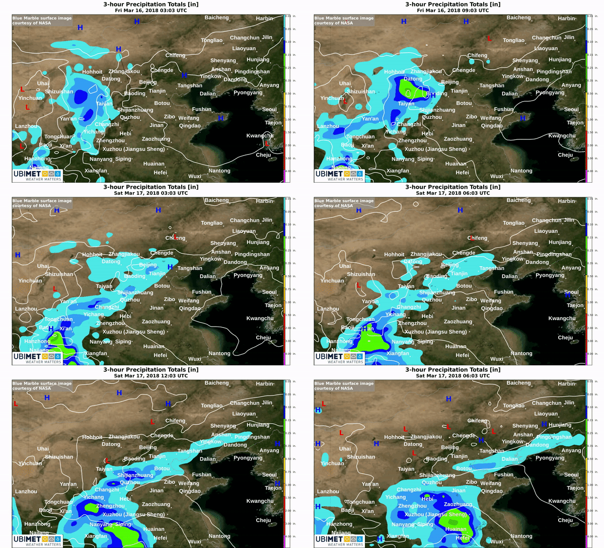
A fast moving disturbance that crossed north-central China early Saturday generated just enough moisture for the snow. Weather models depicted this precipitation event in advance rather well.
Why So Dry
Much of western and northern China reside in the Gobi Desert. The desert lays west of Beijing, however, the cold season pattern often brings a west to northwest flow which steers the dry air from the desert into the city.
Even during the drier winter months the city still averages about 3-9 mm of precipitation a month.
A major contributor to the recent stretch of dry conditions is a storm track that has been consistently to the south of north-central China.
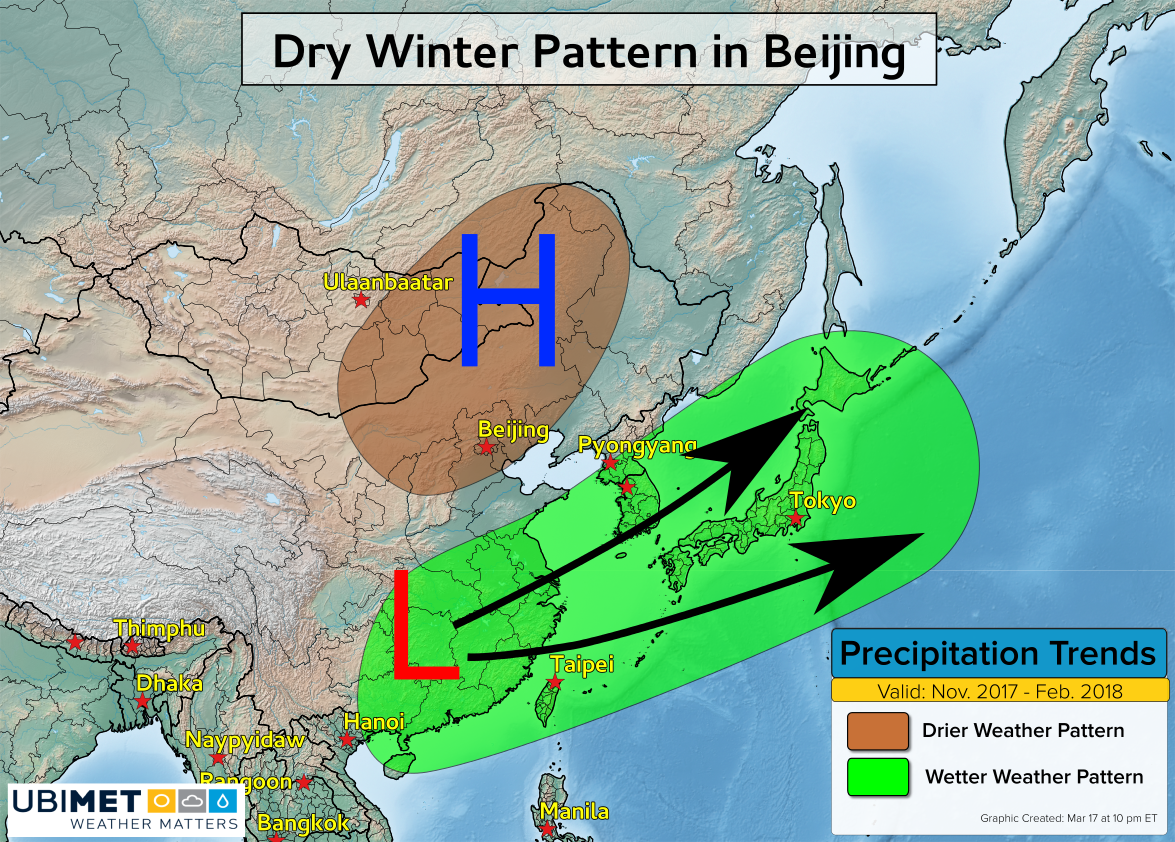
As the cold season transitions to the warm season, moisture from the Pacific and Indian Oceans penetrate farther northward in China. Eventually that moisture reaches Beijing with increased chances for precipitation from April to October.

