UPDATE: Flooding Will Remain a Major Threat in the Mid-South Through Thursday!
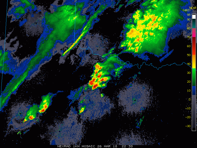
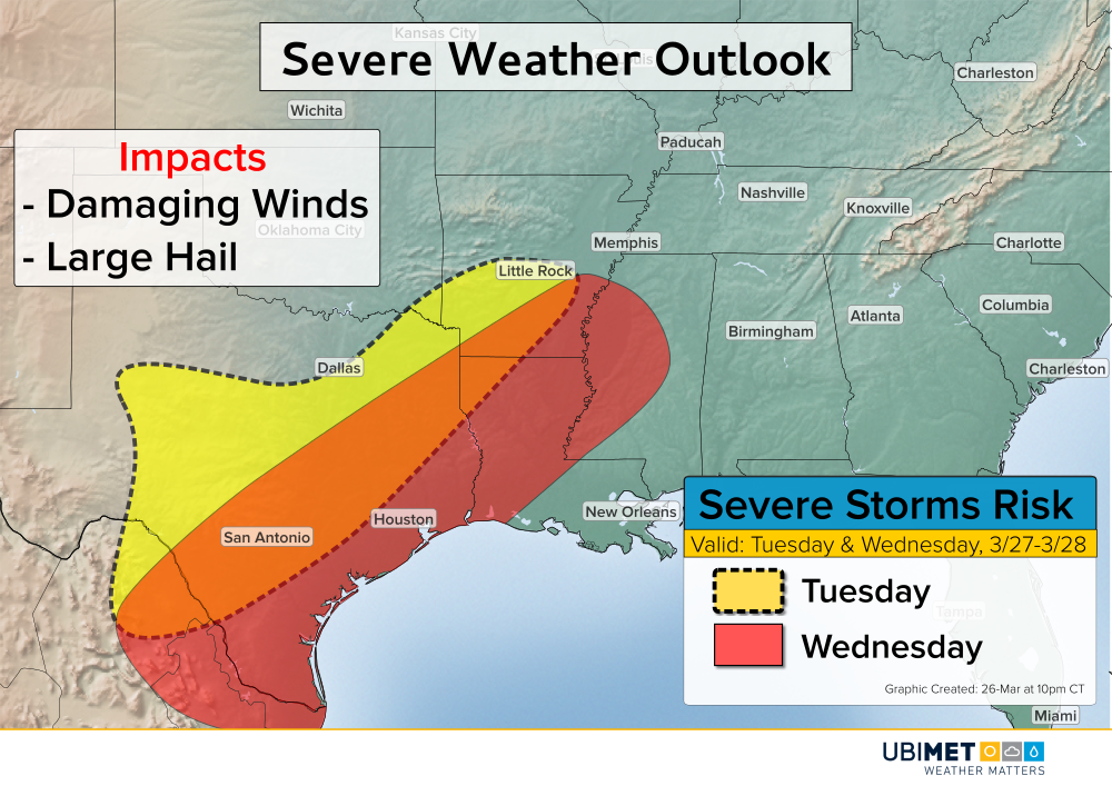
A band of heavy rain is moving from eastern Texas into Louisiana. The leading edge of the rain band contains some severe cells capable of producing high winds, large hail, and perhaps even an isolated tornado or two. However, the more widespread threat across the region will be flash flooding through Thursday.
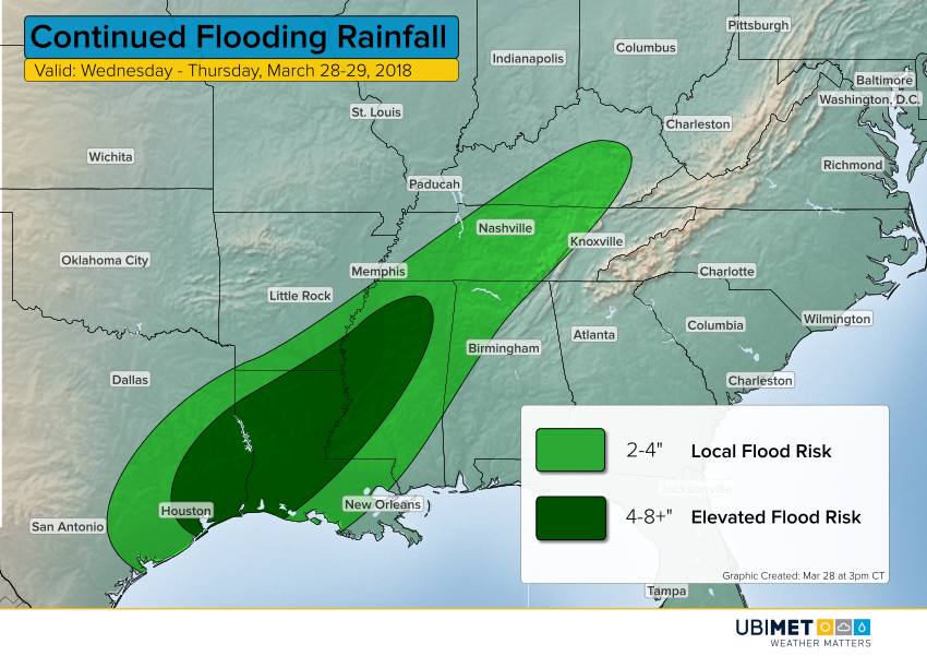
The heaviest rainfall of 4-8 inches will fall from the Houston metro area through much of central Louisiana into parts of Mississippi. The time frame for this rainfall is this evening into tonight. Localized amounts exceeding eight inches are certainly possible, leading to significant flash flooding. Later on Thursday, the frontal system responsible for the heavy rains will start to weaken and move faster to the east, reducing the threat for these higher amounts.