Severe Storms Damage Hangar At Houston Texas Airport

Severe thunderstorms tore across Texas on Tuesday and Tuesday evening bringing damaging winds and large hail to parts of the state.
Houston’s Hobby airport was hit especially hard with a severe thunderstorm late Tuesday evening. A preliminary storm survey done by the national weather service concluded that winds reached 80 mph (70 kts) at the airport just before midnight.
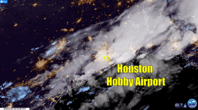
Those wind speeds caused damage to a private hangar on the airport grounds. 8 planes at the hangar suffered damage, and all totaled damage estimates at the airport are expected to be in the millions of dollars.
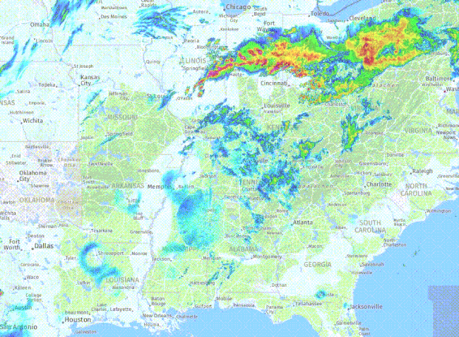
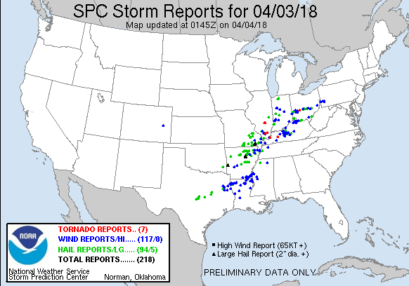
The severe weather in Houston was part of a larger severe weather outbreak that stretched from Texas to Pennsylvania. There were several reports of tornadoes, as well as hundreds of large hail and damaging wind reports from 16 states.
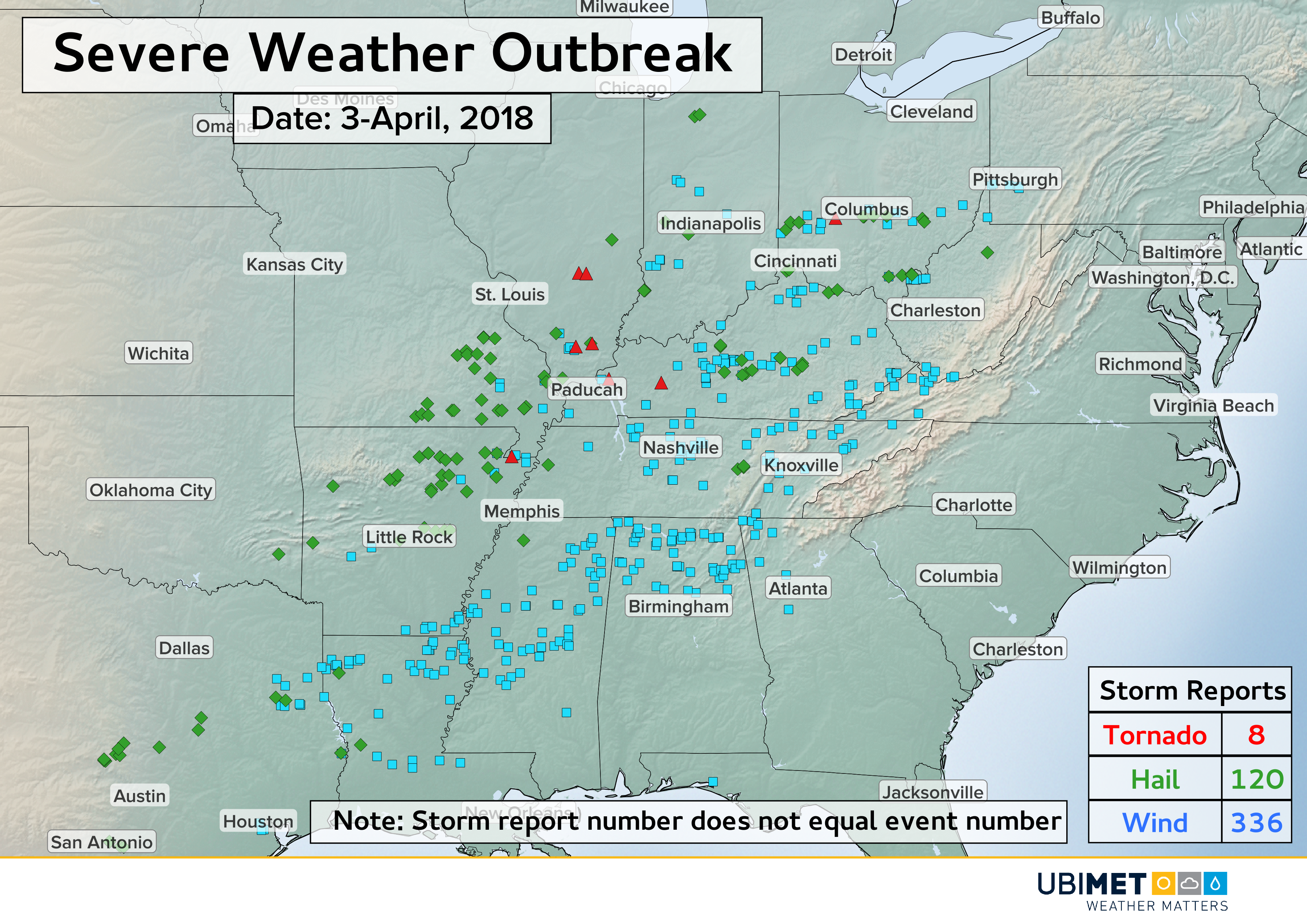
Large hail up to the size of baseballs balls (7 cm) fell near Pangburg, Arkansas Tuesday afternoon. Many reports of wind gusts ranging from 60-70 mph (52-61 kts) were observed, causing additional damage and even several injuries.