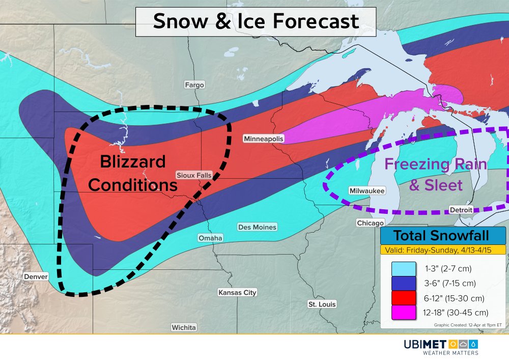
Powerful Spring Storm Dropping Tornadoes and Blizzard Conditions!
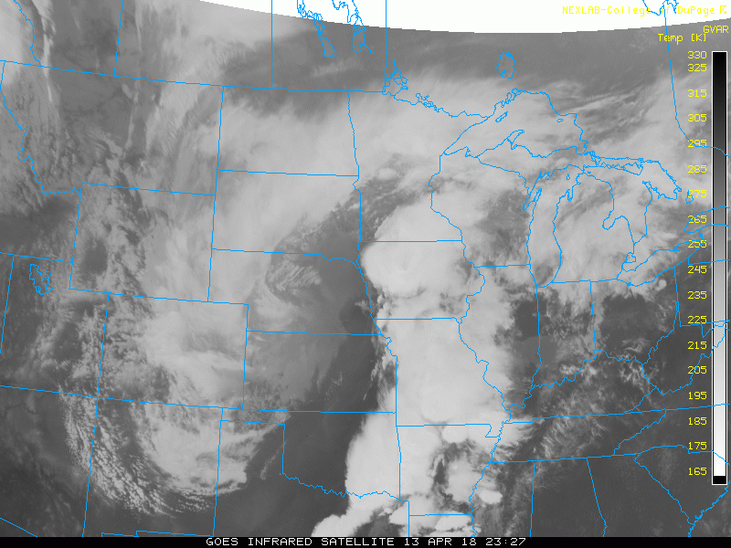
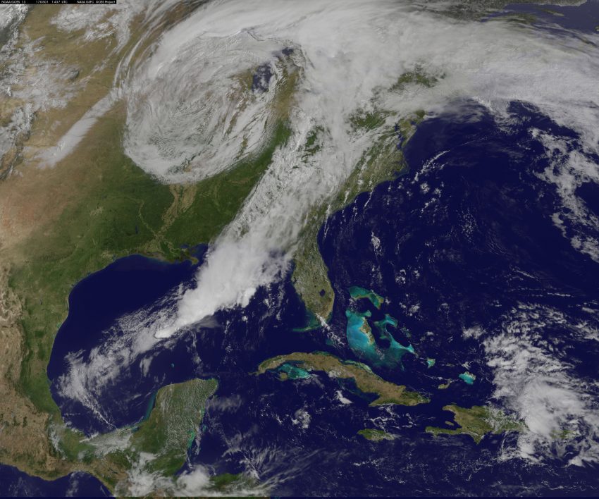
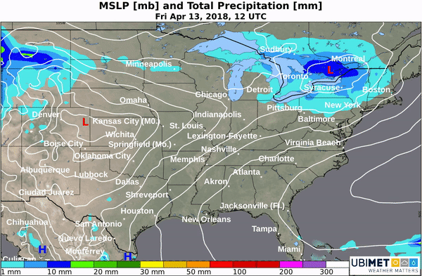
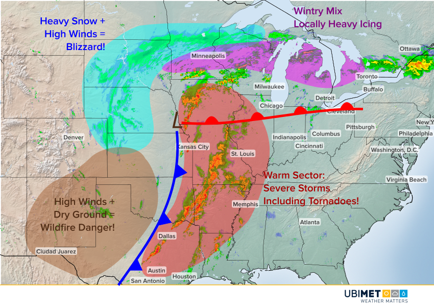
A strong, wide-ranging mid-latitude cyclone is spinning across the Plains. On the cold side, bands of heavy snow are combining with high winds to create dangerous blizzard conditions. On the warm side, severe storms are producing high winds, large hail, and even some strong tornadoes (see tweets below). In other areas, heavy icing and wind-driven wildfires threaten large swaths.
Exactly what NOT to do: Head on with a tornado!
Mountainburg, AR
Credit/Permission: Scott Michaels#ARwx pic.twitter.com/1tqiMYpJo9
— Live Storm Chasers (@LiveStormChaser) April 13, 2018
Pea to nickel size #hail falling on the east side of Sioux Falls. Time is 7:03 AM CDT. #SDwx @NWSSiouxFalls pic.twitter.com/vRU8j2kJ58
— Derek Thompson (@DerekjT1003) April 13, 2018
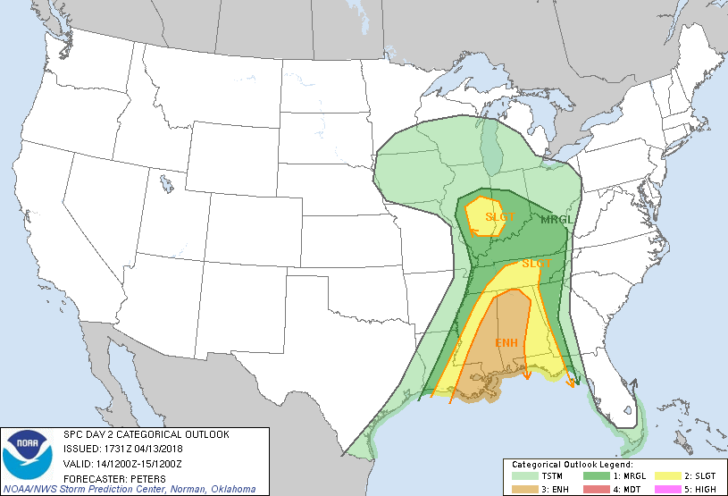
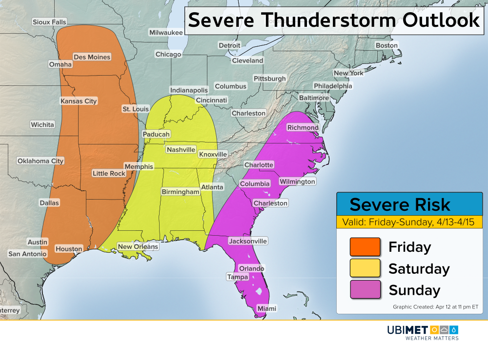
The storm system will move east and by Saturday, the severe storm threat will shift to the mid-South (see graphic below from the Storm Prediction Center). Meanwhile, heavy snow and mixed precipitation will continue to keep residents across the northern tier in winter’s icy grip.