Unusual April Ice Storm Unfolding over the Interior Northeast US!
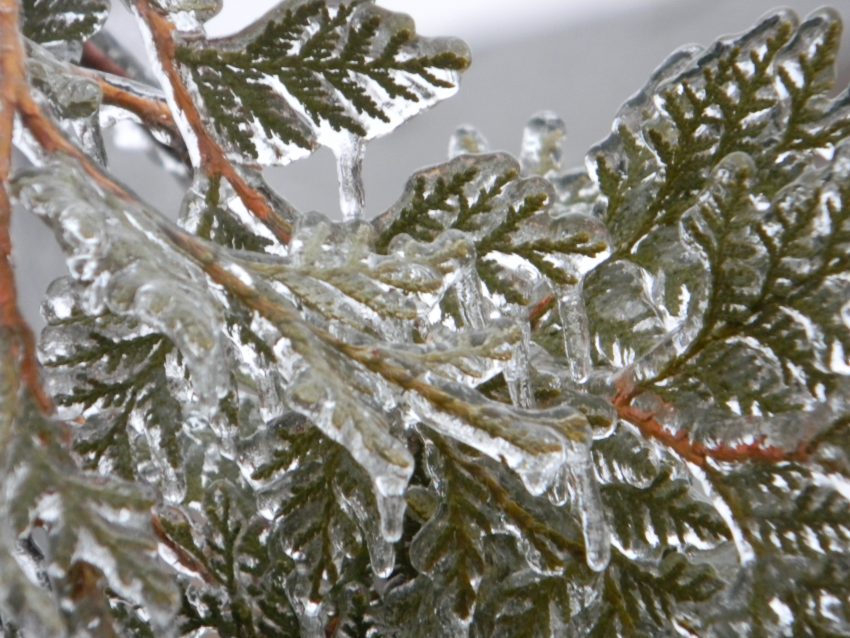
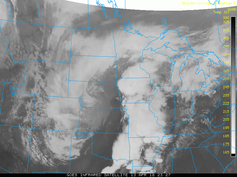
Typically by this time in April, cold air has begun to retreat to the wilds of Canada, leaving behind longer, warmer days even across the U.S. northern tier. However, a powerful spring storm is helping to produce heavy precipitation on top of a frigid near-surface air mass. Temperatures this afternoon in Buffalo, NY have hovered around 30 deg (-1 deg C), colder even than the average low temperature this time of year. Significant warming is not expected in the next 18 hours, setting the stage for an unusually late, major icing event.
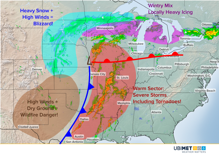
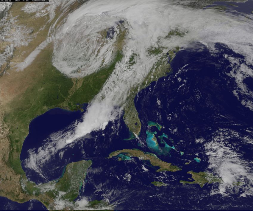
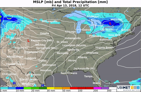
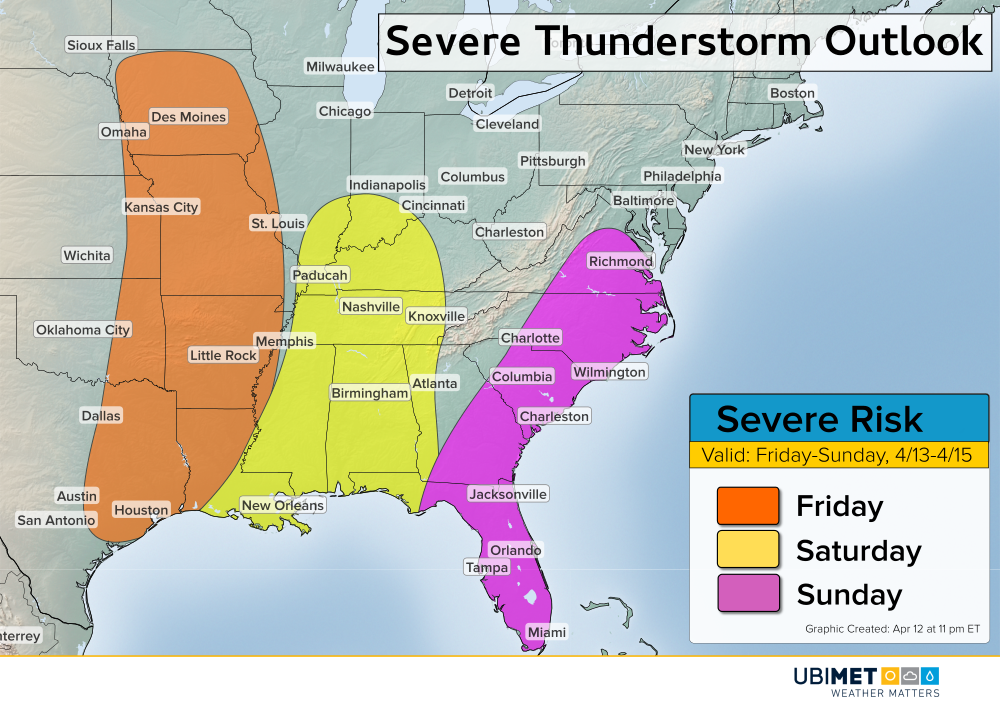
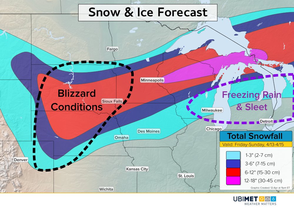
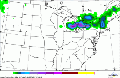
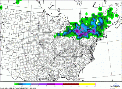
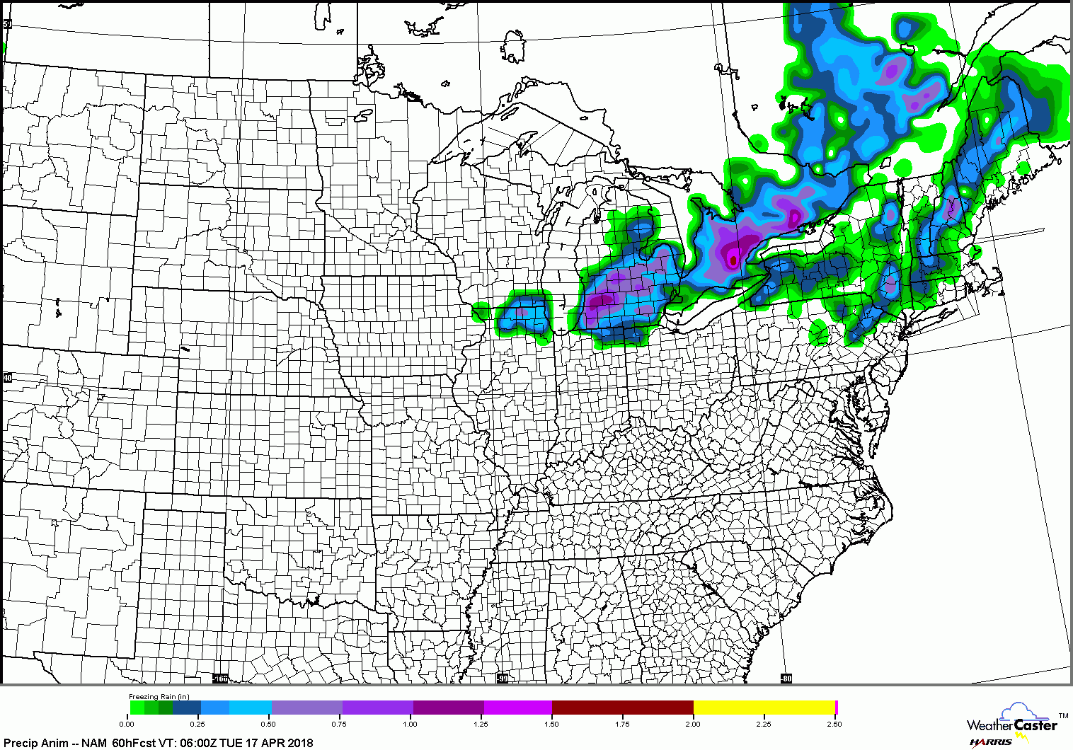
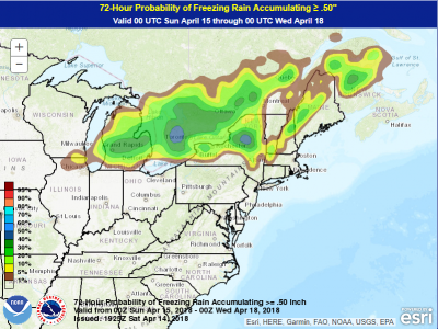
This same dynamic storm system has been responsible for blizzard conditions in the Central Plains and Midwest as well as big tornadoes in the South. The storm is pushing moisture and warm air into the Northeast, but a stubborn layer of cold air near the surface will cause traffic and power outage headaches. Freezing rain and sleet will lead to ice accumulation up to 0.5 inch (1.25 cm), locally higher, across the Great Lakes, Northeast, and adjacent Canada. As you can see from the models below, there’s still some question about where the heaviest icing will occur. However, there is a general consensus on interior portions of Ontario and New York, especially where mountains can shelter pockets of subfreezing air.
Many areas will see temps rise above freezing just enough later in the day on Monday to end the icing threat. However, expect hazardous travel conditions tonight through Monday morning at least. Scattered power outages will be a concern as well due to ice accrual and gusty winds felling tree branches and powerlines.