Severe Storms Threaten Argentina On Tuesday & Tuesday Night

Severe thunderstorms are expected to erupt across Argentina during the midday and afternoon hours on Tuesday. Some of the severe storms are likely to push into Uruguay and far southern Brazil Tuesday night.
The Details
A disturbance will move off of the Andes Mountains and across Argentina on Tuesday. The disturbance will run into an unstable environment which will trigger the development of strong to severe thunderstorms.
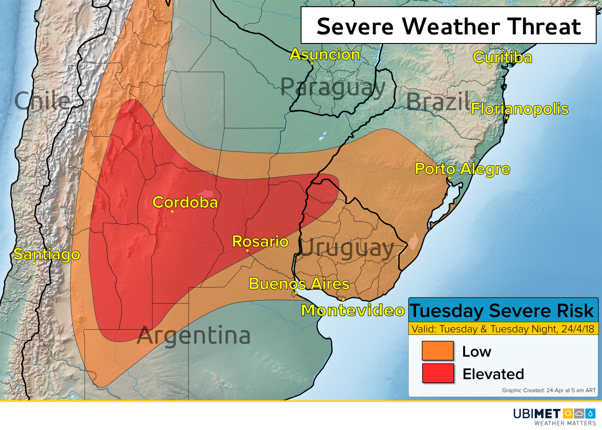
The greatest risk for severe thunderstorms will be east of the Andes Mountains and include cities such as Cordoba and Rosario. In this area, damaging winds are the primary concern. However, frequent lightning and localized flash flooding can accompany any storm.
Buenos Aires will lay on the southern edge of the severe thunderstorm potential, with the greatest threat for severe weather expected just to the north.
On Tuesday evening into Tuesday night the severe risk will shift into parts of Uruguay and far southern Brazil.
A few lingering showers or thunderstorms will extend into Wednesday morning, but this these storms are not expected to be severe.