Scorching Heat for the USA on Independence Day
Searing triple-digit heat affected much of the southern and western USA on the nation’s Independence Day, July 4th. Outdoor activities ordinarily associated with the holiday were hampered by the life-threatening temperatures. It’s part of a pattern of extreme heat that will persist well into next week.
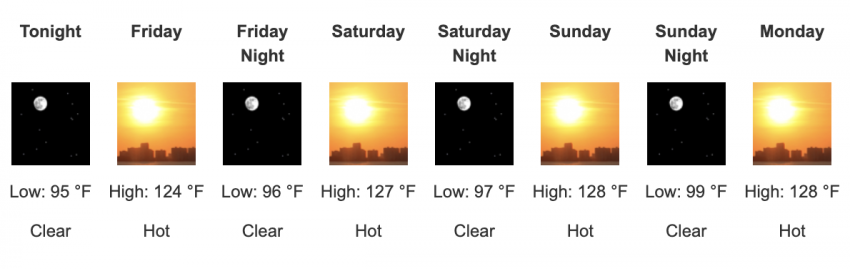
Extreme heat advisories and warnings were issued for much of the western and southern USA. In the West, temperatures on Thursday soared well into the 40s (105-115 deg F) over the lower elevations. A few traditionally hot spots reached the upper 40s to near 50 degrees (117-122 deg F). Death Valley, international record-holder for warmest temperature, could approach the mid-50s (near 130 deg F) in the next week (see forecast above). That would threaten the highest temperature mark ever recorded since modern record-keeping began.
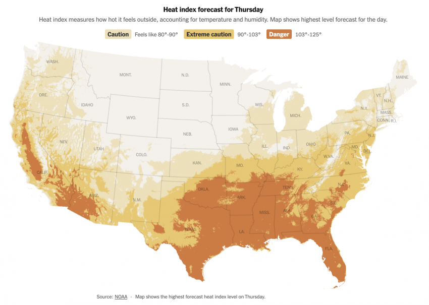
Temperatures further east have been lower, generally peaking in the middle to upper 30s (95-102 deg F). However, high humidity has pushed heat index values well into the dangerous range in the lower and middle 40s (105-115 deg F). Either temperatures or heat index values in this range drastically increase the likelihood of heat stroke, a potentially lethal condition.