Tornadoes, 100-mph Winds, and Baseball-Size Hail Ravage the Plains
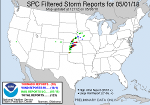
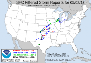
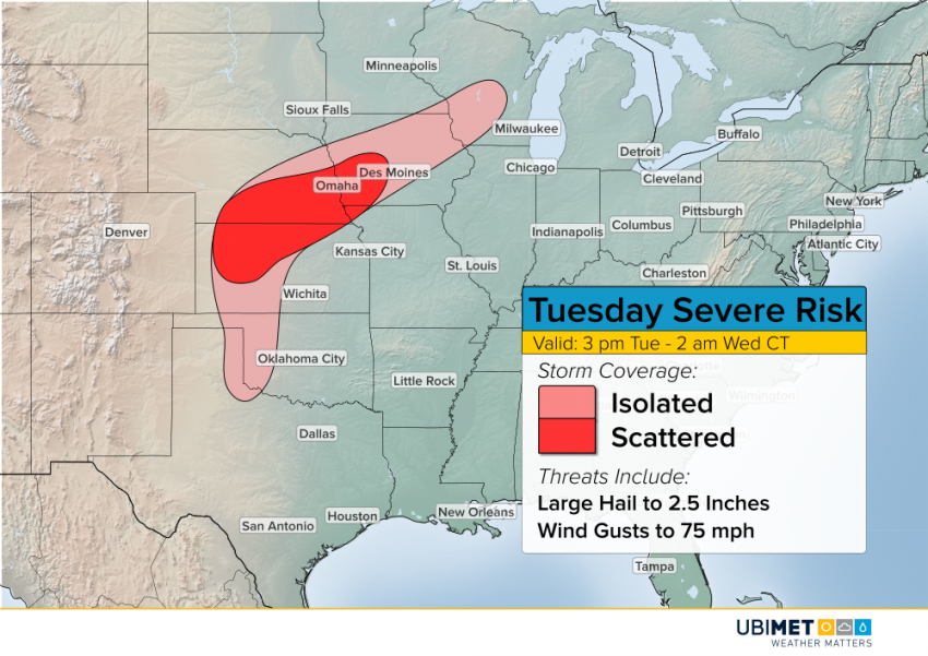
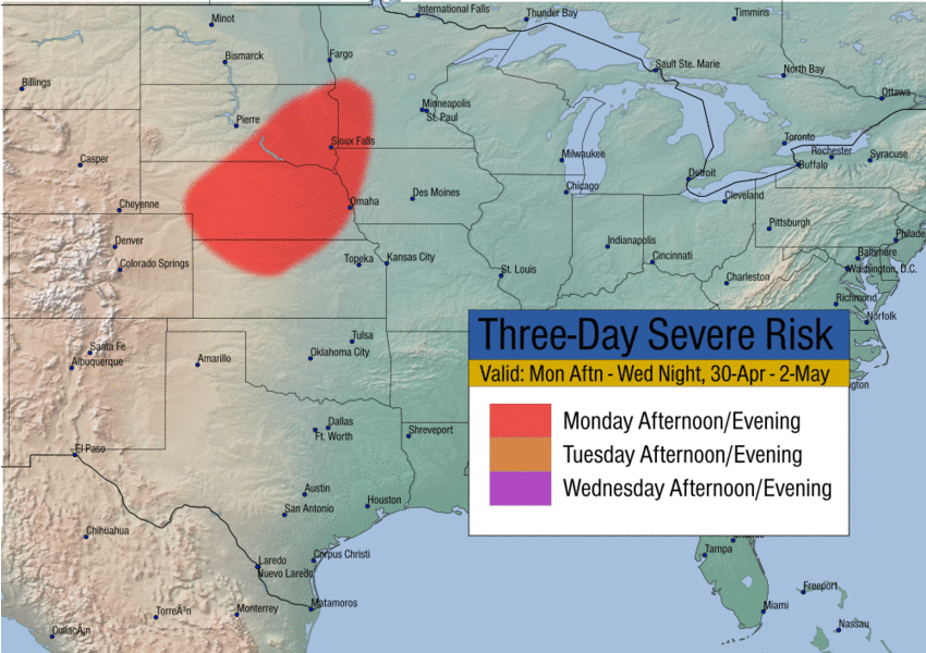
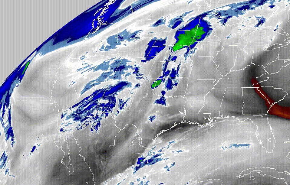
A slow-moving trough has been pumping dynamic mid to upper level energy across the Plains (see water vapor imagery below) over the last several days. Meanwhile, juicy Gulf moisture and warmth have fed in from the south. The combination of upper level energy and surface instability has led to multiple rounds of severe storms. Almost 400 reports of severe weather were received on 1-2 May (Tuesday and Wednesday), including 32 tornadoes.
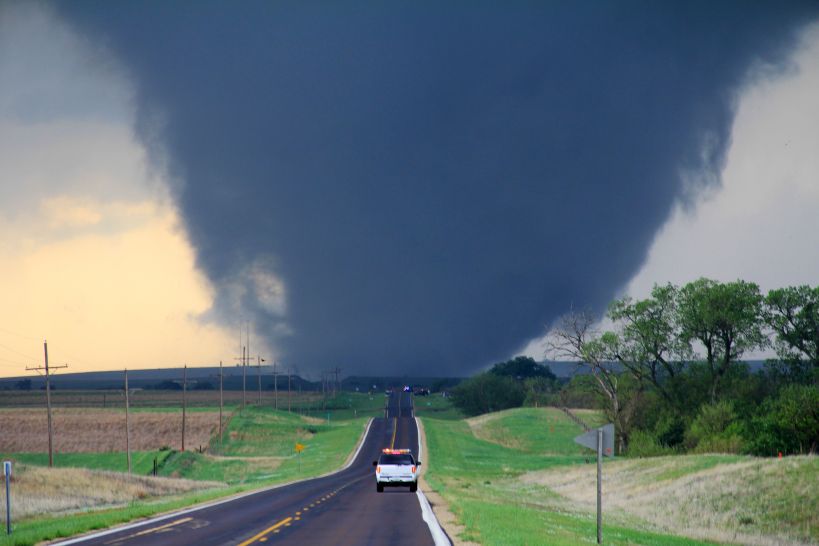
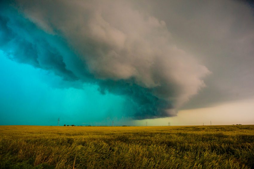
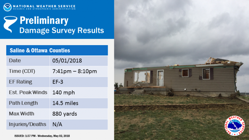
One of the largest tornadoes of the outbreak rolled across northern Kansas on Tuesday evening (see tweeted video below). The twister had a lifespan of about 30 minutes, covering almost 15 miles in that time, and was at one point almost 1,000 yards wide! After post-storm damage analysis, the tornado was rated EF-3 on the Enhanced Fujita scale. Elsewhere, large hail up to four inches in diameter was recorded with storms in Nebraska and Kansas. A wind gust to 106 mph was recorded with a severe cell in Oklahoma.
TIMELAPSE: Culver, KS EF-3 Tornado timelapse from our dash camera! @AlexHaworthWx @mikebettes @KathrynProciv @JimCantore @SarahDillingham @RyanDavidsonWX @WunderCave @spann @wxnewsdesk @LiveStormsMedia pic.twitter.com/EtsTp9dU5o
— Brandon Copic (@BrandonCopicWx) May 3, 2018
Funnel and hail larger than baseballs near Wilson. Time 7:10pm @JayPraterCBM @NWSWichita @KAKEnews @ForbesRicky @ReedTimmerAccu @WeatherNation #kswx pic.twitter.com/c0psypxcCx
— Cody Frye (@frenchfrye_95) May 2, 2018