Tropical Cyclone Sagar Brings Major Flooding to Deserts of Northern Somalia!
A rare tropical cyclone has traversed the Gulf of Aden and is taking aim on northern Somalia. This is a desert region that rarely sees rainfall. Outer rainbands from Sagar have already produced heavy rain and flooding, leading to at least one fatality.
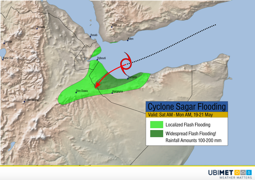
Sagar is currently producing sustained winds up to 65 mph (105 kph) over a small area, but a much more widespread and dangerous threat is freshwater flooding. Some areas will see rainfall totals of 6-8 inches (150-200 mm), as much rainfall as they typically see in a whole year. Particularly in the north-facing mountains and normally dry deserts, this kind of rainfall will lead quickly to serious flooding.
The cyclone is expected to make landfall near Lughaya, Somalia later on Saturday or early Sunday. Heavy rain will persist as the circulation moves inland and weakens through Monday.