Tropical Trouble in the West Pacific
Ubimet meteorologists will be monitoring a couple of tropical trouble spots in the West Pacific over the next week.
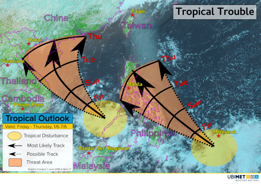
Tropical Disturbance #1
The first area of disturb weather is west of the Philippines with disorganized showers and thunderstorms.
Environmental conditions will be favorable for further organization over the next few days, and it’s possible a tropical cyclone could develop by the end of this weekend.
Steering winds will take this system toward the northwest this weekend into early next week. Toward the middle and end of next week, the weather pattern may favor a slower movement of this system. Consequently, interests from Vietnam to southern China should monitor the latest trends with this disturbance.
Tropical Disturbance #2
The second tropical feature of interest is located to the southeast of the Philippines. Similarly to the first disturbance, this second system will be in an environment that is favorable for tropical development over the next several days.
The steering winds will carry this disturbance toward the northwest this weekend and next week. Interests in the Philippines should continue to monitor the latest trends as rain and wind impacts are possible in parts of the country as early as Tuesday.
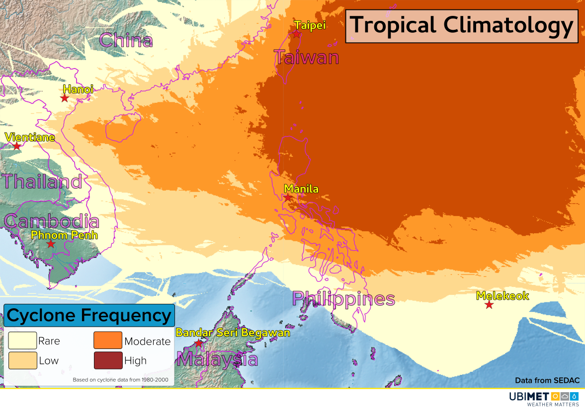
Climatology
The Western Pacific Ocean is no stranger to tropical cyclones. However, climatology indicates that the two systems that are being monitored are a bit too far south for cyclone development.