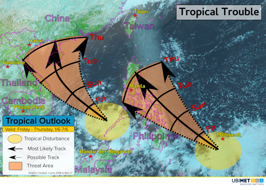
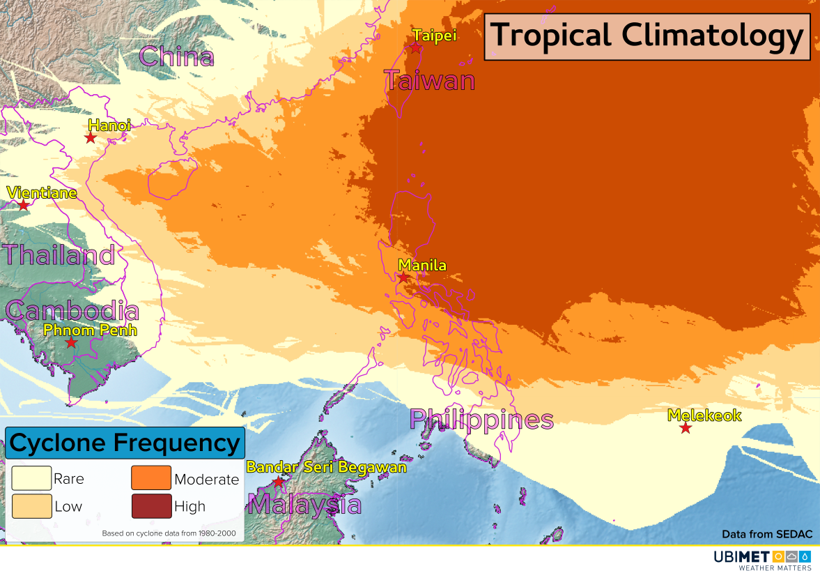
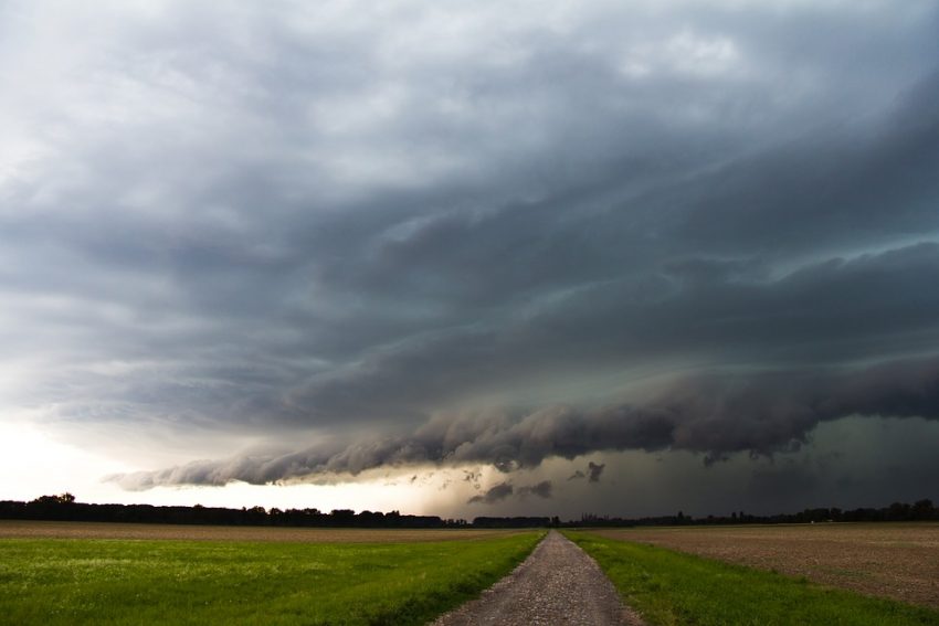
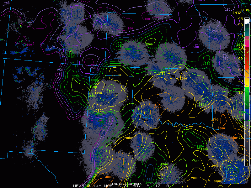
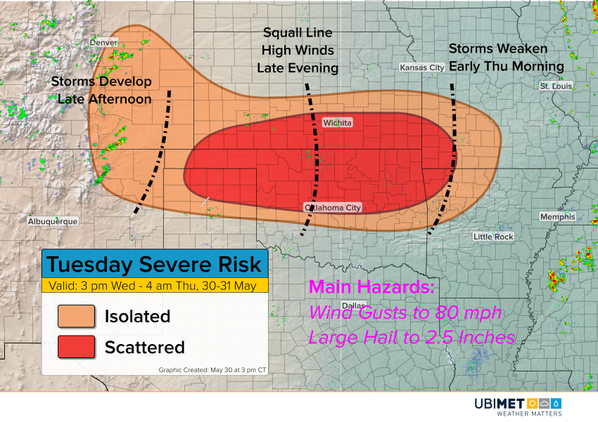
Dangerous Squall Line Set to Explode over the Northern Plains!
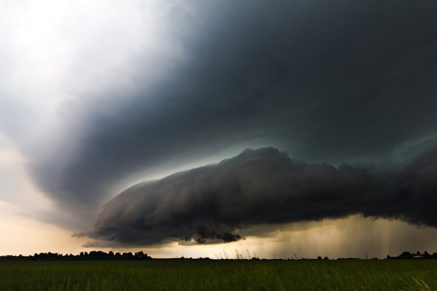
Extreme instability has developed thanks to high humidity and hot surface temperatures in a narrow corridor through the Plains. Storms are blossoming in this corridor and are likely to become severe, expanding and intensifying through tonight.
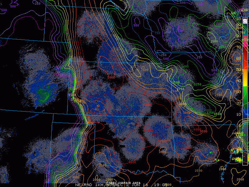
It looks likely that the storms will organize again this evening into a fast-moving squall line. Widespread destructive winds will occur with gusts commonly 60-75 mph (90-120 kph) and up to 90 mph (140 kph) in localized cases. Although high winds will be the predominant threat later on, this afternoon and evening there will be cases of big hail to 3 inches (7.5 cm) in diameter and isolated tornadoes.
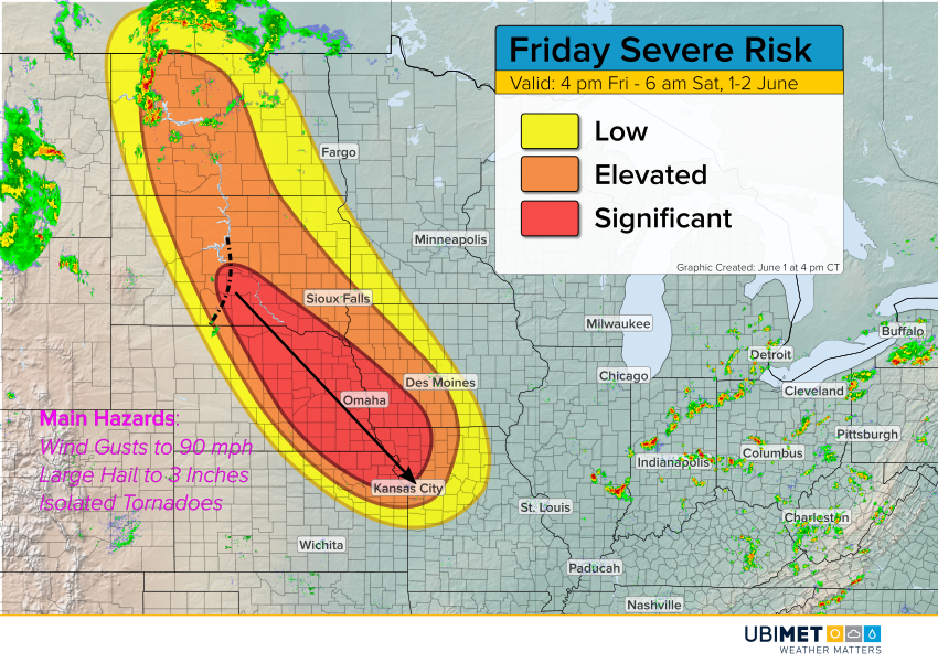
The squall line will persist well into the overnight into the Missouri Valley. The Topeka to Kansas City corridor could see severe storms well after midnight, towards 3-4 am CT.