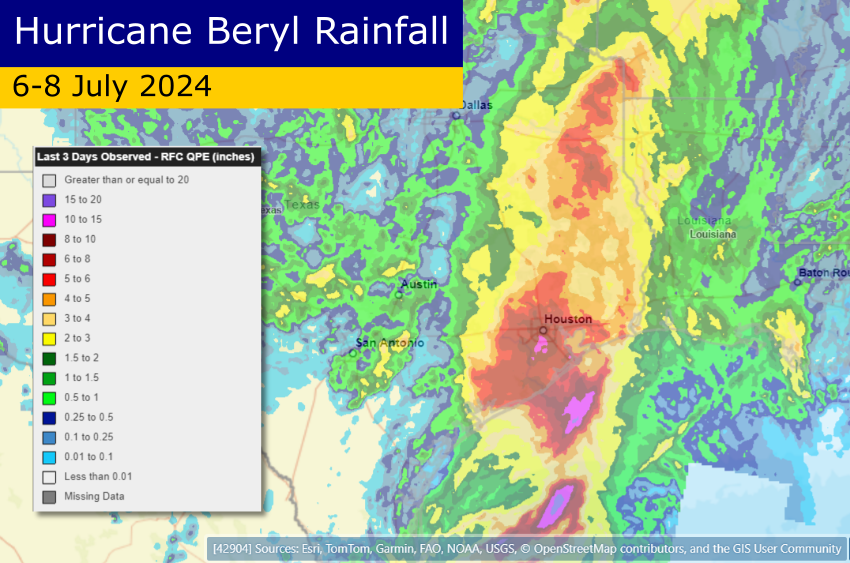
Catastrophic Flooding as Hurricane Helene Slams the Southeast USA
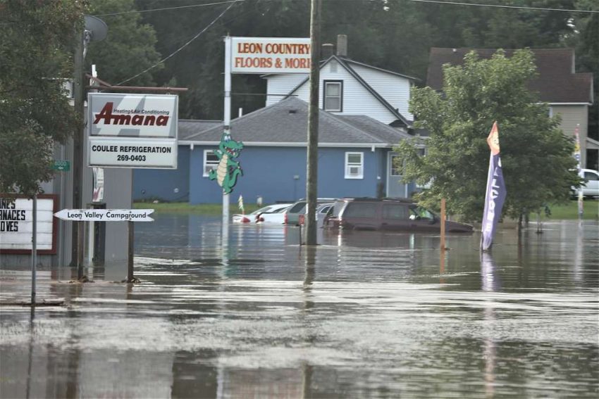
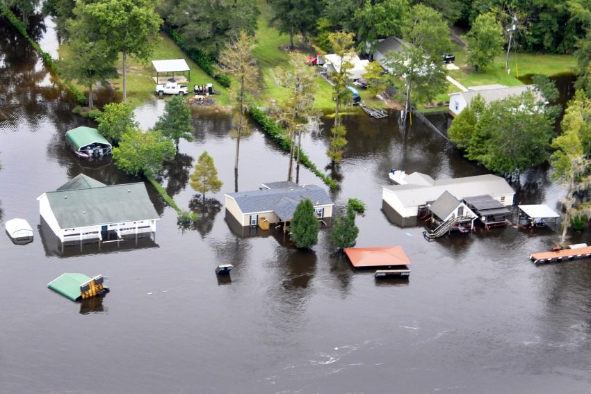
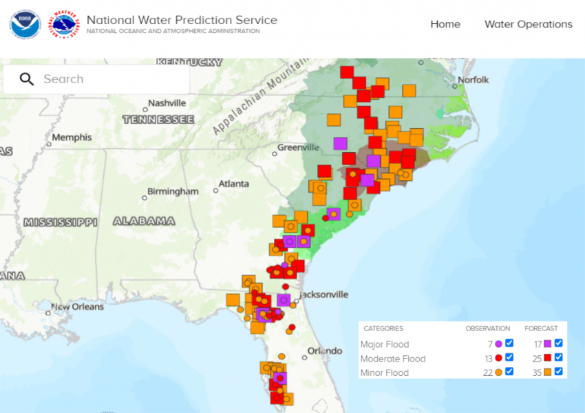
Rivers are surging to record levels due to three days of torrential rainfall in the mountains of western North and South Carolina. The rainfall has been falling ahead of major Hurricane Helene which made landfall in the Big Bend area of Florida on Thursday night. The hurricane brought significant wind damage and surge flooding to the Gulf Coast and adjacent inland areas. However, the most long-lasting and serious impacts are from inland freshwater flooding. The death toll in the region is near 40 as of Friday night and still rising.
Heartbreaking scene as catastrophic storm surge leaves Horseshoe Beach, Florida destroyed. Almost every house sustained damage. @MyRadarWX #Hurricane #Helene pic.twitter.com/LcfXADRnEB
— Jordan Hall (@JordanHallWX) September 27, 2024
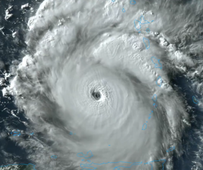
Helene strengthened rapidly on Thursday from a Category One to a dangerous Category Four hurricane. It made landfall around 10 pm local time near Perry, FL. The hurricane then moved rapidly north and weakened through the morning hours. Severe damage occurred in this region due to a storm surge upwards of 10 feet (3 m) as far east as Tampa Bay. Numerous trees and powerlines were downed thanks to widespread wind gusts of 70-100 mph (110-160 kph). The resultant power outages are regionwide and will linger in some spots for days.
The historic #LakeLure Flowering Bridge appears to be gone. #RutherfordCountyNC #Helene pic.twitter.com/slM2MTAj5W
— Annie M. Dance 🕵️♀️ 📰 (@AnnieMDance) September 27, 2024
Video of a house floating away and collapsing in Asheville as tropical storm Helene floods the area. pic.twitter.com/6HORGSg8cX
— ABC11 EyewitnessNews (@ABC11_WTVD) September 27, 2024
I kept seeing people say, “Chimney Rock is just gone” and I thought they were exaggerating … but they were not. pic.twitter.com/gtwbO999yt
— Caroleeena 🍉 (@Caroleeenalala) September 28, 2024
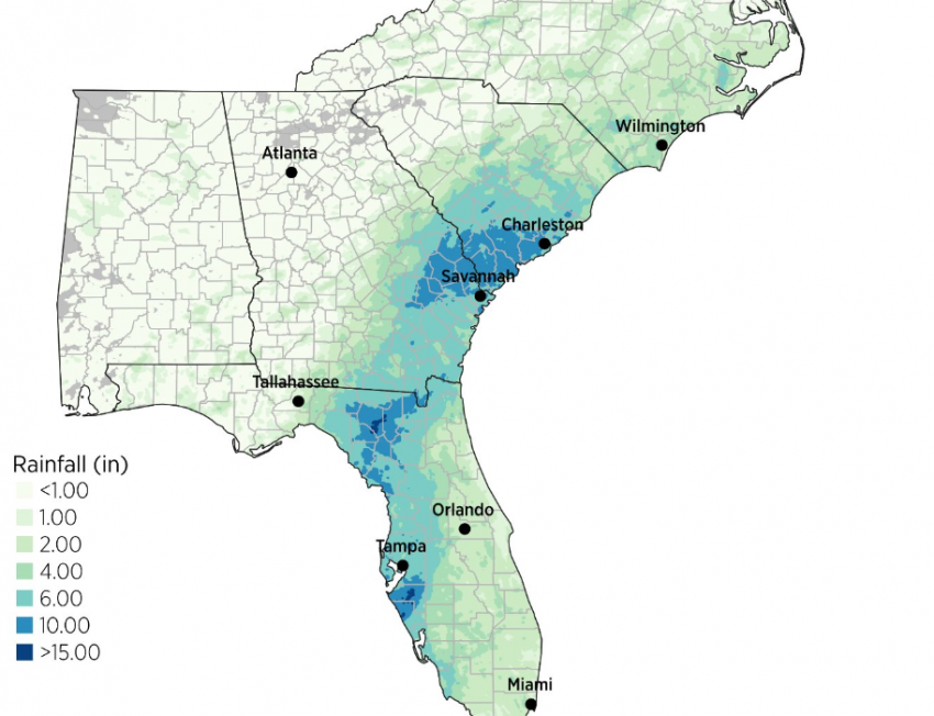
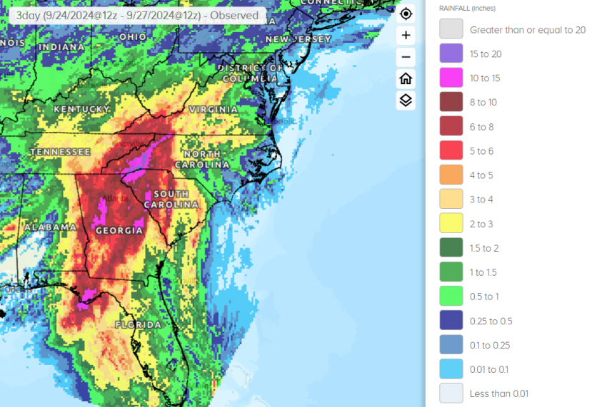
However, Helene will go down in the history books for the catastrophic flooding focused in the mountains of Georgia and the Carolinas. Rainfall approaching 20 inches (500 mm) or even 30 inches (750 mm) in a few spots (see map above) has completely overwhelmed the drainage system. Rivers across the region are in major flood stage with several setting new record levels. In fact the French Broad River at Fletcher, NC is expected to crest tonight more than ten feet above the previous high mark! Whole towns and highways are being inundated and swept away. The sloped terrain is also causing massive landslides and washouts. The dam at Lake Lure in Hendersonville, NC is disintegrating and in imminent danger of failure, forcing thousands to evacuate downstream. The rain and wind are dwindling as Helene finally spins down, but the flooding hazards will continue for several days in the mountains and downstream.