2018 US Climate: Wet & Warm Weather Dominates
The 2018 summer solstice began at 10:07 GMT on 21-June in the northern hemisphere. Since the start of the solstice is close to the halfway point of the year, it marks a good time to check in on the state of the climate so far in 2018.
The maps and information below were compiled by Ubimet using close to 900 stations across the United States. The data from these stations compare 2018 observations to historical climate data with a record period of at least 30 year or more.
Precipitation:
Wetter than average conditions have dominated many locations from the northern Rockies eastward to the Midwest, Northeast, Mid-Atlantic, and Florida.
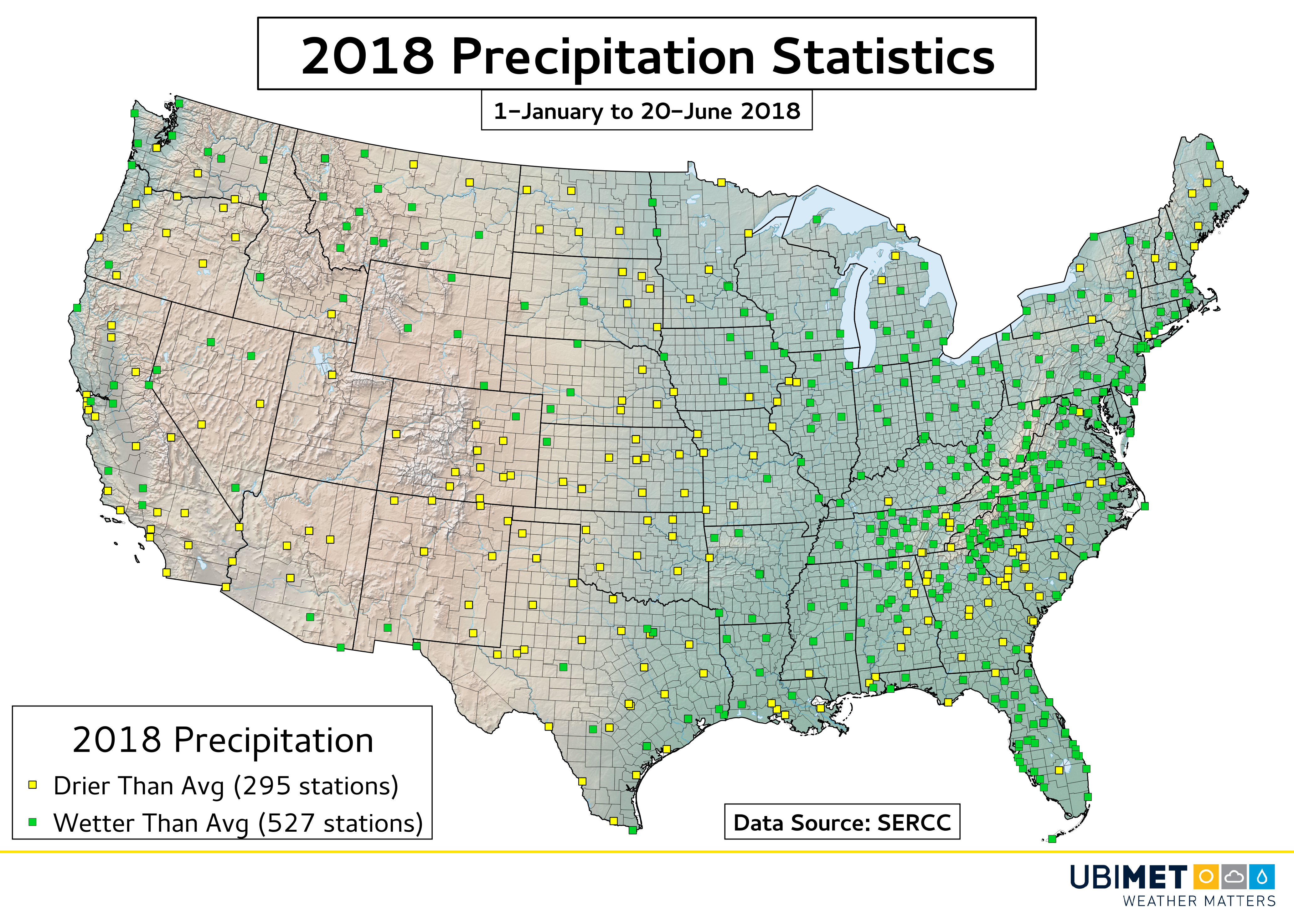
February was a particularly wet month from the Mississippi Valley up into the Mid-Atlantic as precipitation surpluses ranged from between 200-300% of normal.
The Southern Plains and Southwest have largely been drier than normal, which is not good news for the ongoing drought in these area. January and April were particularly dry months for these regions.
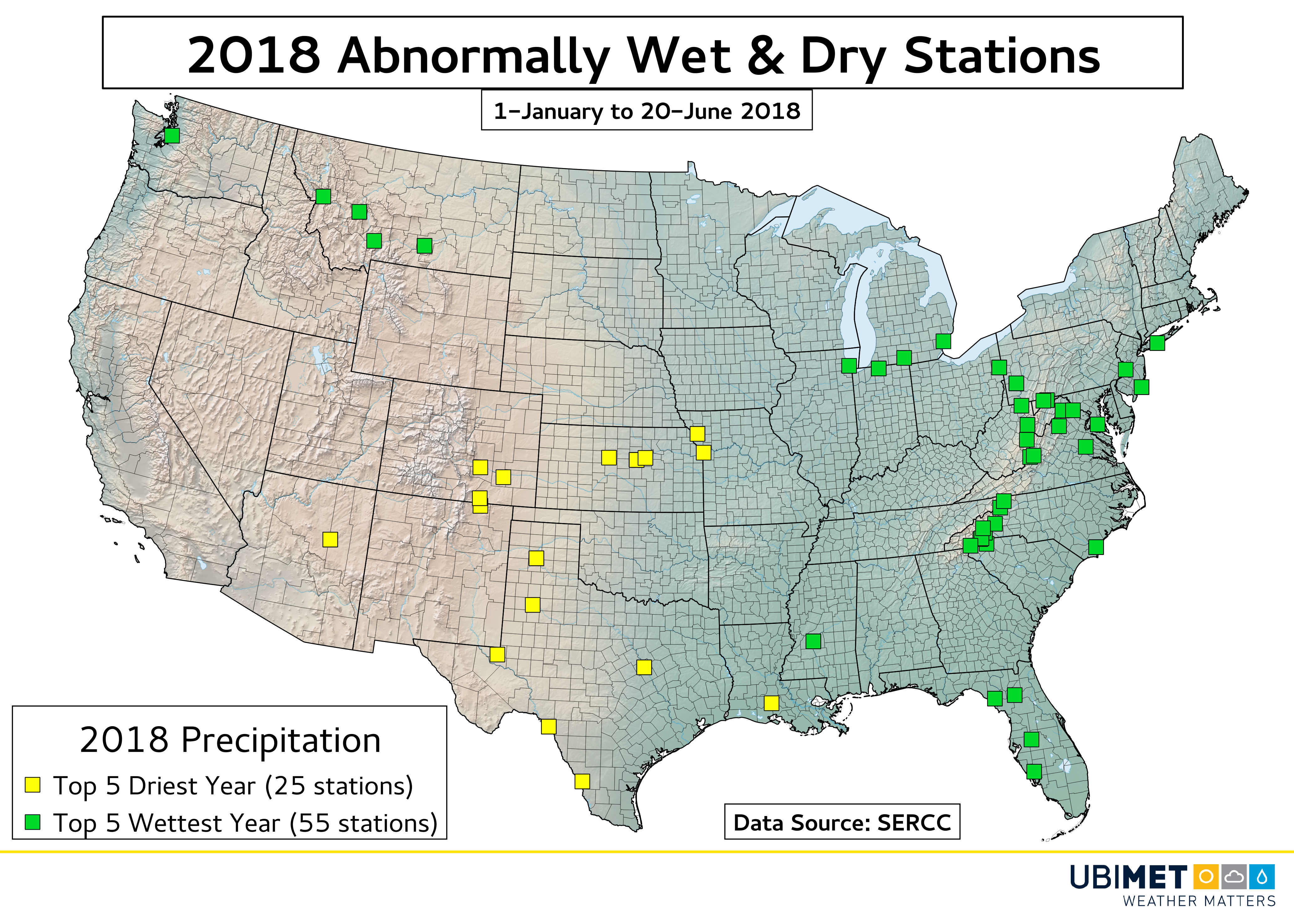
The next map below takes a look at stations which are experiencing a top 5 driest or wettest year so far through 20-June. Stations experiencing a top 5 wettest year outnumber those with a top 5 driest year by a greater than 2:1 margin.
Temperature:
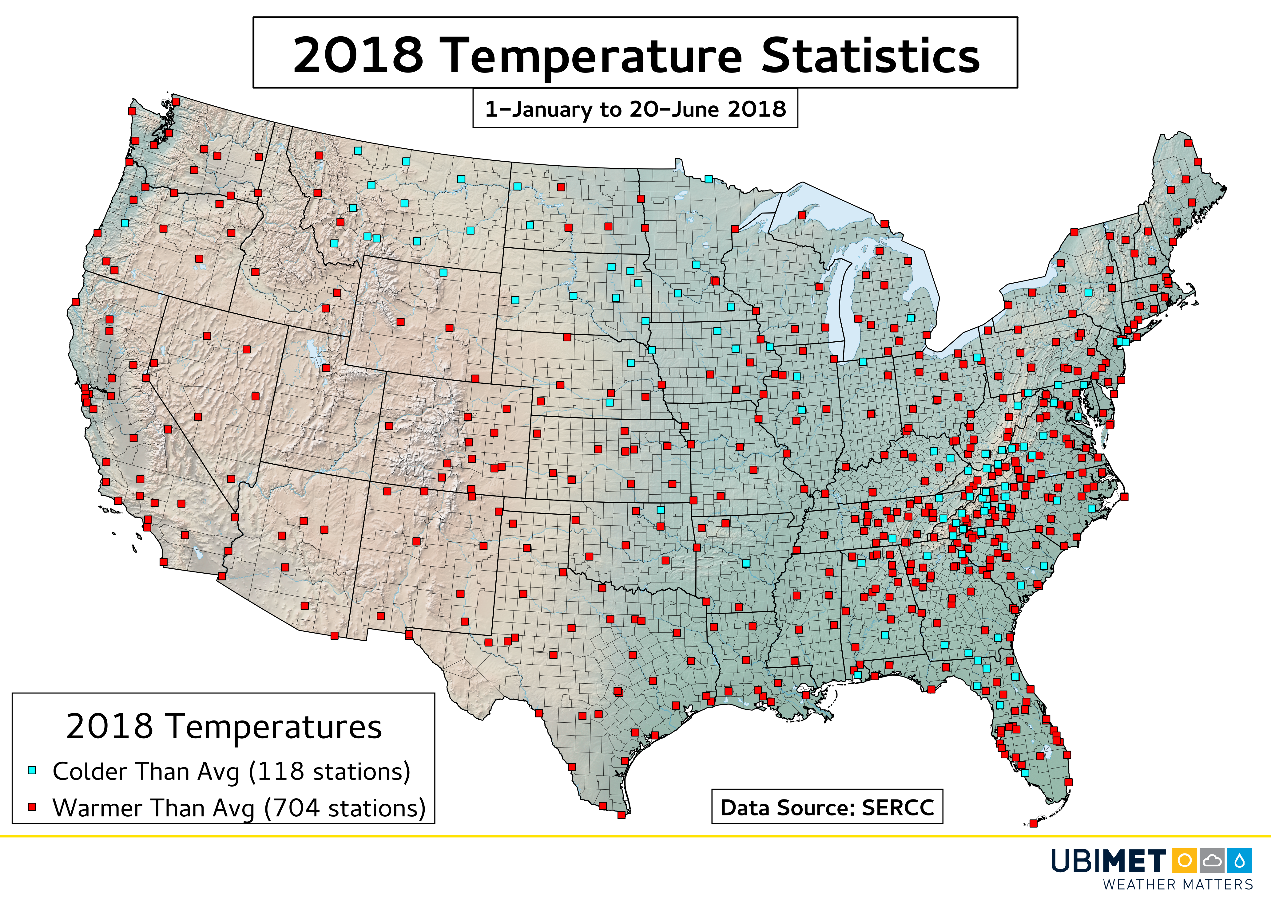
Warmer than average temperatures have dominated much of the United States through the first half of 2018. Communities from the West Coast to the southern Plains to the East Coast have largely been warmer than the long-term average.
There have been some colder than normal pockets that extend from Montana into parts of the Midwest; and a second area across the Appalachians. However, out of the 822 stations with temperature data only 16.7% are colder than their long-term average.
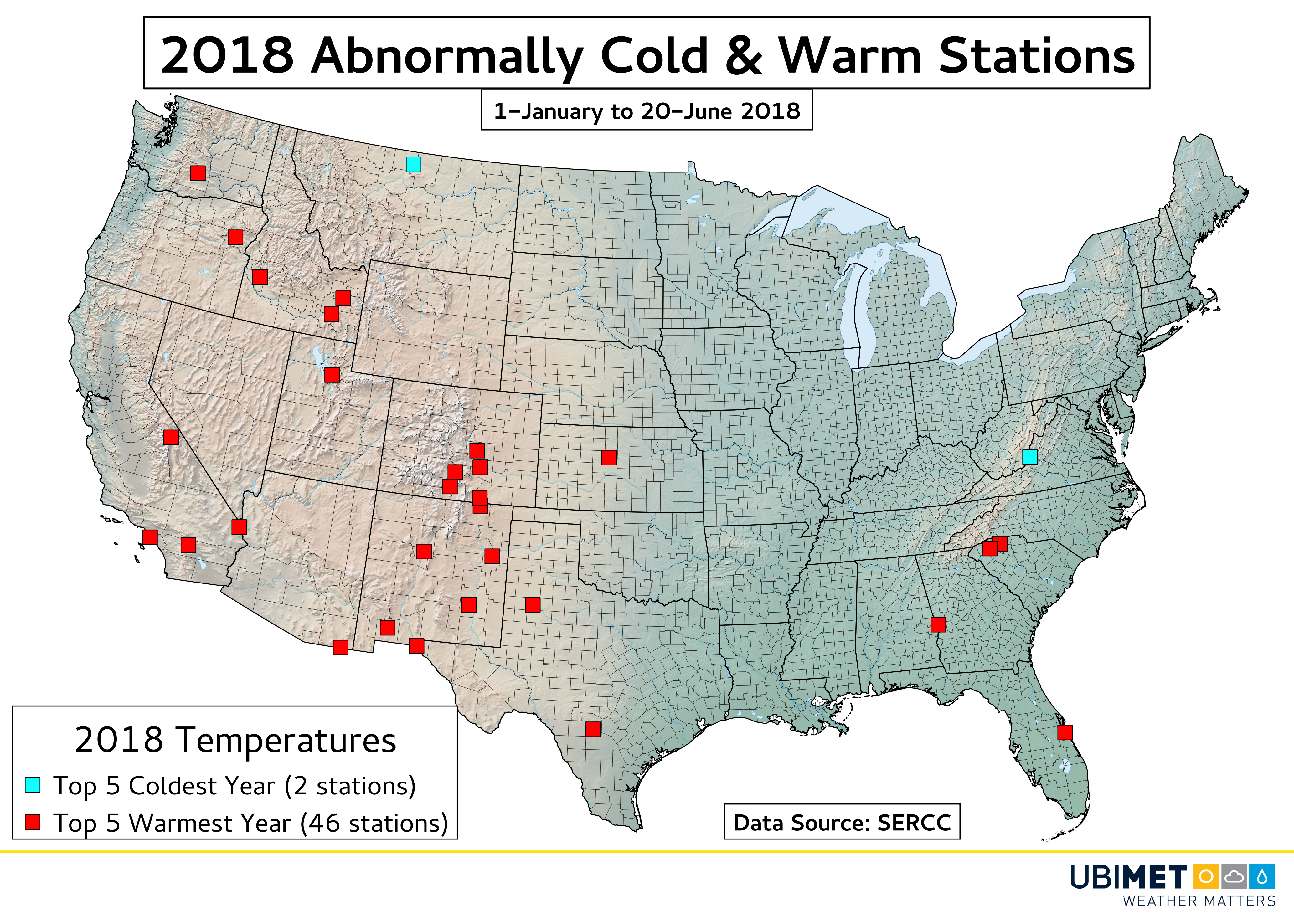
The last map below takes a look at stations which are experiencing a top 5 coldest or warmest year so far through 20-June. Stations experiencing a top 5 warmest year outnumber those with a top 5 coldest year by a 23:1 margin!
The temperature trend observed in the United States through the first half of 2018 is consistent with the latest IPCC assessment which concludes that the Earth as a whole is warming.
Keep an eye out for more climate-related information and visual content from Ubimet in the coming weeks and months.