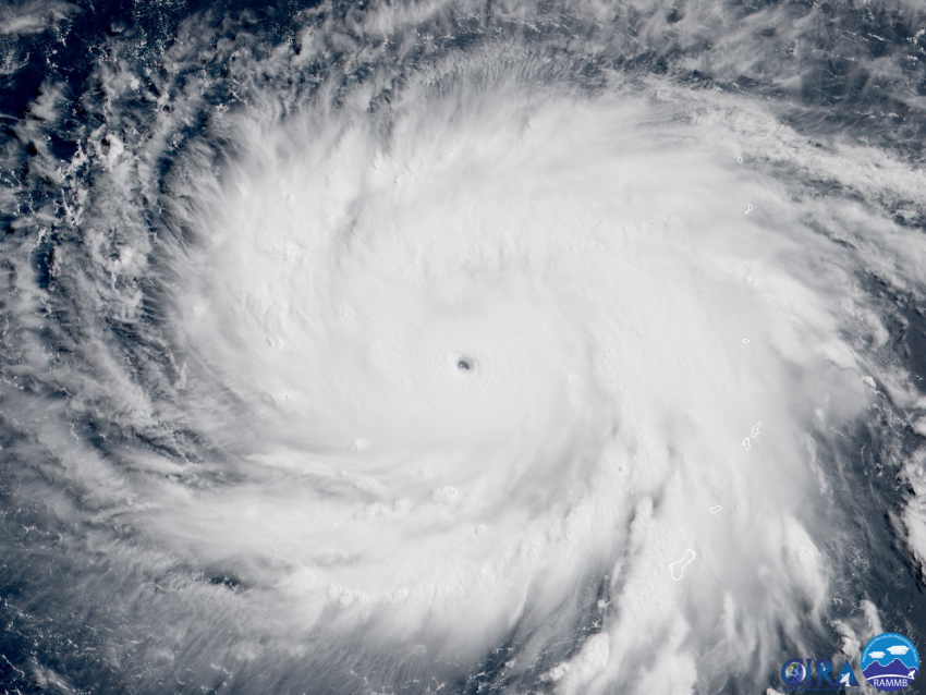
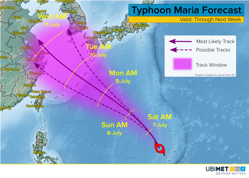
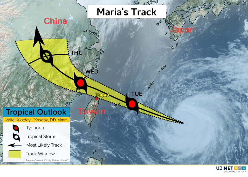
Typhoon Maria to Impact Taiwan; make Landfall in China.
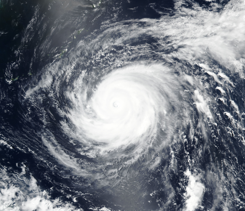
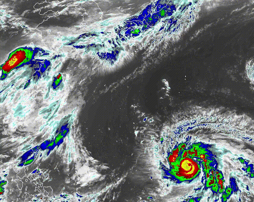
Powerful Typhoon Maria is tracking west-northwest across the West Pacific Ocean en route to eastern China.
Maria briefly reached Super Typhoon status on Monday, however, slight weakening has occurred early Tuesday as the cyclone moves over a bit cooler ocean waters.
The cyclone will pass close to the Japanese island of Miyakojima Tuesday evening, then move just north of Taiwan late Tuesday night before making landfall in eastern China early Wednesday.
Maria Impacts
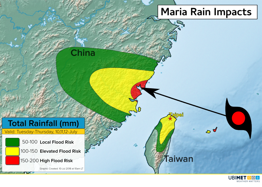
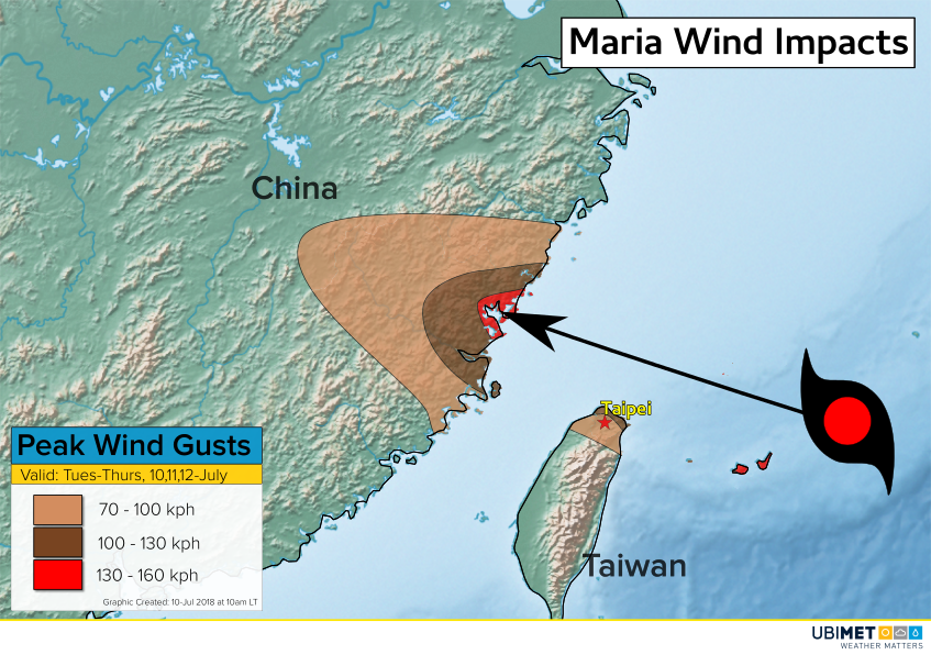
Flooding rain along with damaging winds and a storm surge are expected across northern Taiwan and the eastern Chinese provinces of Zhejiang and Fujian.
Along and near the center of Maria, rainfall amounts of 100-200 mm are expected, with locally higher totals. This amount of rain in a 12-18 hour time frame will lead to a high risk of flooding across extreme northern Taiwan and eastern China.
Wind gusts over 100 kph are expected to span out close to 50 miles from Maria’s center as the storm makes landfall early Wednesday.
Maria will be moving rather briskly into and through eastern China, and by Thursday Maria will be degenerating over land.