Another Active Severe Storm Day in the High Plains!
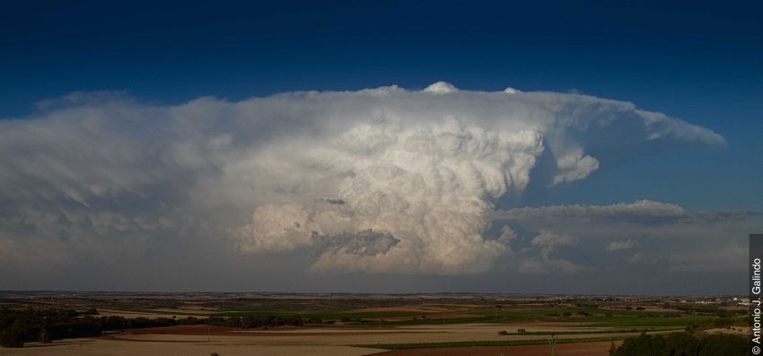
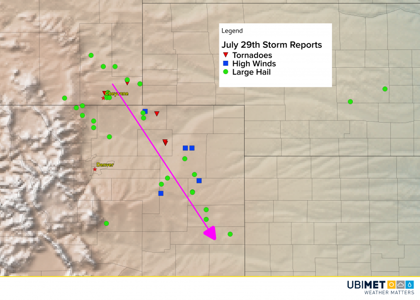
Severe storms have ripped down through the High Plains for much of the past week, producing everything from tornadoes to huge hail and destructive winds. Today was no exception as meteorologists watched an intense supercell move all the way from near Cheyenne to eastern Colorado. The NWS Doppler radar site at Front Range Airport just east of Denver captured the evolution of the storm (animation below).
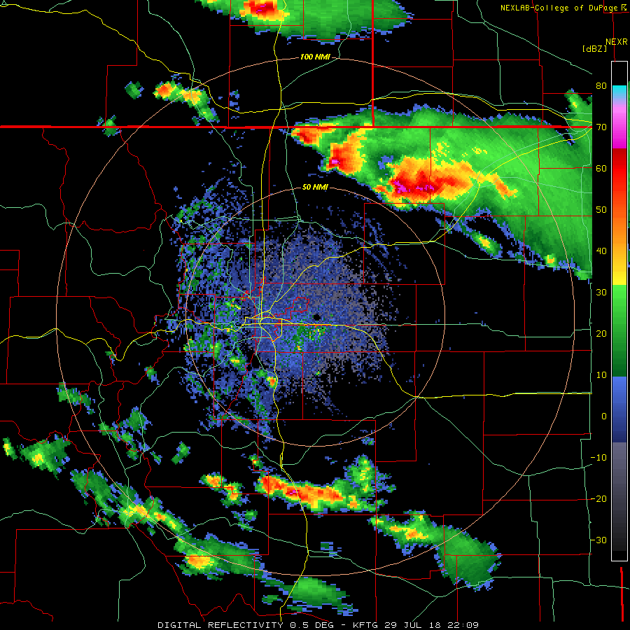
You can see the storm initially just south of the Colorado-Wyoming border at the top of the screen. It moves on a south-southeast trajectory, at times displaying the intense spinning motion that contributes to giant hail and tornadoes. Reflectivity values are near the radar’s max, indicating the presence of either large hail or torrential rain, or both. Spotters along the path of this storm reported numerous hail stones of 2-3 inches (5-7.5 cm) in diameter, wind gusts of 70-85 mph (110-135 kph), and a few tornadoes.
You might also spot the outflow front pushed out by the severe storms while they were near the state line. It’s the thin green line that moves directly towards Denver and the radar site (the radar is located where you see the small hole in radar values at the center of the screen). You might also notice that part of the line deforms and seems to hang back just south of the radar site compared to other parts of the outflow to the west and east. That’s the outflow front hitting a small bank of hills and slowing down!
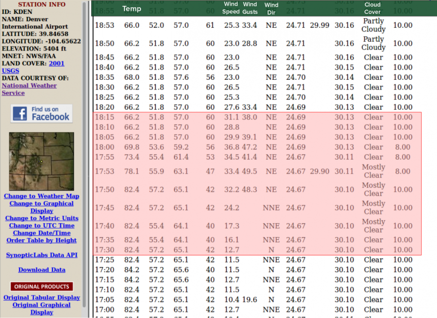
We can also detect the outflow front’s arrival at Denver International Airport, located northwest of the radar site. The record of observations from the airport shown above tells the story. Winds for much of the day were from the north at about 10-15 mph (15-25 kph). The outflow arrives at about 5:45 pm LT – winds quickly shifted to the northeast, gusting to 50 mph (80 kph). At the same time temperatures dropped from the lower and middle 80s to the middle 60s. Note that skies remain mostly sunny through this period with no storms in the vicinity.