Strong, Hot Winds Drive Fast-Spreading Fires in the L.A. Basin
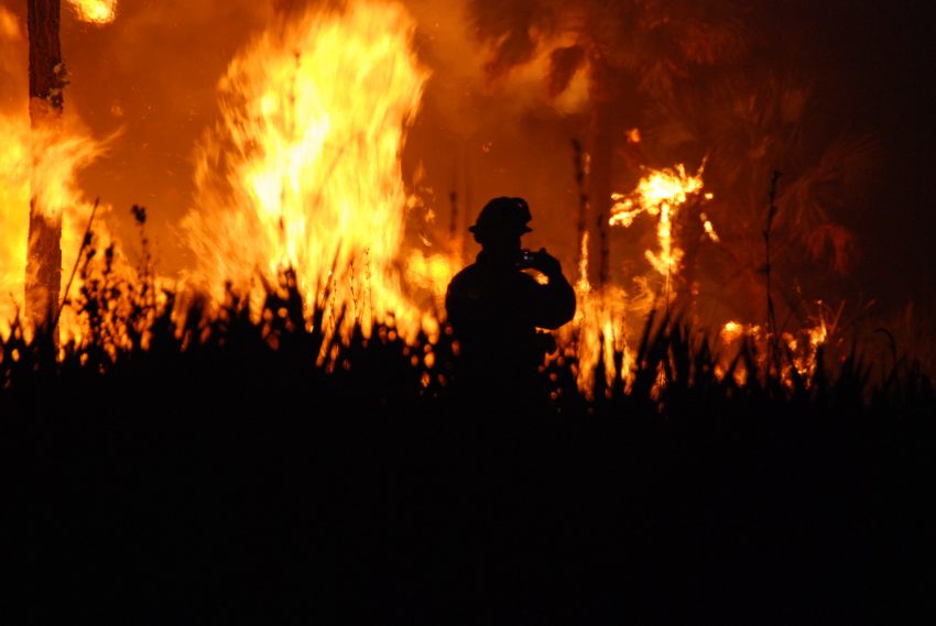
Destructive fires sparked on Tuesday morning spread rapidly near Malibu and Pacific Palisades on the west side of Los Angeles. The fires are being driven by hot, dry gusts known as the Santa Ana winds. These winds blow downhill from the mountains, gaining momentum as they lose moisture. The result is extremely strong gusts and low humidity, perfect conditions for fires to rapidly spread out-of-control.
This is what the #ClimateCrisis looks like.
More frequent and more intense fires. #PalisadesFire
pic.twitter.com/ytuKaD8uVe— Nick Young (@nickofnz) January 8, 2025
The #PalisadesFire has jumped PCH. Here’s our drive going south next to Will Rogers Beach State Park.#PacificPalisades #Pacificpalisadesfire pic.twitter.com/x5QFsVA6Z1
— Liz Kreutz (@LizKreutzNews) January 8, 2025
Winds have been gusting 50-65 mph (80-105 kph) over large areas of the L.A. Basin today. Isolated higher gusts have been reported up to 86 mph (138 kph) at the Magic Mountain trailhead. These strong winds are knocking numerous trees and powerlines down, providing plenty of opportunities for fire-starting sparks. The fire now threatening Pacific Palisades was first reported around 10:30 am Tuesday morning. Within 20 minutes it grew from 20 acres to 200 acres, and by mid-afternoon it was approaching 1,300 acres in size. By this time, tens of thousands of homes and businesses were in danger. Evacuation orders were issued for 30,000 local residents, leading to a major traffic jam. Unfortunately, the advancing fire and heavy smoke closed major highways, forcing nearly 200 of the evacuees to abandon their cars.
Nightmare Fuel
Two men and a dog trapped in a home surrounded by the Palisades fire. pic.twitter.com/YDCkFmLNbH— Kevin Dalton (@TheKevinDalton) January 8, 2025
Smaller fires have developed in other spots across the L.A. Basin, putting a severe strain on regional fire-fighting resources. The dangerously dry, windy conditions will continue overnight and through much of Wednesday, finally easing on Wednesday evening. Lead photo courtesy US Fish and Wildlife Service