Blistering Heat Subsides in the Northwest, but Drought Still Worsening
Record-breaking heat that was scorching the Pacific Northwest last week has shifted a bit to the east. The observation at West Glacier, Montana saw 100° F (38° C) heat for the first time on record on Sunday! Meanwhile, highs in Washington and Oregon stayed in the 80s instead of the 90s and 100s of a few days ago. However, the long-term dry spell continues with no substantial relief in sight.
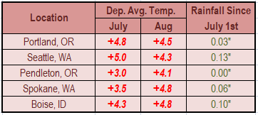
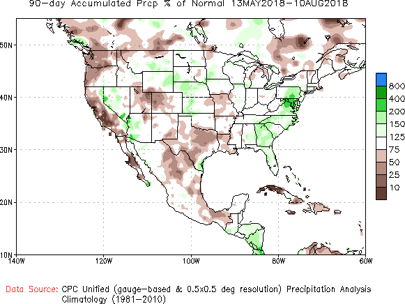
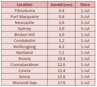
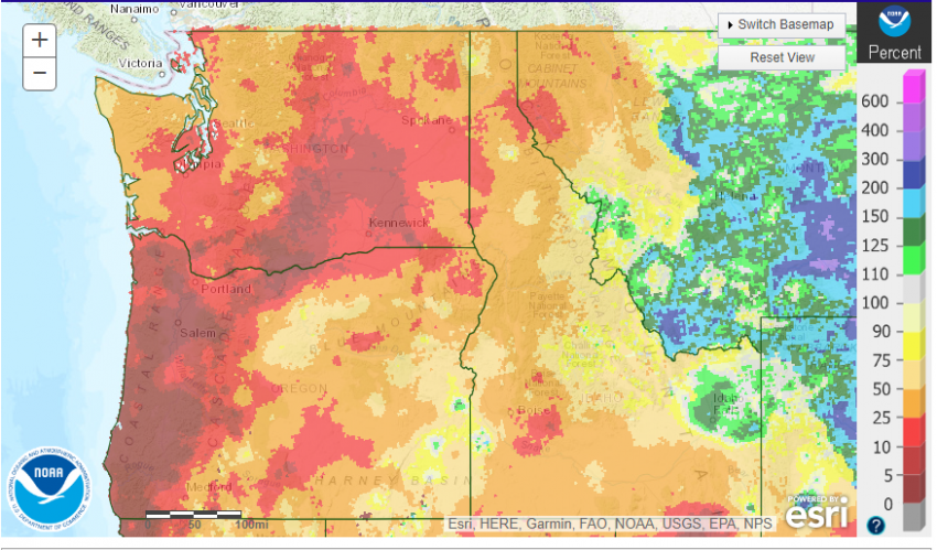
The table above shows rainfall since July 1st as well as departures from normal temperatures for select cities in the Pacific Northwest. The map below shows the percentage of normal rainfall the region has received. A majority of interior Washington and western Oregon are around 10% or less of normal precipitation in the past 60 days. The picture of much drier-than-normal conditions is clear.
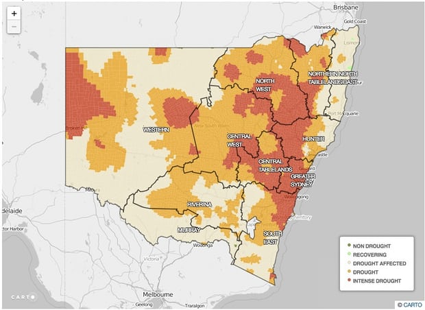
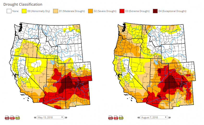
Further down, you can see the map of drought expansion over the past two months. From mostly drought-free in mid-May, currently almost the entire region is in a moderate to severe drought. The lack of rainfall has taken a major toll. Livestock production is reported much diminished over important grazing lands in interior Oregon, for instance. The region-wide presence of wildfire smoke and haze is adding to the unhealthy conditions.
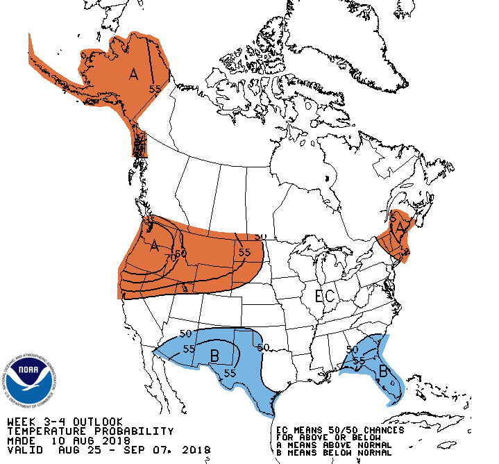
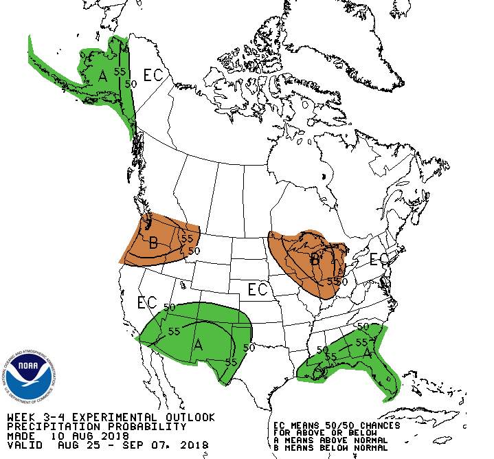
Unfortunately, the mid-range prospects for significant rainfall are not promising. A ridge will remain anchored in place for the next few weeks. The outlooks at bottom reflect the expectation for continued hot (left map) and dry (right) weather into early September.