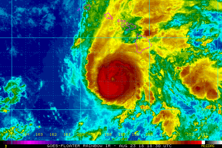
Florence Approaching Warmer Waters, Intensification Likely

Hurricane Florence has weakened significantly today thanks to high wind shear. The shear is expected to diminish in the next few days, however. As the storm approaches warmer waters in the western Atlantic, restrengthening is likely.
Florence has been charting a steady west-northwest course since forming a week ago near the Azores. This trajectory will likely continue over the next several days underneath a large mid-ocean ridge. By Tuesday, the storm could be near Bermuda. Most of the model guidance suggests the storm will pass far enough south of Bermuda to limit impacts on the island to some gusty winds and passing rain squalls. However, interests on Bermuda should closely monitor the storm in case a northward deviation occurs.
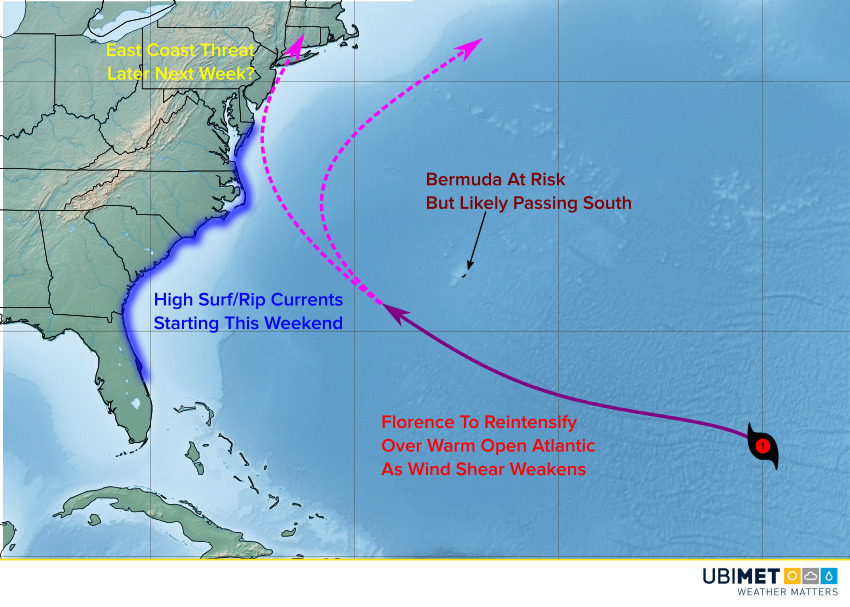
Later in the week, models diverge on the future track. Some bring the cyclone close to the U.S. east coast, but some curve the storm well offshore. It’s simply too early to be able to forecast with any accuracy the landfall potential. Regardless of where the storm goes, there will be some big waves and rip currents along the Eastern Seaboard starting late this weekend and persisting through next week.
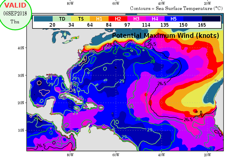
Florence may weaken below hurricane status tonight or Friday. However, warmer water and lessening vertical wind shear could allow the cyclone to strengthen again (see potential intensity map above). In fact Florence may be a major hurricane again by the middle of next week! Where and when the storm curves north will determine intensity later in the week.