Florence Now A Tropical Storm, But Increasing Threat for a U.S. Landfall!
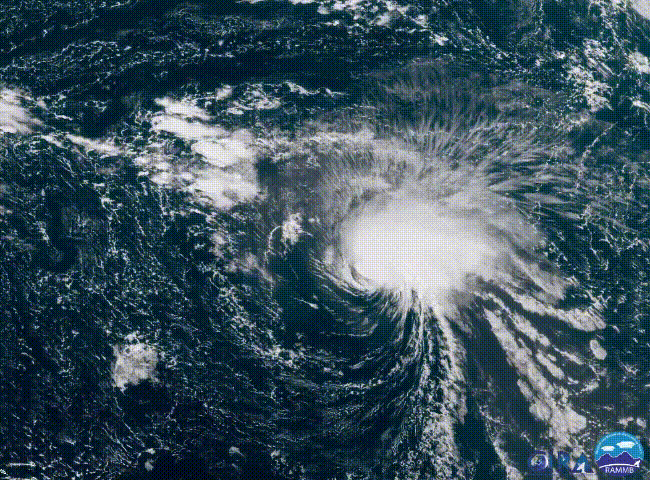
As expected, high vertical wind shear has continued to disrupt the circulation of Florence today. Florence has been downgraded to a high-end tropical storm. However, restrengthening is expected this weekend into early next week as the cyclone moves over warmer waters. Lessening shear will contribute to the potential intensification. Even more unsettling, model guidance has continued to trend further westward with the future track. A landfall along the U.S. Eastern Seaboard, while far from guaranteed, is becoming more likely!
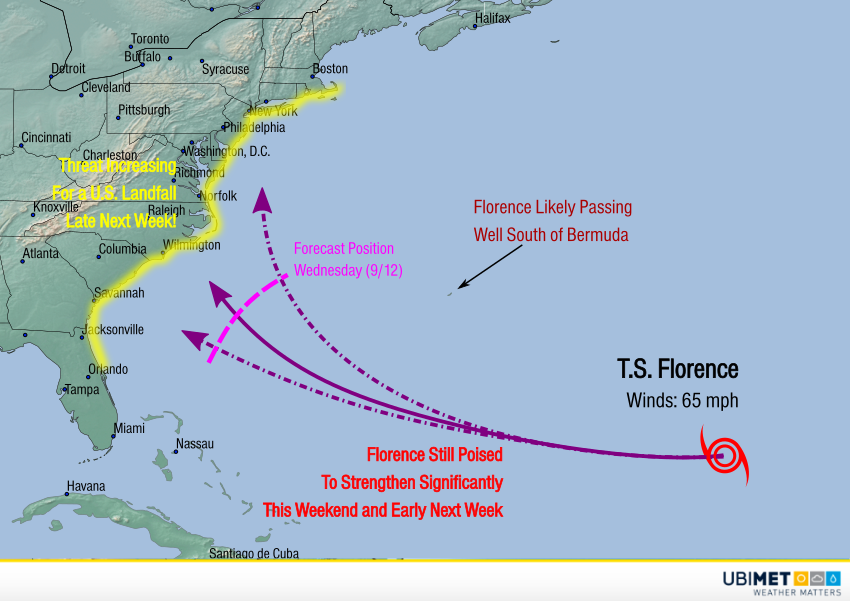
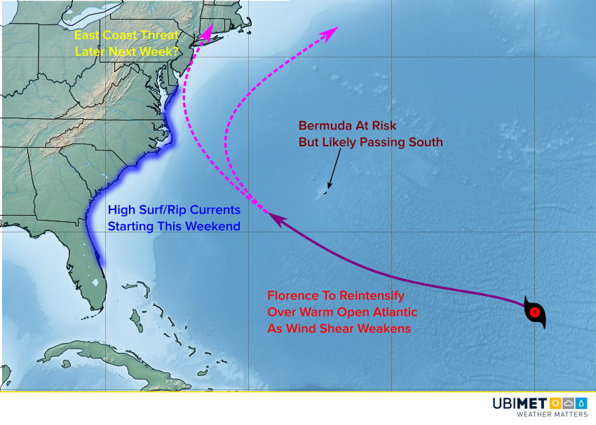
Florence will continue on a slow westerly heading through this weekend. Early next week, the storm should pass well south of Bermuda. A larger system will start to pull Florence toward the northwest into the middle of next week. However, indications are now that Florence may not be turned north and out to sea as was previously hoped. High pressure may build in fast enough to push Florence towards the East coast. There is the potential for a landfall anywhere from northern Florida to southern New England. However, the most likely trajectory would put the Carolinas in the bullseye late in the week into the weekend. Although it’s still too early to say with confidence where Florence will move, preliminary hurricane precautions should be taken.
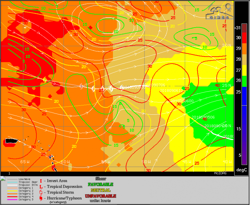
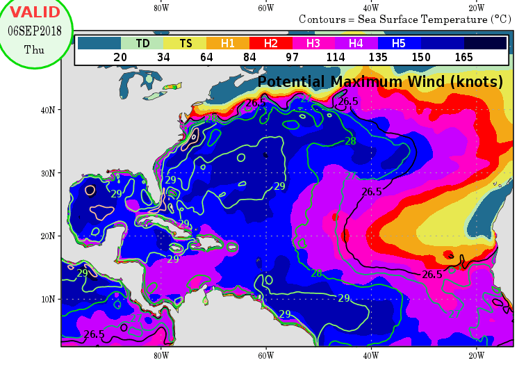
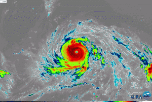
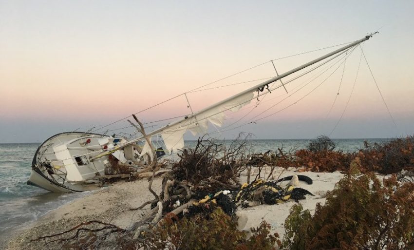
The map above (courtesy of CIMSS) depicts various factors that determine a cyclone’s intensity. The shades of color indicate sea surface temperatures, while the solid lines show wind shear aloft. As you can see, Florence will be moving into a region of warmer water temperatures (orange and red shades) and decreasing shear (yellow and green lines). Many models even strengthen Florence back to major hurricane status! Well ahead of the storm, large waves and rip currents will pose a grave hazard to swimmers along the East coast this weekend and beyond. Lead photo courtesy National Park Service.