Florence Exiting, But Cleanup from Flooding Will Take Months
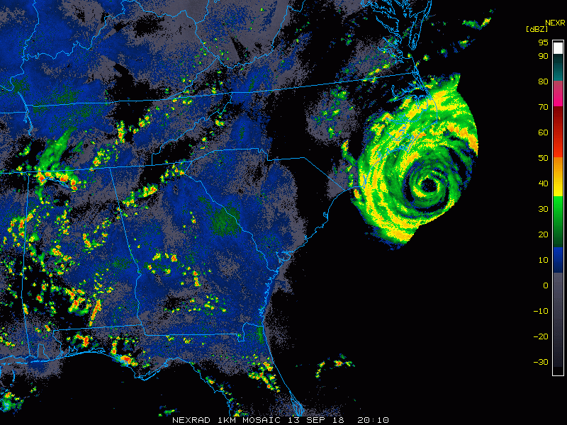
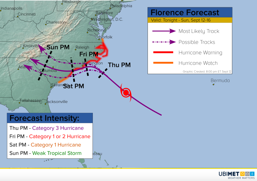
The remnants of Hurricane Florence are moving through the Northeast tonight. The worst of the weather associated with the storm is over. However, devastating flooding is still ongoing as the record-shattering rainfall runs off into the larger rivers. These floodwaters will take days if not a couple of weeks to crest and then recede. Even after this occurs, the recovery from this catastrophe will take months.
Stoney Creek Plantation in Leland, NC on the Morgan Branch of Town Creek has devestating flooding from #HurricaneFlorence @JimCantore @StevePetyerak #ncwx pic.twitter.com/Z4jtnLNw36
— Charles Peek (@cpeek7) September 17, 2018
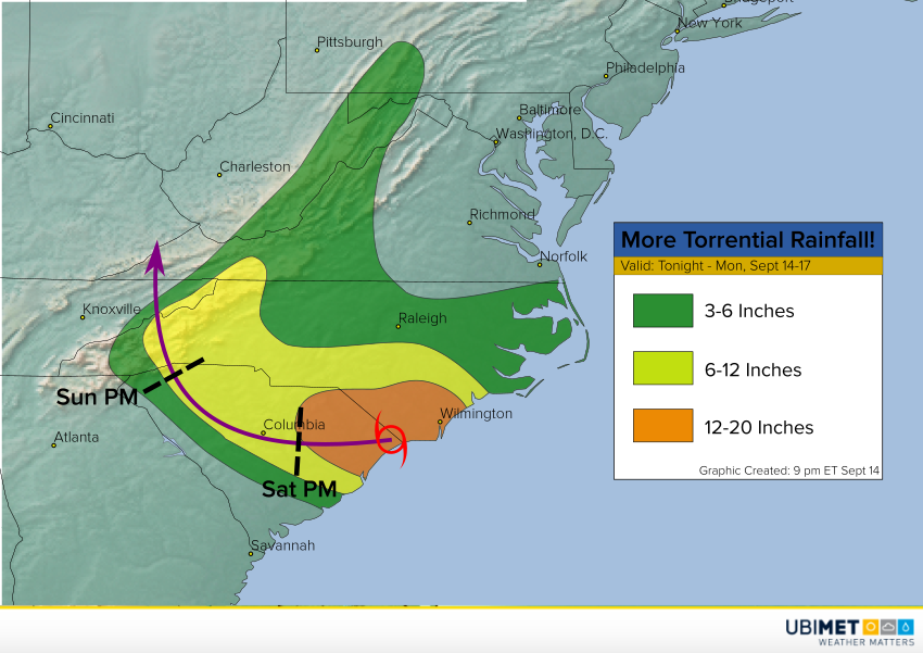
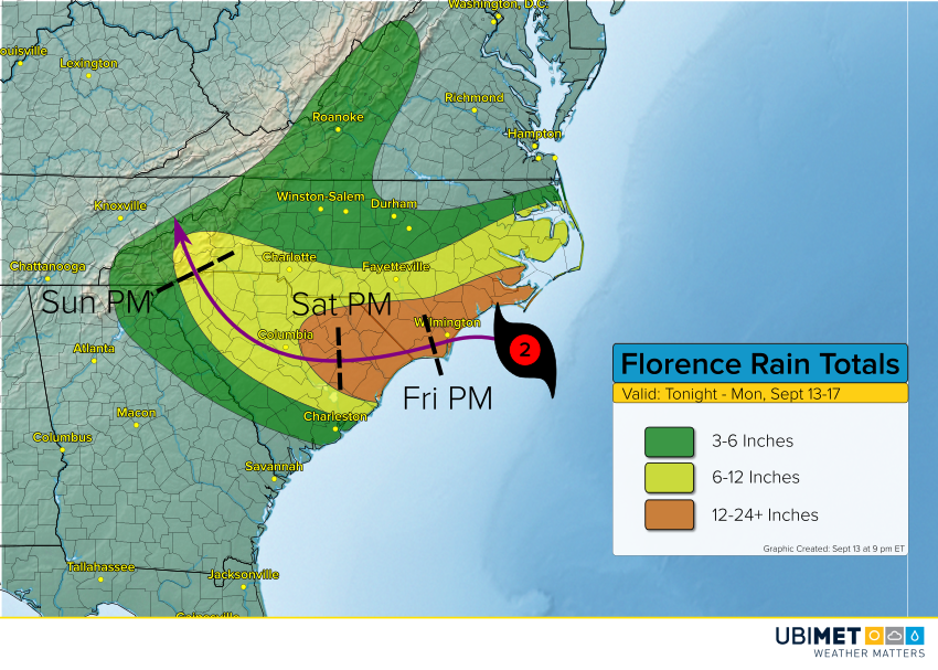
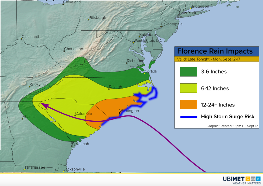
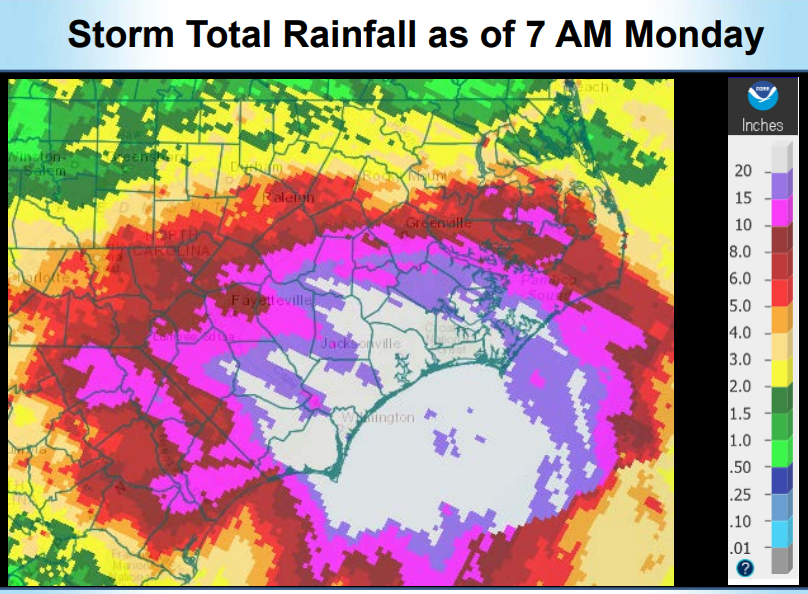
As you can see from the graphic below, days of tropical rainfall left totals of well over 20 inches over much of southeast North Carolina. Official totals are still being tallied and verified, however it is quite likely the state record for tropical cyclone rainfall, formerly around 24 inches, was easily broken. Some areas saw 30-36 inches all told! This torrential rainfall initially led to widespread, severe flash flooding. However, as the water has drained into streams and creeks, then rivers, the focus has shifted to record-breaking river flooding.
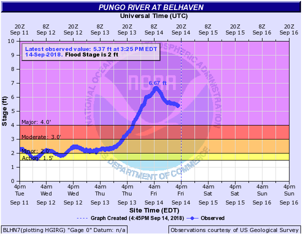
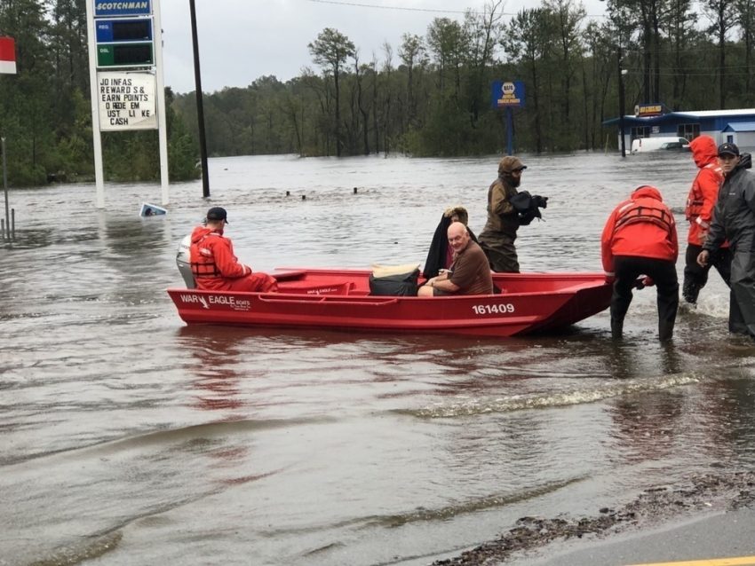
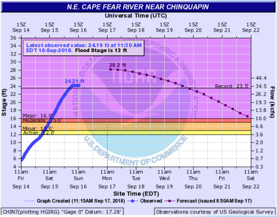
Many of the rivers in the area are reporting major flooding, some to levels never before measured. In fact at least two rivers are not reporting accurate measurements because the water level is above the gauge! Below is an example of a gauge site unable to measure further water rises. Hundreds if not thousands of homes are underwater, and highways and interstates across the eastern half of North Carolina and far eastern South Carolina remain closed. Officials in Jones County, North Carolina, reported the entire county was underwater earlier today! That’s more than 470 square miles inundated by river flooding in that county alone.
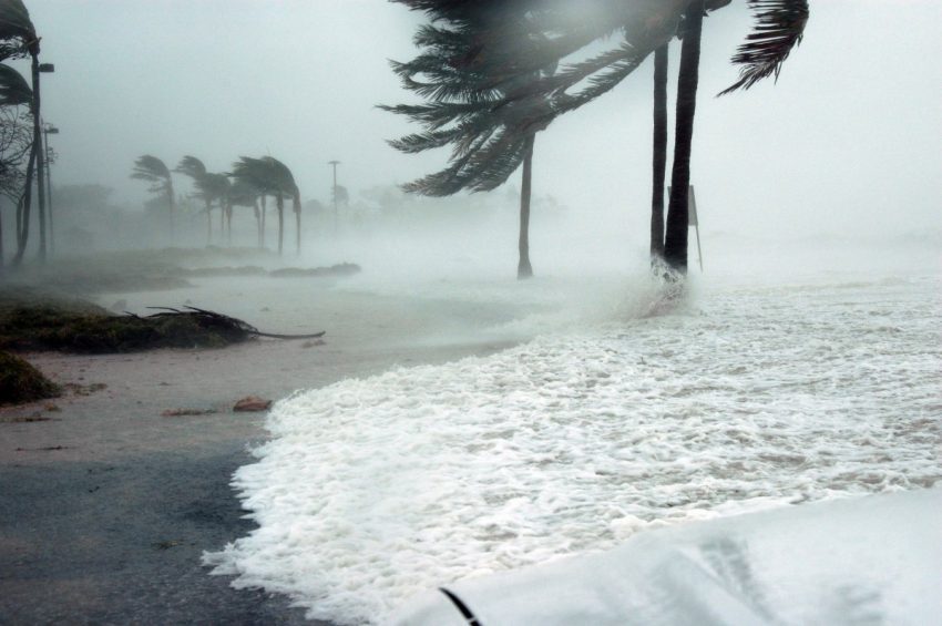
The larger rivers in the region are only now beginning to shoulder the water-draining burden. They’ll continue to rise slowly through the week, many approaching record levels late this week or this weekend. The recession of floodwaters from these rivers won’t occur until well into next week, meaning at least two more weeks of closed highways, towns underwater, and hundreds of thousands of lives displaced. Lead photo courtesy CPO Stephen Kelly, US Coast Guard.