Flooding from Florence Will Be Worse than Hurricane Floyd in North Carolina
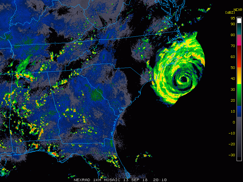
Nineteen years before Florence almost to the day, Hurricane Floyd lashed eastern North Carolina with damaging winds and storm surge. But the most lasting and devastating impact from Floyd was the torrential rain that lead to record-breaking river flooding. The ongoing floods from Hurricane Florence have been or will be even worse in some areas (see maps below).
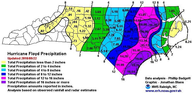
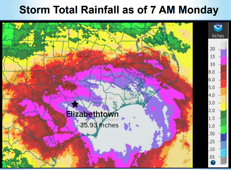
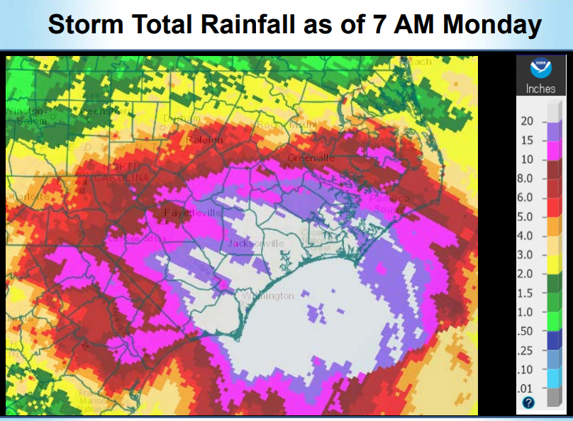
Hurricane Floyd was a different kind of storm from Florence. It was a stronger storm, category three at landfall compared to Florence’s category one status. It was also moving much faster – the heavy rainfall totals were caused by Floyd joining forces with a storm system already in place over the East Coast. Florence, on the other hand, was working on its own but moving much more slowly. There are some striking similarities, however. The two cyclones, exactly nineteen years apart, made landfall within 25 miles of each other. And the rainfall footprint is rather similar, especially in southeast North Carolina. The magnitude of rains from Florence, although covering a somewhat smaller area of the state, is greater. Floyd held the previous state record for rainfall from a tropical cyclone at just over 24 inches. Florence shattered it with nearly 36 inches of rain recorded at Elizabethtown.
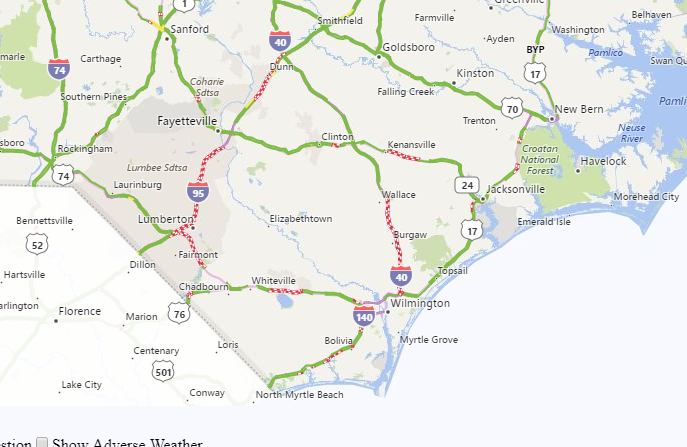
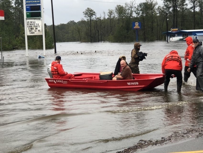
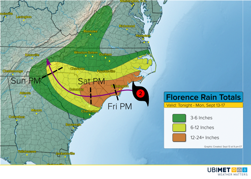
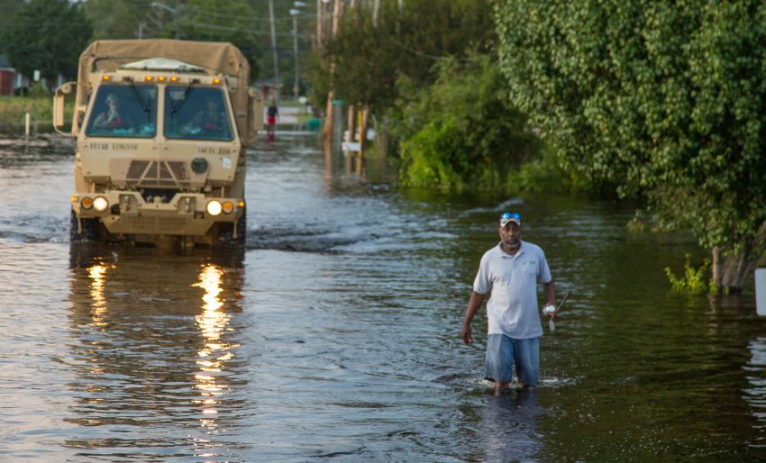
Floyd caused over three billion dollars in damages, mostly from the flooding, and cost 51 people their lives. So far Florence has tallied 25 deaths on North Carolina, but that number will probably increase. It’s too early to specify monetary damages on a state-by-state level, but some agencies are already putting Florence in the top ten of costly U.S. hurricanes. Major highways and interstates across the southeast part of the state are still closed (see red dashed lines on the map above) and will likely remain closed well into next week. Lead photo courtesy Spc. Andrea Salgado Rivera, U.S. Army.
Roads in #NorthCarolina completely impassable this afternoon. A scene seen widely. Report: @ABC #HurricaneFlorence #florence #flood pic.twitter.com/HEjI0BTVQf
— WEATHER/ METEO WORLD (@StormchaserUKEU) September 18, 2018