Flooding from Hurricane Florence Yet To Subside in Some Areas
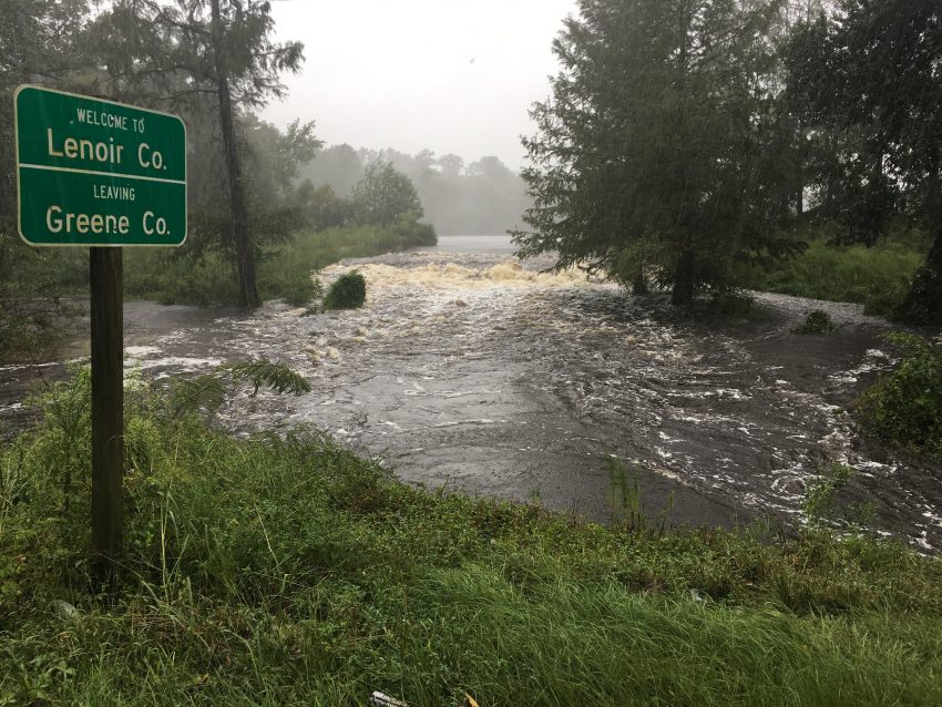
The last raindrops from deadly Hurricane Florence fell in the Carolinas more than a week ago. However, the massive amount of water the storm dropped is still moving through the region’s river systems. In fact, one of the larger rivers in the region, the Waccamaw, has yet to crest. Record flooding is ongoing, adding to a damage toll that will eventually put Florence among the top ten costliest cyclones of all time.
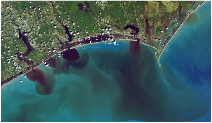
In the NASA satellite image above, you can see the darker sediments and debris flowing into the Atlantic from rain-swollen rivers. Florence dropped close to three feet of rain in some areas of southern North Carolina and eastern South Carolina. The resultant flooding constitutes the bulk of a price tag that Moody’s Analytics predicts will finish between $38 and 50 billion dollars. Even the bottom end of that range would put Florence at sixth on the all-time list of costliest U.S. tropical cyclones. Florence is also being blamed for 48 deaths in the U.S.
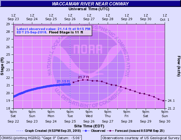
Flood waters have receded in many of the hard-hit areas of the Carolinas. However, the clean-up of thousands of water-damaged homes and businesses will take months. Many of these swamped structures will have to be totally gutted and rebuilt. However, some of the larger rivers are still absorbing runoff from upstream. The Waccamaw River in eastern South Carolina is still rising as of Tuesday evening (see gauge map above). It’s already two to three feet higher than previous record crests. Major towns like Conway and Georgetown are facing widespread flooding (see tweet link below) that will last through the end of the week at least.
More drone video of the flooding on the Riverwalk near the Marina Drive area in Conway. Video via Robbie Bischoff. #scwx pic.twitter.com/ZiFLmTetF9
— Ed Piotrowski (@EdPiotrowski) September 24, 2018