UPDATE: Heavy Rains from Rosa Spreading into the Desert Southwest!

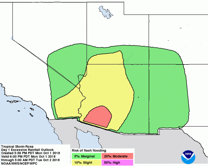
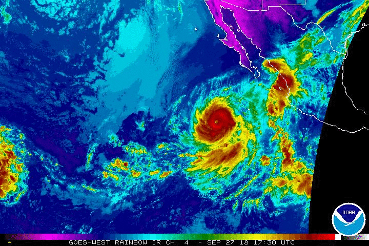
Tropical Storm Rosa is making landfall tonight over the northern Baja California. Rosa is weakening rapidly with sustained winds less than 40 mph, barely hanging on to tropical storm status. The main threat going forward will be heavy rain falling over a desert area unaccustomed to tropical rains. Flash flooding will be a widespread hazard through the next few days!
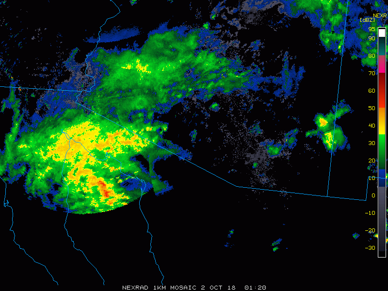
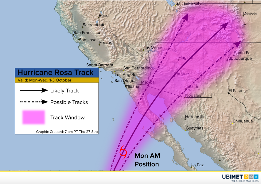
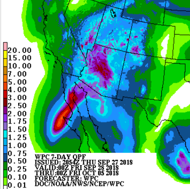
Outer rainbands from the cyclone are already moving into southern Arizona (see radar animation above). Rosa will be moving fairly quickly through the Southwest U.S. and will be absorbed into a front over the Plains by Wednesday. However, despite the short duration, heavy rainfall rates will mean big storm totals. Some locations will see amounts up to 4-5 inches (mm), especially where south-facing terrain like the Mogollon Rim enhances rainfall rates. Serious flooding will be the result. Mudslides will be common in the hilly terrain. Lead photo courtesy Syed Wali Peeran.