Unprecedented Flooding Wreaks Havoc Along New South Wales Coast
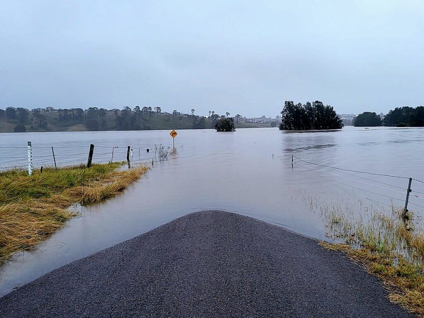
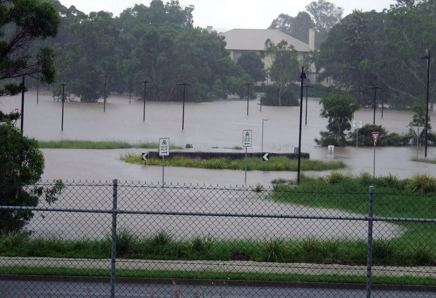
A torrential rain band has persisted along the north-central NSW coast for the past several days as an upper low remains parked over the region. This rain band has dropped widespread 300-500 mm (12-20 in) amounts, leading to tremendous runoff and severe flooding. Some rivers are reaching levels never before recorded, inundating numerous homes and businesses and forcing thousands to evacuate.
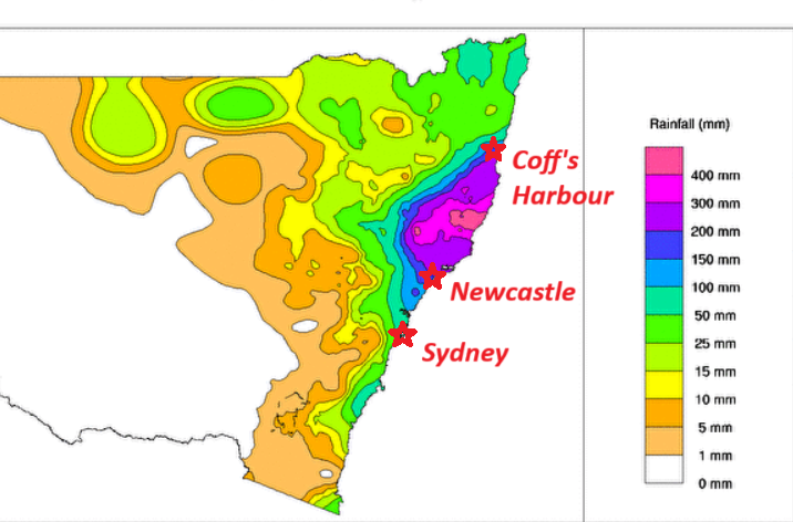
The rain band developed early Monday and has been wobbling slowly up and down the coast between roughly Newcastle and Coff’s Harbour. Rainfall rates within this band are exceeding 30-40 mm/hr (1.2-1.6 in/hr) with some locations seeing many hours of such rates. The highest storm total thus far seems to have been reported at Mt. Seaview with 593 mm (23.3 in). However, almost all stations in the region have seen at least 300-500 mm. These copious rains over such a widespread area have completely overwhelmed drainage systems.
#Australia #Flooding #Taree #NewSouthWales #destruction #anomaly #climatecrisis #climatechange
On May 21, 2025, the town of Taree in New South Wales experienced catastrophic flooding as the Manning River surged to a record 6.4 meters, surpassing the previous high from 1929 pic.twitter.com/9nhgVzh0js
— Joy Station (@solodenkij) May 21, 2025
Australia: New South Wales is grappling with some of the worst flooding in living memory. The city of Taree is practically underwater, with 48,000 people cut off, potentially for weeks pic.twitter.com/7RMFdUM7Bt
— @ChinarvSublett (@BobbySeeta) May 21, 2025
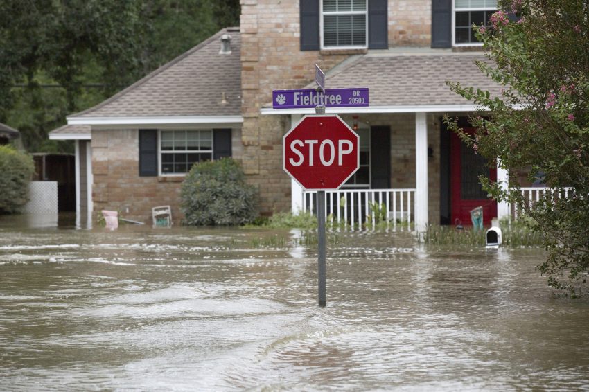
Streams and rivers are spilling out of their banks and flooding or cutting off entire towns. The Manning River shattered a record level that had stood for almost 100 years. Emergency services have responded to hundreds of car and home rescue calls. Some residents have been forced to retreat to their rooftops to escape the floodwaters. The threat for at least localized heavy rains will continue through Thursday before waning Thursday night. Lead photo courtesy Wikipedia contributor Qumarchi.